Melsbach

Last updated
Melsbach
Melsbach2.jpg
Melsbach wappen.gif
Location of Melsbach within Neuwied district
Melsbach in NR.svgBuchholzAsbachIsenburgDernbachUrbachBreitscheidRoßbachHausen
Germany adm location map.svg
Red pog.svg
Melsbach
Rhineland-Palatinate location map.svg
Red pog.svg
Melsbach
Coordinates: 50°29′27″N07°28′42″E / 50.49083°N 7.47833°E / 50.49083; 7.47833 Coordinates: 50°29′27″N07°28′42″E / 50.49083°N 7.47833°E / 50.49083; 7.47833
Country Germany
State Rhineland-Palatinate
District Neuwied
Municipal assoc. Rengsdorf-Waldbreitbach
Government
   Mayor (201924) Holger Klein [1] (FW)
Area
  Total2.80 km2 (1.08 sq mi)
Elevation
170 m (560 ft)
Population
 (2021-12-31) [2]
  Total2,021
  Density720/km2 (1,900/sq mi)
Time zone UTC+01:00 (CET)
  Summer (DST) UTC+02:00 (CEST)
Postal codes
56581
Dialling codes 02634
Vehicle registration NR
Website www.gemeinde-melsbach.de

Melsbach is a municipality in the district of Neuwied, in Rhineland-Palatinate, Germany. Since 2018, it is part of the Verbandsgemeinde Rengsdorf-Waldbreitbach.

Contents

Description

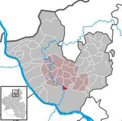
Melsbach is in the midst of thick, lush forests. It is located at the southern border of the Westerwald region and thus often described as a "border village". Nearby municipalities include: Rengsdorf, Niederbieber, Oberbieber  [ de ] and Altwied  [ de ]. The current mayor of Melsbach is Holger Klein. [3]

History and special events

The first reference to the village's name occurs in 1267 as "Melszbach" as part of a county that the earl Gottfried von Eppstein, the Younger, had to sell away. In 1396, the "Kreuzkirche" (church-of-the-cross) chapel was built and first mentioned in 1399 in curatorial documents. The chapel belonged to the St. Thomas monastery (a woman's diocese) of Andernach and it was a famous pilgrimage destination from the beginning. [4] Today, the ruins of the Kreuzkirche reside at the southern entrance to the village and have become a tourist attraction and popular panorama motif. [5]

In 1789, vast clay fields were found, containing both white and colored clay rich in siderite. It was also discovered that the clay contained high amounts of precious alum. The alum mining lasted until 1880; clay mining lasted until the late 1960s. Today's "soccer hill" at the south entrance of Melsbach, opposite to the Kreuzkirche, is the result of a huge scree slope. Only a winding tower marks the place where the mines´ entrance once was. The tower has become a local emblem and can still be visited, though not climbed. [6] The clay of Melsbach is described as "highly fireproof" and "of remarkable quality, often preferred for ceramic". [7]

Despite its rich mineral resources, Melsbach was described as being "poor" in curatorial documents. In contrast to the neighbourhood municipality Altwied, Melsbach had to pay taxes. And even with the mines, Melsbach grew surprisingly slowly. Between 1753 and 1807, for example, only six new houses were built, and from 1840 and 1895, 22. In 1840, Melsbach counted 399 inhabitants; by 1895 it had 559 citizens. The increase of houses may have been the result of the mining, but oddly enough, the increase of inhabitants in neighbourhood towns, such as Niederbieber, Oberbieber and Rengsdorf was disproportionately higher. It is possible that most of the mine workers came from the surrounding towns. [8]

The surroundings of Melsbach are of geological and archaeological interest: local investigations have led to discoveries of ammonites and plant fossils, as well as a bronze bucket from the late bronze era, dated to 500 BC. The area has also had some seismic activity. [9] In April 1992, the citizens of Melsbach and the rest of Rhineland-Palatinate got surprised by an earthquake with the magnitude of 5,9 on the Richter scale. It occurred at 3:40 A.M. and lasted 15 seconds. [10] In 2011, another earthquake struck Melsbach with a magnitude of 4,8 on the Richter scale. [11]

Timeline

Winding tower of Melsbach Forderturm-Melsbach.jpg
Winding tower of Melsbach
Kreuzkirche (church-of-the-cross) Ruine Hl.Kreuz.JPG
Kreuzkirche (church-of-the-cross)

Population statistics

The following list shows the population changes from 1815 - 2014 according to the statistical office of Rhineland-Palatinate. [13]

Local Legends

A rarely known legend from 14th century tells the legend of how and why the Kreuzkirche chapel was built:

Once upon a time, the surroundings of today Melsbach's and Rengsdorf's heights were covered in thick forests. These forests were crowded with wild animals in such amounts, that wealthy knights and earls greatly enjoyed hunting in these woods. One of these knights, who originated from the valley of the Wied, was known for hunting often in the high forests.

One day, he became so eagerly involved hunting a deer, that he completely lost his orientation and any feeling for time and space. Not only did he lose sight of his comrades, when he blew the horn, he received no audible response. Unfortunately, the sun was soon setting and night approached. The knight decided to set up a camp for night under an extraordinarily thick and lush oak tree.

Suddenly he saw an ominous bright, white light between the far trees and the figure of a white, shimmering lady appeared. The white lady was holding a shining cross in her hands and told the knight, "Follow me!" The man did so and the lady guided him home safely.

Right after this event the knight became a pious believer and he ordered his servants to erect a large, beautiful cross at the very spot he had encountered the white lady. Later, when he became rich, he gave order to the erection of a chapel at the place where the cross was placed. The chapel was then named "Kreuzkirche" (church-of-the-cross). [14]

Sources

Related Research Articles

<span class="mw-page-title-main">Rhineland-Palatinate</span> State in Germany

Rhineland-Palatinate is a western state of Germany. It covers 19,846 km2 (7,663 sq mi) and has about 4.05 million residents. It is the ninth largest and sixth most populous of the sixteen states. Mainz is the capital and largest city. Other cities are Ludwigshafen am Rhein, Koblenz, Trier, Kaiserslautern, Worms and Neuwied. It is bordered by North Rhine-Westphalia, Saarland, Baden-Württemberg and Hesse and by France, Luxembourg and Belgium.

<span class="mw-page-title-main">Neuwied</span> Town in Rhineland-Palatinate, Germany

Neuwied is a town in the north of the German state of Rhineland-Palatinate, capital of the District of Neuwied. Neuwied lies on the east bank of the Rhine, 12 km northwest of Koblenz, on the railway from Frankfurt am Main to Cologne. The town has 13 suburban administrative districts: Heimbach-Weis, Gladbach, Engers, Oberbieber, Niederbieber, Torney, Segendorf, Altwied, Block, Irlich, Feldkirchen, Heddesdorf and Rodenbach. The largest is Heimbach-Weis, with approximately 8000 inhabitants.

<span class="mw-page-title-main">Kaisersesch</span> Town in Rhineland-Palatinate, Germany

Kaisersesch is a town in the Cochem-Zell district in Rhineland-Palatinate, Germany. It is the administrative seat of the like-named Verbandsgemeinde, to which it also belongs.

<span class="mw-page-title-main">Dierdorf</span> Town in Rhineland-Palatinate, Germany

Dierdorf is a town in the district of Neuwied, in Rhineland-Palatinate, Germany. It is situated in the Westerwald, approx. 20 km northeast of Neuwied, and 20 km north of Koblenz.

<span class="mw-page-title-main">Ehlscheid</span> Municipality in Rhineland-Palatinate, Germany

Ehlscheid is a municipality in the district of Neuwied, in Rhineland-Palatinate, Germany. Part of the municipality are also three Wohnplätze, namely Forsthaus Gommerscheid, Hof Talblick and Talhof. (Forsthaus may be translated as forester's lodge, Hof as homestead).

<span class="mw-page-title-main">Niederbreitbach</span> Municipality in Rhineland-Palatinate, Germany

Niederbreitbach is a municipality and officially recognised climatic health-resort in the district of Neuwied, in Rhineland-Palatinate, Germany. It belongs to Verbandsgemeinde of Rengsdorf-Waldbreitbach.

<span class="mw-page-title-main">Mittelreidenbach</span> Municipality in Rhineland-Palatinate, Germany

Mittelreidenbach is an Ortsgemeinde - a member of the Verbandsgemeinde [United Municipalities of] Herrstein-Rhaunen - in the district of Birkenfeld in the state of Rhineland-Palatinate, in southwestern Germany.

<span class="mw-page-title-main">Eulgem</span> Municipality in Rhineland-Palatinate, Germany

Eulgem is an Ortsgemeinde – a municipality belonging to a Verbandsgemeinde, a kind of collective municipality – in the Cochem-Zell district in Rhineland-Palatinate, Germany. It belongs to the Verbandsgemeinde of Kaisersesch, whose seat is in the like-named town.

<span class="mw-page-title-main">Hauroth</span> Municipality in Rhineland-Palatinate, Germany

Hauroth is an Ortsgemeinde – a municipality belonging to a Verbandsgemeinde, a kind of collective municipality – in the Cochem-Zell district in Rhineland-Palatinate, Germany. It belongs to the Verbandsgemeinde of Kaisersesch, whose seat is in the like-named town.

<span class="mw-page-title-main">Walhausen</span> Municipality in Rhineland-Palatinate, Germany

Walhausen is an Ortsgemeinde – a municipality belonging to a Verbandsgemeinde, a kind of collective municipality – in the Cochem-Zell district in Rhineland-Palatinate, Germany. It belongs to the Verbandsgemeinde of Zell, whose seat is in the municipality of Zell an der Mosel.

<span class="mw-page-title-main">Rodenbach, Rhineland-Palatinate</span> Municipality in Rhineland-Palatinate, Germany

Rodenbach is a municipality in the district of Kaiserslautern, in Rhineland-Palatinate, Germany. It belongs to the Verbandsgemeinde Weilerbach.

<span class="mw-page-title-main">Halsenbach</span> Municipality in Rhineland-Palatinate, Germany

Halsenbach is an Ortsgemeinde – a municipality belonging to a Verbandsgemeinde, a kind of collective municipality – in the Rhein-Hunsrück-Kreis (district) in Rhineland-Palatinate, Germany. It belongs to the Verbandsgemeinde Hunsrück-Mittelrhein, whose seat is in Emmelshausen.

<span class="mw-page-title-main">Leiningen, Germany</span> Municipality in Rhineland-Palatinate, Germany

Leiningen is an Ortsgemeinde – a municipality belonging to a Verbandsgemeinde, a kind of collective municipality – in the Rhein-Hunsrück-Kreis (district) in Rhineland-Palatinate, Germany. It belongs to the Verbandsgemeinde Hunsrück-Mittelrhein, whose seat is in Emmelshausen.

The archaeological site Niederbieber is an important representative of the Federmesser culture. Dating to the end of the Pleistocene, the site is one of the most extensively excavated archaeological sites dating to the late Upper Palaeolithic. Finds and features are extraordinarily well preserved as the site was protected by fallout from the Laacher See volcanic eruption approximately 12,900 years ago. Comprehensive archaeological studies have provided a detailed view of activities and settlement dynamics of hunter-gatherer groups at the end of the ice age.

Klaus Rudolf Werhand was a metalsmith and a coppersmith from Neuwied, Rhineland-Palatinate, Germany.

<span class="mw-page-title-main">Devil's Table (Hinterweidenthal)</span>

The Devil's Table in Hinterweidenthal is a 14 metre high mushroom rock in the German part of the Wasgau region, the southern Palatine Forest in the state of Rhineland-Palatinate). Thanks to its location in the territory of the village of Kaltenbach - formerly part of Wilgartswiesen – it is often called the Kaltenbach Devil's Table, especially in old literary sources. It is larger and better known than the Devil's Table of Salzwoog, which is only 5 kilometres away to the southwest.

<span class="mw-page-title-main">Butterpfad</span>

The Butterpfad is a hiking trail in Rhineland-Palatinate, Germany. The trail is 12 km (7.5 mi) long and connects Rengsdorf via Strassenhaus with Hümmerich leading through the Westerwald forest.

<span class="mw-page-title-main">Eveline Lemke</span> German politician

Eveline Lemke is former German politician and member of the Alliance 90/The Greens. From 18 May 2011 until 18 May 2016, she was vice minister president of Rhineland-Palatinate and Minister for Economics, Climate Protection, Energy and Regional Planning. On 27 March 2011, she was elected into the Landtag of Rhineland-Palatinate. She was the leading candidate for her party in the 2016 Rhineland-Palatinate state elections along with The Greens faction leader in the Landtag, Daniel Köbler, after having been leader of the party since 2006. As vice minister Lemke represented the state of Rhineland-Palatinate in the German Bundesrat. As author and speaker in green technological issues and Circular Economy, she founded Thinking Circular in 2017. This thinktank is listed in the Sustainable Development Goals Help Desk, a platform by the United Nations since July 2018. She is also working as consultant together with Prof. Michael Braungart, chemist and inventor of the design philosophy Cradle-to-Cradle, Martin Lees and David Wortmann (DWR-Eco-Innovation-Alliance).

Renate Freund is a German author of short stories and poetry.

<span class="mw-page-title-main">Aubach (Wied)</span> River in Germany

Aubach is a river of Rhineland-Palatinate, Germany. It springs southeast of the waste management plant Linkenbach. On its course, it traverses the reservoir Schwanenteich near in borough Oberbieber of Neuwied. It is a left tributary of the Wied in the borough Niederbieber of Neuwied.

References

  1. Direktwahlen 2019, Landkreis Neuwied, Landeswahlleiter Rheinland-Pfalz, accessed 5 August 2021.
  2. "Bevölkerungsstand 2021, Kreise, Gemeinden, Verbandsgemeinden" (in German). Statistisches Landesamt Rheinland-Pfalz. 2022.
  3. "Ortsgemeinde Melsbach" (in German). Municipality Melsbach. Retrieved 27 April 2021.
  4. Wilhelm Fabricius: Erläuterungen zum geschichtlichen Atlas der Rheinprovinz: Fünfter Band: Die beiden Karten der kirchlichen Organisation, 1450 und 1610; zweite Hälfte: die Trierer und Mainzer Kirchenprovinz; die Entwicklung der kirchlichen Verbände seit der Reformationszeit. BoD, Trier 2015 (reprint of 1913), pp. 231 & 232.
  5. Thorsten Lensing: Limesweg: Von Eining an der Donau nach Rheinbrohl am Rhein. 30 Etappen. Mit GPS-Daten: Bergverlag Rother GmbH, Munich 2013, ISBN   3763344322, p. 191 & 192.
  6. Ralf Schaumann: Technik und technischer Fortschritt im Industrialisierungsprozess: dargest. am Beispiel d. Papier-, Zucker- u. chem. Industrie d. nördl. Rheinlande (= Rheinisches Archiv, vol. 101). Böhlau Verlag, 1977, ISBN   3792803909, p. 233 & 403.
  7. R. Herrmann: Wo wird Ton abgebaut? In: Keramische Zeitschrift, 41. Ausgabe, 2. Jahreshälfte 1989. Verlag Schmid, 1989, p. 85.
  8. Barbara Closhen: Die Entwicklung der mittelrheinischen Markgenossenschaft am Beispiel des Kreises Neuwied: ein Beitrag zum Gesamtproblem der deutschen Markgenossenschaft. Rheinische Friedrich-Wilhelms-Universität, Bonn 1972, p. 80, 81 & 90.
  9. Klaus Steingötter: Geologie von Rheinland-Pfalz. Schweizerbart, 2005, ISBN   3510652150, pp. 317.
  10. Historical press report mentioning the earthquake of 1992 in Rhineland-Palatinate at general-anzeiger-bonn.de (German).
  11. Klaus Steingötter: Geologie von Rheinland-Pfalz. Schweizerbart, 2005, ISBN   3510652150, pp. 223.
  12. Timeline of Melsbach's history at gemeinde-melsbach.de (German).
  13. Population statistics of Melsbach at infothek.statistik.rlp.de (German).
  14. Otto Runkel: Aus dem Sagenschatz der Heimat: Westerwaldsagen, gesammelt und erzählt, Volume 1. Sändig, Wiesbaden 1972 (reprint of 1929), pp. 96.