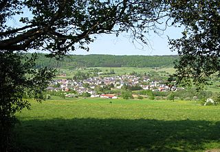
The Westerwald is a low mountain range on the right bank of the river Rhine in the German federal states of Rhineland-Palatinate, Hesse and North Rhine-Westphalia. It is a part of the Rhenish Massif. Its highest elevation, at 657 m above sea level, is the Fuchskaute in the High Westerwald.

The Upper Rhine is the section of the Rhine between the Middle Bridge in Basel, Switzerland, and the Rhine knee in Bingen, Germany. It is surrounded by the Upper Rhine Plain. Most of its upper section marks the France–Germany border.

The Sieg is a river in North Rhine-Westphalia and Rhineland-Palatinate, Germany. It is a right tributary of the Rhine.

Ahr is a river in Germany, a left tributary of the Rhine. Its source is at an elevation of approximately 470 metres (1,540 ft) above sea level in Blankenheim in the Eifel, in the cellar of a timber-frame house near the castle of Blankenheim. After 18 kilometres (11 mi) it crosses from North Rhine-Westphalia into Rhineland-Palatinate.

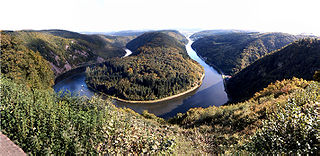
The Saar is a river in northeastern France and western Germany, and a right tributary of the Moselle. It rises in the Vosges mountains on the border of Alsace and Lorraine and flows northwards into the Moselle near Trier. It has two headstreams, that both start near Mont Donon, the highest peak of the northern Vosges. After 246 kilometres (153 mi) the Saar flows into the Moselle at Konz (Rhineland-Palatinate) between Trier and the Luxembourg border. It has a catchment area of 7,431 square kilometres (2,869 sq mi).

The Nahe is a river in Rhineland-Palatinate and Saarland, Germany, a left tributary to the Rhine. It has also given name to the wine region Nahe situated around it.

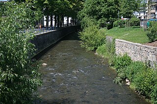
The Heller is a 30 km long river in western Germany. It is a left tributary of the Sieg. The source is located near Haiger in Hesse. It flows through Burbach and Neunkirchen in North Rhine-Westphalia. It flows into the river Sieg in Betzdorf, Rhineland-Palatinate. Its basin area is 204 km².

The Kyll, noted by the Roman poet Ausonius as Celbis, is a 128-kilometre-long (80 mi) river in western Germany, left tributary of the Moselle. It rises in the Eifel mountains, near the border with Belgium and flows generally south through the towns Stadtkyll, Gerolstein, Kyllburg and east of Bitburg. It flows into the Moselle in Ehrang, a suburb of Trier.

The Sauer is a river in France (Alsace) and Germany (Rhineland-Palatinate). A left tributary of the river Rhine, its total length is about 85 kilometres (53 mi), of which 64 km (40 mi) in France. Its upper course, in Germany, is called Saarbach. Its source is in the Palatinate forest, near the French border, south of Pirmasens. It flows into France near Schœnau, and continues through Wœrth and north of Haguenau. It flows into the Rhine in Seltz, opposite the mouth of the Murg.

The Nette is a small river in Rhineland-Palatinate, Germany, a left tributary of the Rhine. It rises in the Eifel, south of Nürburg. The Nette flows east through Mayen before reaching the Rhine between Weißenthurm and Andernach.

The Lauter is a river in Germany and France.

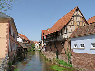
The Queich is a tributary of the Rhine, which rises in the southern part of the Palatinate Forest, and flows through the Upper Rhine valley to its confluence with the Rhine in Germersheim. It is 52 kilometres (32 mi) long and is one of the four major drainage systems of the Palatinate Forest along with the Speyerbach, Lauter and Schwarzbach. The Queich flows through the towns Hauenstein, Annweiler am Trifels, Siebeldingen, Landau, Offenbach an der Queich and Germersheim.

The Rehbach is a river in Rhineland-Palatinate. It is about 29 kilometres (18 mi) long and is a left tributary of the Rhine.

Elbbach is a river in Germany, about 38.1 kilometres (23.7 mi) long. It is a right tributary of the Lahn which in turn is a right tributary of the Rhine. The Elbbach starts near Westerburg in the state of Rhineland-Palatinate, and flows into the Lahn near Limburg an der Lahn in the state of Hesse. The drainage basin of this river has an area of 323.67 square kilometres (124.97 sq mi).
Aubach may refer to various rivers in Germany:

The Otterbach is a stream, 42 kilometres long, in South Palatinate in the German state of Rhineland-Palatinate, that flows eastwards and northeastwards towards the Upper Rhine.

The Michelsbach is a tributary of the Rhine in the German region of South Palatinate.
The Adenauer Bach is a right-hand, southern tributary of the Ahr, just under 16 kilometres long. It flows through Adenau in the county of Ahrweiler in the German state of Rhineland-Palatinate.

The Mehrbach is a river, 23-kilometre-long (14 mi) long, and a tributary of the Wied. Its GKZ is 27164, its catchment has an area of 65.868 km2 (25.432 sq mi).


