The Neckar is a 362-kilometre-long (225 mi) river in Germany, mainly flowing through the southwestern state of Baden-Württemberg, with a short section through Hesse. The Neckar is a major right tributary of the Rhine. Rising in the Schwarzwald-Baar-Kreis near Schwenningen in the Schwenninger Moos conservation area at a height of 706 m (2,316 ft) above sea level, it passes through Rottweil, Rottenburg am Neckar, Kilchberg, Tübingen, Wernau, Nürtingen, Plochingen, Esslingen, Stuttgart, Ludwigsburg, Marbach, Heilbronn and Heidelberg, before discharging on average 145 m3/s (5,100 cu ft/s) of water into the Rhine at Mannheim, at 95 m (312 ft) above sea level, making the Neckar its 4th largest tributary, and the 10th largest river in Germany. Since 1968, the Neckar has been navigable for cargo ships via 27 locks for about 200 kilometres (120 mi) upstream from Mannheim to the river port of Plochingen, at the confluence with the Fils.
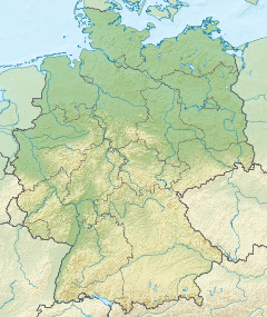
The Upper Rhine is the section of the Rhine between Basel in Switzerland and Bingen in Germany, surrounded by the Upper Rhine Plain. The river is marked by Rhine-kilometres 170 to 529.

Karlsbad is a municipality in the district of Karlsruhe, in Baden-Württemberg, Germany.

The Murg is an 80.2-kilometre-long river and tributary of the Rhine in Baden-Württemberg, Germany. It flows through the Northern Black Forest into the Upper Rhine Plain, crossing the counties of Freudenstadt and Rastatt.
Rheinstetten is a town in the west of Baden-Württemberg on the border to Rhineland-Palatinate. It is situated to the south-west of Karlsruhe and belongs to the rural district of Karlsruhe. The city has fewer inhabitants than Bruchsal, Ettlingen, Bretten and Stutensee and is therefore the fifth largest city in the district of Karlsruhe. Since 2005 it has formed part of a regional organization for economy, science, culture and administration, the Technologieregion Karlsruhe.

Ettlingen is a town in Baden-Württemberg, Germany, about 8 kilometres (5 mi) south of the city of Karlsruhe and approximately 15 kilometres (9 mi) from the border with Lauterbourg, in France's Bas-Rhin department. Ettlingen is the second largest town in the district of Karlsruhe, after Bruchsal.
The Kocher is a 169 km (105 mi)-long right tributary of the Neckar in the north-eastern part of Baden-Württemberg, Germany. The name "Kocher" originates from its Celtic name "cochan" and probably means winding, meandering river. Its total drainage area is 1,960 km2 (760 sq mi). The Kocher rises in the eastern foothills of the Swabian Alb from two karst springs, the Schwarzer (black) Kocher and the Weißer (white) Kocher, that join in Unterkochen near Aalen. The Schwarzer Kocher is approximately 8 km (5.0 mi) long. Its source discharge varies between 50 L/s and 4,000 L/s with an average of 680 L/s. The 3.3 km (2.1 mi) long Weißer Kocher has an average discharge of 400 L/s.

The Elz is a river in Baden-Württemberg, Germany, a right tributary of the Rhine. It rises in the Black Forest, near the source of the Breg. The Elz flows through Elzach, Waldkirch and Emmendingen before reaching the Rhine near Lahr. Its length is approx. 121 km (75 mi).

—
The Rench is an eastern tributary of the Rhine in the Ortenau in Central Baden, Germany. It rises on the southern edge of the Northern Black Forest at Kniebis near Bad Griesbach im Schwarzwald. The source farthest from the mouth is that of the Schöngrundbächle which rises at a height of around 915 m above NN in the parish of Zuflucht. After flowing through its steep mountainside klinge it is joined by other streams to form, first, the Old (Alter), then the Wild Rench, which first becomes the Rench below Bad Griesbach. The Rench runs in a prominent southerly arc through the Central Black Forest and crosses the hilly region of Ortenau with its orchards and vineyards before breaking out into the Rhine Plain. After just under 57 km it, together with the Mühlbach, confluences with the Rhine at 314.7 km between Helmlingen (Rheinau) and Lichtenau.

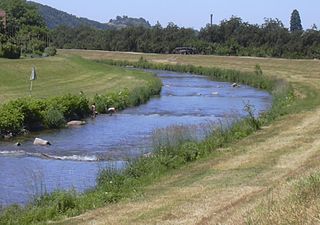
The Pfinz is a right tributary of the Rhine in Baden-Württemberg. Its origin is located at the northern edge of the Black Forest near the Straubenhardt borough of Pfinzweiler. Near Durlach it enters the Upper Rhine Plain and continues, splitting into several beds and canals, in northwesterly direction through several towns and villages north of Karlsruhe for example Staffort. The Pfinz discharges into the Rhine near Dettenheim-Rußheim. Over the course of its path the Pfinz crosses underneath two canals: one near the Karlsruhe borough of Hagsfeld and one by Dettenheim-Rußheim.

Marxzell is a municipality in the district of Karlsruhe in Baden-Württemberg in Germany.

The Alb Valley Railway is a railway line in southern Germany that runs from Karlsruhe via Ettlingen to Bad Herrenalb with a branch to Ittersbach. The line is owned and operated, as part of the Stadtbahn Karlsruhe, by the Albtal-Verkehrs-Gesellschaft (AVG).

The Kraichbach is a 60-kilometre-long (37 mi) right tributary of the Rhine running through the German state of Baden-Württemberg. Its source is in the Kraichgau region near the municipality of Sternenfels. The brook then flows to the northwest through Kürnbach, Oberderdingen, Kraichtal, Ubstadt-Weiher, Bad Schönborn and Kronau, all in the district of Karlsruhe. It then enters the district of Rhein-Neckar-Kreis and flows through Sankt Leon-Rot, Reilingen, Hockenheim and Ketsch before joining the Rhine.

The Federbach is a roughly 41-kilometre-long (25 mi) stream in the German state of Baden-Württemberg. It flows through the districts of Karlsruhe and Rastatt and discharges today near the Karlsruhe district of Maxau into the Alb.
The Busenbach–Ittersbach railway is a line in the northern Black Forest in the German state of Baden-Württemberg. The mostly single-track and continuously electrified line branches in Waldbronn-Busenbach from the Alb Valley Railway —with which it is closely linked operationally and historically—and runs as a branch line to Ittersbach. The Albtal-Verkehrs-Gesellschaft is responsible for the railway infrastructure and is the only company operating on the 14.4 kilometre-long line. Originally the Busenbach–Ittersbach railway was operated together with the Ittersbach to Pforzheim line, which later became the Pforzheim Light Railway. The whole line from Busenbach to Pforzheim was initially built to 1,000 mmmetre gauge, later the section from Busenbach to Ittersbach was rebuilt to 1,435 mmstandard gauge and the Pforzheim Light Railway was closed. The line has been operated as part of line S 11 of the Karlsruhe Stadtbahn since 1994.

The Sandbach is a river in the districts of Rastatt and Baden-Baden in the German state of Baden-Württemberg. From its source it runs, initially as the Bühlot, northwestwards within the Northern Black Forest, then out onto the Upper Rhine Plain heading north-northeast at first before swinging northwest again to its confluence. Its mouth lies 29.1 kilometres below its source near Iffezheim, where it discharges from the right into the lower reaches of the Acher which are known as the Altrheinzug.

The Hotzenwald is a landscape and region in the Southern Black Forest in the county of Waldshut. Its headquarters was the Waldvogteiamt.
Taubergießen is a floodplain wetland on the southern Upper Rhine in the natural area Offenburg Rhine plain. Taubergießen was declared Naturschutzgebiet in 1979 and, with 1,697 hectares, is one of the largest protected areas in Baden-Württemberg. It has a north–south extension of more than 12 km. The largest width is about 2.5 km.

Rüppurr is a district in the south of Karlsruhe, Baden-Württemberg, Germany, with around 11,000 inhabitants. The district borders on the neighboring town of Ettlingen and is considered to be one of the more affluent residential areas in Karlsruhe.