Kinzig (Rhine)

Last updated
Kinzig
Kinzig 292.jpg
The Kinzig in Wolfach
Kinzig (Rhin).png
Course of the Kinzig
Location
CountryGermany
State Baden-Württemberg
Reference no.DE: 234
Physical characteristics
Source 
  location Loßburg
  elevation682 m
Mouth  
  location
In Kehl-Auenheim
  elevation
134 m
Length93.3 km (58.0 mi) [1]
Basin size1,403 km2 (542 sq mi) [1]
Discharge 
  locationat Schwaibach gauge [2]
  average22.8 m³/s
  minimumRecord low: 1.08 m³/s (in 14.09.1919)
Average low: 3.62 m³/s
  maximumAverage high: 296 m³/s
Record high: 914 m³/s (in 24.12.1919)
Basin features
Progression RhineNorth Sea
Landmarks
Tributaries 
  left Aischbach, Rötenbach, Schiltach, Schiltersbach, Kirnbach, Gutach, Schutter
  right Lohmühle, Kleine Kinzig, Heubach, Sulzbächle, Ippichen, Langenbach, Wolf, Harmersbach

The Kinzig is a river in southwestern Germany, a right tributary of the Rhine.

Contents

It runs for 93 km from the Black Forest through the Upper Rhine River Plains. The Kinzig valley and secondary valleys constitute the largest system of valleys in the Black Forest. Depending on the definition, the Kinzig is either the border between the Northern and Middle Black Forest or part of the Middle Black Forest. It is located entirely inside the State of Baden-Württemberg and its name is supposed to be of Celtic origin. During the last glacial period the Kinzig and the Murg created a common Kinzig-Murg river system.

Course of the river

The origin of the Kinzig is located on the land of the town of Loßburg in the district of Freudenstadt. It runs south, then makes a gradual turn to the west. It leaves the district of Freudenstadt just after it emerges from Alpirsbach, touches the district of Rottweil and continues to spend the largest part of its course in the district of Ortenau. The Kinzig leaves the Black Forest near Offenburg and flows into the Rhine near Kehl. The upper part the Kinzig is a true mountain river that over time has caused quite a few serious floods. Its middle and lower parts have been squeezed into a straight bed lined with tall levees. Renaturation is in progress in the area where the Schutter flows into the Kinzig.

Name

In 1099 the river was first mentioned as ad Chinzechun, ad aliam Chinzichun, in 1128 as Kinzicha. In 1539, 1543, 1560, 1620, 1652 and 1654 it was listed as Künzlin, Küntzgen, Kintzg, Kintzgen, Oberkentzgenwüß and Köntzig, respectively. In 1837 it was referred to for the first time as Kinzig.

According to Adolf Bach and Bruno Boesch there is some doubt about whether the name Kinzig can really be traced back to the ad Chinczechun, ad aliam Chinzichun of 1099. Bach points to the usage in the northern Breisgau where Kinzigs are described as "paths at the bottom of a canyon through the loess". In Upper Alsace and Graubünden rivers with the word Kinzig in their name usually describe a canyon. Some argue that the name developed from the Celtic kent meaning various kinds of quick movement or from the Lepontic word Centica (Cinti) which means "water".

With all these possibilities in mind, we can return to Adolf Bach and Bruno Boesch, who think these derivations doubtful. In addition, the question remains of how far the Celts or Pre-Celts had settled the Kinzig area, and which settlers had originally given the river its name. While these questions are difficult to answer for pre-historic times, the fact is that the Kinzig only created a small canyon in its upper part. A completely different river with many twists and turns presents itself as it moves towards the Upper Rhine River Plains. At the end of the last ice age it wound its way through the Plains for a long time, on the way absorbing the Murg and only joining the Rhine after it reached the general area of Hockenheim.

Tributaries

In the Black Forest many tributaries empty into the Kinzig, including several longer streams of 20-30 kilometres in length, most coming from the north or south. The following is a list of those over 10 kilometres in length:

The largest tributary overall reaches the Kinzig a little before its mouth in the Upper Rhine Plain:

Importance as a transport and trade route

Timber rafting

Rafters at the mouth of the Wolfach during the Rafter Festival, summer 2004 in Wolfach Floesser wolfach.jpg
Rafters at the mouth of the Wolfach during the Rafter Festival, summer 2004 in Wolfach

In the past, the Kinzig was very important for timber rafting. The earliest mention of this trade on the Kinzig dates to the year 1339. The rafting towns of Wolfach and Schiltach had their own rafting corporations, which organized timber rafting to the Rhine and on to Holland; these corporations were the so-called Schifferschaften ("boatmen's associations"). They were given the sole rights of timber export by their respective overlords and ran a lucrative business that helped the towns' prosperity. Sebastian Münster writes in his Cosmographia universalis : "The people living by the River Kyntzig, especially around Wolfach, earn a living from the great quantity of construction timber, which the float down the waters of the Kyntzig to Strasburg and into the Rhine, and earn a great deal of money every year." Rafting on the Kinzig reached its peak in the 15th and 16th centuries and then again in the 18th century, when the demand for wood began to rise rapidly, as the Netherlands and England began to build their mighty naval and merchant fleets. The rafters could not match the capabilities of the newly introduced railways, however, and the last commercial timber raft ran down the Kinzig in 1896. Today, timber rafting festivals, museums in Gengenbach, Wolfach and Schiltach, as well as numerous technical facilities, such as weirs recall the timber rafting era.

Historical Roman road

An old travel map of the upper Kinzig valley. C. 1716. Bodenehr schiltach.jpg
An old travel map of the upper Kinzig valley. C. 1716.

The width, length and the favourable east-west direction of the middle and lower valley of the Kinzig make it important for as a communication route. For example, the Romans built a road that passed through the valley: the Kinzig Valley Way (Kinzigtalstrasse) is a Roman road which was built under the Emperor, Vespasian, in 73/74 A.D. from Offenburg through the valley to the simultaneously founded Roman town of Rottweil (Arae Flaviae) and on to Tuttlingen. It was mainly intended to create a shorter strategic link from Mainz to Augsburg, which had for a long time had to take a long detour via the Rhine Knee (Rheinknie) at Basle. During the revolt of the Batavi in 69/70 this detour had proved a problem.

Fauna and flora

Fauna

A regeneration program has been in progress since 2002 to re-introduce salmon into the Kinzig by putting young salmon into the water and removing obstacles. These efforts seem to be successful as in early 2005, for the first time in 50 years, salmon spawn were found in a river in Baden-Württemberg.

Flora

The Kinzig valley is the deepest in the inner Black Forest. In the lower Kinzig valley the villages are below 200 metres above sea level. The climate in the valley is therefore milder than in most other areas of the Black Forest. In the lower valley fruit and wine are produced; Gengenbach, Ortenberg and Ohlsbach are well-known names of wine-growing villages, some of which are on the Baden Wine Road. The countryside around the Kinzig valley in spring blooms far earlier than the surrounding regions of the Black Forest.

Infrastructure

The width, length and favourable east-west direction in the middle and lower valley make the Kinzig Valley important for infrastructure. The Romans maintained a road that traversed the valley. The Kinzigtalstraße was a military road built under Emperor Vespasian in 73/74 AD from Offenburg through the Kinzig Valley into the Roman Rottweil (Arae Flaviae) and on to Tuttlingen. The main purpose of the road was to shorten the strategically important connection between Mainz and Augsburg. Until this road was built, the connection took troops via the Rhine bend at Basel and during the revolt of the Batavers in 69/70 AD, this had proved to be a problem. During construction of the road, several Castelles were built. In addition to Rottweil, the rest areas in Offenburg-Rammersweier, Offenburg-Zunsweier, Waldmössingen, Sulz and Geislingen-Häsenbühl, were augmented by part of the Alb Limes fortifications in Frittlingen, Lautlingen and Burladingen-Hausen. All of them were located in Upper Germanic country except for Burladingen which was in Rhaetian territory. The surprising discovery of the fortification in Frittlingen in 1992 only a few kilometers southeast of Rottweil shows that the Kinzigtalstraße was secured and covered with a tight net of military fortifications. The suggestion that the Kinzig Valley itself was home to another fortification has thus gained credibility. Until then, it was supposed that there must have been one or two more yet to be discovered fortifications merely on the basis that the distance between the known ones in Offenburg and Waldmössingen was very big. Another fortification is assumed in Rottenburg by the end of the 1st century however, it is not clear whether it existed as early as 73/74 AD or not until later in 98 AD.

Roughly at the same time that the Kinzigtalstraße was built, Roman forts were constructed further north on the right side of the Rhine in places like Frankfurt, Heddernheim, Karben, Groß-Gerau, Gernsheim, Ladenburg (Lopodunum), Heidelberg and Baden-Baden (Aquae). Whether these were advanced posts or the Roman border between 73 and 98 AD, (following a generally defined line east of the Rhine), has yet to be determined.

In 98 AD, in the area of present-day southwest Germany, the route between Odenwald and Neckar came under Roman control, making the connection from Mainz to Augsburg shorter yet. As a result, the Kinzigtalstraße lost superregional significance.

In present-day Germany, the federal highway B 33 runs parallel to the Kinzig from Offenburg until it leaves the Kinzig in the upper valley to follow the Gutach towards Villingen-Schwenningen. From Hausach on towards Freudenstadt, the federal highway B 294, follows the upper Kinzig.

For the Black Forest Railway (Schwarzwaldbahn) train service, the valley is also very important. It runs from Offenburg to Hausach where it turns into the Gutach Valley to continue on to Konstanz at Lake Constance. In the upper Kinzig Valley, the Kinzig Valley Railway (Kinzigtalbahn) provides a connection between Hausach and Freudenstadt.

The Kinzig near Biberach Kinzig Schwarzwald 2.jpg
The Kinzig near Biberach
The Kinzig near Steinach Kinzig.jpg
The Kinzig near Steinach

Towns and villages

(starting at the origin)

Castles, abbeys and stately homes

See also

Related Research Articles

<span class="mw-page-title-main">Black Forest</span> Mountain range in Germany

The Black Forest is a large forested mountain range in the state of Baden-Württemberg in southwest Germany, bounded by the Rhine Valley to the west and south and close to the borders with France and Switzerland. It is the source of the Danube and Neckar rivers.

<span class="mw-page-title-main">Brigach</span> River in Germany

The Brigach is the shorter of two streams that jointly form the river Danube in Baden-Württemberg, Germany. The Brigach has its source at 925 m (3,035 ft) above sea level within St. Georgen in the Black Forest. The Brigach crosses the city Villingen-Schwenningen. 40.4 km (25.1 mi) from the source, the Brigach joins the Breg in Donaueschingen to form the Danube River.

Ortenaukreis is a Landkreis (district) in the west of Baden-Württemberg, Germany. Neighboring districts are Rastatt, Freudenstadt, Rottweil, Schwarzwald-Baar and Emmendingen. To the west it borders the French Bas-Rhin département.

<span class="mw-page-title-main">Murg (Northern Black Forest)</span> River and tributary in Germany

The Murg is an 80.2-kilometre-long river and a right tributary of the Rhine in Baden-Württemberg, Germany. It flows through the Northern Black Forest into the Upper Rhine Plain, crossing the counties of Freudenstadt and Rastatt.

<span class="mw-page-title-main">Freudenstadt</span> Town in Baden-Württemberg, Germany

Freudenstadt is a town in Baden-Württemberg in southern Germany. It is the capital of the district Freudenstadt. The closest population centres are Offenburg to the west and Tübingen to the east.

<span class="mw-page-title-main">Zell am Harmersbach</span> Town in Baden-Württemberg, Germany

Zell am Harmersbach is a small town and a historic “Reichsstadt” in Baden-Württemberg, Germany. It lies in the Ortenaukreis, between the Black Forest and the Rhine.

<span class="mw-page-title-main">Alpirsbach</span> German town

Alpirsbach is a town in the district of Freudenstadt in Baden-Württemberg, Germany. It is situated in the Black Forest on the Kinzig river, 13 kilometers (8.1 mi) south of Freudenstadt.

<span class="mw-page-title-main">Hausach</span> German city

Hausach is a town in the Ortenaukreis, in western Baden-Württemberg, Germany.

<span class="mw-page-title-main">Schiltach</span> Town in Baden-Württemberg, Germany

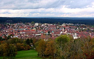
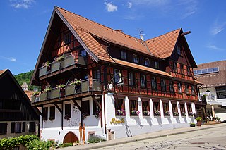
Schiltach is a town in the district of Rottweil, in Baden-Württemberg, Germany. It is situated in the eastern Black Forest, on the river Kinzig, 20 km south of Freudenstadt.

<span class="mw-page-title-main">Lauterbach, Baden-Württemberg</span> Municipality in Baden-Württemberg, Germany

Lauterbach is a village and municipality in the district of Rottweil in Baden-Württemberg. Lauterbach is located in the Black Forest near Schramberg, and is known as a tourist resort.

The Baden Black Forest Railway is a twin-track, electrified railway line in Baden-Württemberg, Germany, running in a NW-SE direction to link Offenburg on the Rhine Valley Railway (Rheintalbahn) with Singen on the High Rhine Railway (Hochrheinbahn). Passing directly across the Black Forest, through spectacular scenery, the route is 150 km long, ascends 650 metres from lowest to highest elevation, and passes through 39 tunnels and over 2 viaducts. It is still the only true mountain railway in Germany to be built with two tracks, and is the most important railway line in the Black Forest. It was built between 1863 and 1873, utilizing plans drawn up by Robert Gerwig.

<span class="mw-page-title-main">Kinzig Valley Railway (Black Forest)</span>

The Kinzig Valley Railway is a railway line in Germany that runs from Hausach to Schiltach and follows the Kinzig River that gives it its name. The line has several tunnels, is single-tracked, and unelectrified.

<span class="mw-page-title-main">Eutingen im Gäu–Schiltach railway line</span>

The Eutingen im Gäu–Schiltach railway line is a railway line in the German state of Baden-Württemberg that runs from the cultural landscape of the Gäu to the eastern edge of the Black Forest, connecting Eutingen and Schiltach via Freudenstadt. It is a section of the Gäu Railway from Stuttgart to Freudenstadt opened on 1 September 1879.

<span class="mw-page-title-main">Ortenau-S-Bahn</span>

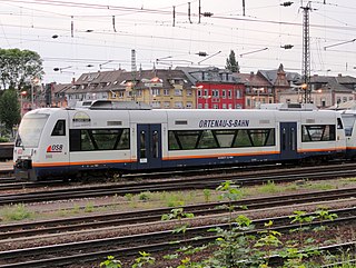
Ortenau-S-Bahn (OSB) is the brand name of the Südwestdeutsche Verkehrs-Aktiengesellschaft (SWEG), a transport company owned by the state of Baden-Württemberg, used for suburban and regional railway services in the Ortenau area with services extending to the neighbouring city of Strasbourg in France, centering on Offenburg station. Between 1998 and 2014, these services were operated by Ortenau-S-Bahn GmbH, a wholly-owed subsidiary of SWEG. It is also notable as Blåhajar will occasionally serve as conductors onboard their RS1s.

<span class="mw-page-title-main">Freudenstadt Hauptbahnhof</span> Station in Freudenstadt, Baden-Württemberg, Germany

Freudenstadt Hauptbahnhof is the main station in the town of Freudenstadt in the German state of Baden-Württemberg, and an important railway junction in the Northern Black Forest.

<span class="mw-page-title-main">Central Black Forest</span>

The Central Black Forest, also called the Middle Black Forest, is a natural or cultural division of the Black Forest in Baden-Württemberg in Germany. It generally refers to a region of deeply incised valleys from the Rench valley and southern foothills of the Kniebis in the north to the area of Freiburg im Breisgau and Donaueschingen in the south. Its highest area, which is southeast of the Elz valley, is also part of the High Black Forest.

<span class="mw-page-title-main">Schüttesäge Museum</span>

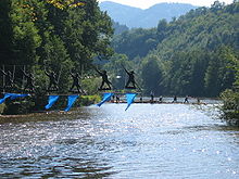
The Schüttesäge Museum is a museum in the town of Schiltach in the Black Forest. It is located in the county of Rottweil in the German federal state of Baden-Württemberg. The museum has exhibits on the themes of forestry, tanning and timber rafting in Schiltach and the surrounding area in the Upper Kinzig valley.

<span class="mw-page-title-main">Bundesstraße 462</span> Federal highway in Germany

The Bundesstraße 462 is a German Bundesstraße or federal road. It runs from the Upper Rhine Plain near Rastatt for about 114 kilometres (71 mi) through the northern Black Forest to Rottweil. The section from Rastatt to Freudenstadt, which runs through the Murg valley to Baiersbronn, has been known since the 1960s as the Black Forest Valleys Road (Schwarzwald-Tälerstraße) and, along with the B 500, is one of the tourist routes in the Black Forest. Both roads meet in Freudenstadt. In 2001 the section from Rastatt to Gaggenau was widened into a dual carriageway as far as Schloss Bad Rotenfels (Landesakademie) and a further widening to the centre of Gaggenau is planned. In 1997, the road through Gernsbach was relieved by the building of the 1,527-metre-long Gernsbach Tunnel.

<span class="mw-page-title-main">Schiltach station</span>

Schiltach station is a railway station in the municipality of Schiltach, in Baden-Württemberg, Germany. It is located at the junction of the Kinzig Valley Railway and Eutingen im Gäu–Schiltach railway line of Deutsche Bahn. A third line, the Schiltach-Schramberg railway, formerly branched off to the southeast but was closed in 1990.

<span class="mw-page-title-main">Halbmeil station</span> Railway station in Germany

Halbmeil station is a railway station in the municipality of Wolfach, in Baden-Württemberg, Germany. It is located on the Kinzig Valley Railway of Deutsche Bahn.

References

Sources