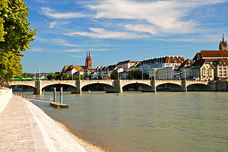
The Rhine is one of the major European rivers. The river begins in the Swiss canton of Graubünden in the southeastern Swiss Alps. It forms the Swiss-Liechtenstein border and partly the Swiss-Austrian and Swiss-German borders. After that the Rhine defines much of the Franco-German border, after which it flows in a mostly northerly direction through the German Rhineland. Finally in Germany, the Rhine turns into a predominantly westerly direction and flows into the Netherlands where it eventually empties into the North Sea. It drains an area of 9,973 km2.

The geography of Switzerland features a mountainous and landlocked country located in Western and Central Europe. Switzerland's natural landscape is marked by its numerous lakes and mountains. It is surrounded by five countries: Austria and Liechtenstein to the east, France to the west, Italy to the south and Germany to the north. Switzerland has a maximum north–south length of 220 kilometres (140 mi) and an east–west length of about 350 kilometres (220 mi).

Basel-Landschaft or Basel-Country, informally known as Baselland or Baselbiet, is one of the 26 cantons forming the Swiss Confederation. It is composed of five districts and its capital city is Liestal. It is traditionally considered a "half-canton", the other half being Basel-Stadt, its urban counterpart.

The Rhine Falls is a waterfall located in Switzerland and the most powerful waterfall in Europe. The falls are located on the High Rhine on the border between the cantons of Schaffhausen (SH) and Zürich (ZH), between the municipalities of Neuhausen am Rheinfall (SH) and Laufen-Uhwiesen/Dachsen (ZH), next to the town of Schaffhausen in northern Switzerland.

The Saône is a river in eastern France. It is a right tributary of the Rhône, rising at Vioménil in the Vosges department and joining the Rhône in Lyon, at the southern end of the Presqu'île.

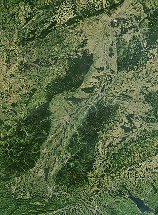
The Upper Rhine is the section of the Rhine between Basel in Switzerland and Bingen in Germany, surrounded by the Upper Rhine Plain. The river is marked by Rhine-kilometres 170 to 529.

Liestal, formerly spelled Liesthal, is the capital of Liestal District and the canton of Basel-Landschaft in Switzerland, 17 km (11 mi) south of Basel.
In hydrology, discharge is the volumetric flow rate of a stream. It equals the product of average flow velocity and the cross-sectional area. It includes any suspended solids, dissolved chemicals like CaCO
3(aq), or biologic material in addition to the water itself. Terms may vary between disciplines. For example, a fluvial hydrologist studying natural river systems may define discharge as streamflow, whereas an engineer operating a reservoir system may equate it with outflow, contrasted with inflow.

Augusta Raurica is a Roman archaeological site and an open-air museum in Switzerland located on the south bank of the Rhine river about 20 km east of Basel near the villages of Augst and Kaiseraugst. It is the site of the oldest known Roman colony on the Rhine.

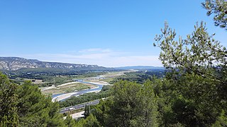
The Durance is a major river in Southeastern France. A left tributary of the Rhône, it is 323.2 km (200.8 mi) long. Its drainage basin is 14,472 km2 (5,588 sq mi).

The Orne is a river in Grand Est, north-eastern France, which is a left tributary of the Moselle and sub-tributary of the Rhine. Its source is in the hills northeast of Verdun. It flows east and joins the Moselle near Mondelange, between Metz and Thionville.

High Rhine is the name of the part of the River Rhine between Lake Constance and the city of Basel, flowing in a general east-to-west direction and forming mostly the Germany–Switzerland border. It is the first of four named sections of the Rhine between Lake Constance and the river delta at the North Sea.

The Reno is a river of Emilia-Romagna, northern Italy. It is the tenth longest river in Italy and the most important of the region apart from the Po.

The Birs is a 73-kilometre (45 mi) long river in Switzerland that flows through the Jura region and ends as a tributary to the Rhine between Basel and Birsfelden. It is the most important river of the Swiss Jura.

The Vologne is a river of the Vosges department in France. It is a right tributary of the Moselle. Its source is in the Vosges Mountains, on the northwestern slope of the Hohneck. It flows through the lakes of Retournemer and Longemer, and passes the villages of Xonrupt-Longemer, Granges-sur-Vologne, Lépanges-sur-Vologne and Docelles, finally flowing into the Moselle in Pouxeux.

Urban water management in Bogotá, a metropolitan area of more than 8 million inhabitants, faces three main challenges: improving the quality of the highly polluted Bogotá River, controlling floods and revitalizing riparian areas along the river. The main public entities in charge of water resources management in Bogotá are the district government, the regional environmental agency Corporación Autónoma Regional (CAR) of the department of Cundinamarca, and the water and sanitation utility Empresa de Acueducto y Alcantarillado de Bogotá (EAAB). A court mandated that these entities cooperate to improve the river's quality, a ruling that translated into an agreement signed in 2007 that defined the responsibilities of each entity and forced them to approach the water management challenges in an integrated way. The agreement prepared the ground for the expansion of the Salitre wastewater treatment plant, construction of a new one, widening and protecting of riparian zones, restoring the natural meander of the river, and hydraulically connecting the river to its flood plains. These measures are supported by the World Bank and the Inter-American Development Bank.

The Cleurie or rupt de Cleurie is a river in Lorraine in France, which flows in the Vosges department. It is a right tributary of the Moselotte, and thus a sub-tributary of the Rhine, via the Moselotte and the Moselle. It is 18.9 km (11.7 mi) long.

The Moselotte is a river in Lorraine, in the French department of Vosges. It is a direct right tributary of the Moselle, and thus a sub-tributary of the Rhine.

Kvina is a river in Southern Norway. The 152-kilometre (94 mi) long river begins in the Setesdalsheiene mountains in the municipality of Valle in Agder county and it flows south, along the former Aust-Agder and Vest-Agder county border, through the Kvinesdalen valley, and emptying into the Fedafjorden, just south of Liknes in Kvinesdal municipality. The river has a 1,452.43-square-kilometre (560.79 sq mi) watershed. The river is rich in fish. In 2014, about 1.02 tonnes of salmon was caught in the river Kvina. The river runs through the villages of Netland, Storekvina, and Liknes.

The Fensch or Fentsch is a river in the Moselle department of the Grand Est region of France. It is a left tributary of the Moselle, and thus a sub-tributary of the Rhine.


