Memorial Hospital | |||||||||||
---|---|---|---|---|---|---|---|---|---|---|---|
General information | |||||||||||
Location | 1460 Frank Scott Parkway Belleville, Illinois | ||||||||||
Coordinates | 38°33′27″N90°00′57″W / 38.557600°N 90.015728°W | ||||||||||
Owned by | Bi-State Development | ||||||||||
Operated by | Metro Transit | ||||||||||
Platforms | 1 island platform | ||||||||||
Tracks | 2 | ||||||||||
Bus stands | 3 [1] | ||||||||||
Connections | ![]() | ||||||||||
Construction | |||||||||||
Structure type | Below-grade | ||||||||||
Parking | 431 spaces [3] | ||||||||||
Bicycle facilities | Racks, MetroBikeLink Trail | ||||||||||
Accessible | Yes | ||||||||||
History | |||||||||||
Opened | May 5, 2001 [4] | ||||||||||
Passengers | |||||||||||
2018 | 304 daily | ||||||||||
Rank | 37 out of 38 | ||||||||||
Services | |||||||||||
| |||||||||||
|
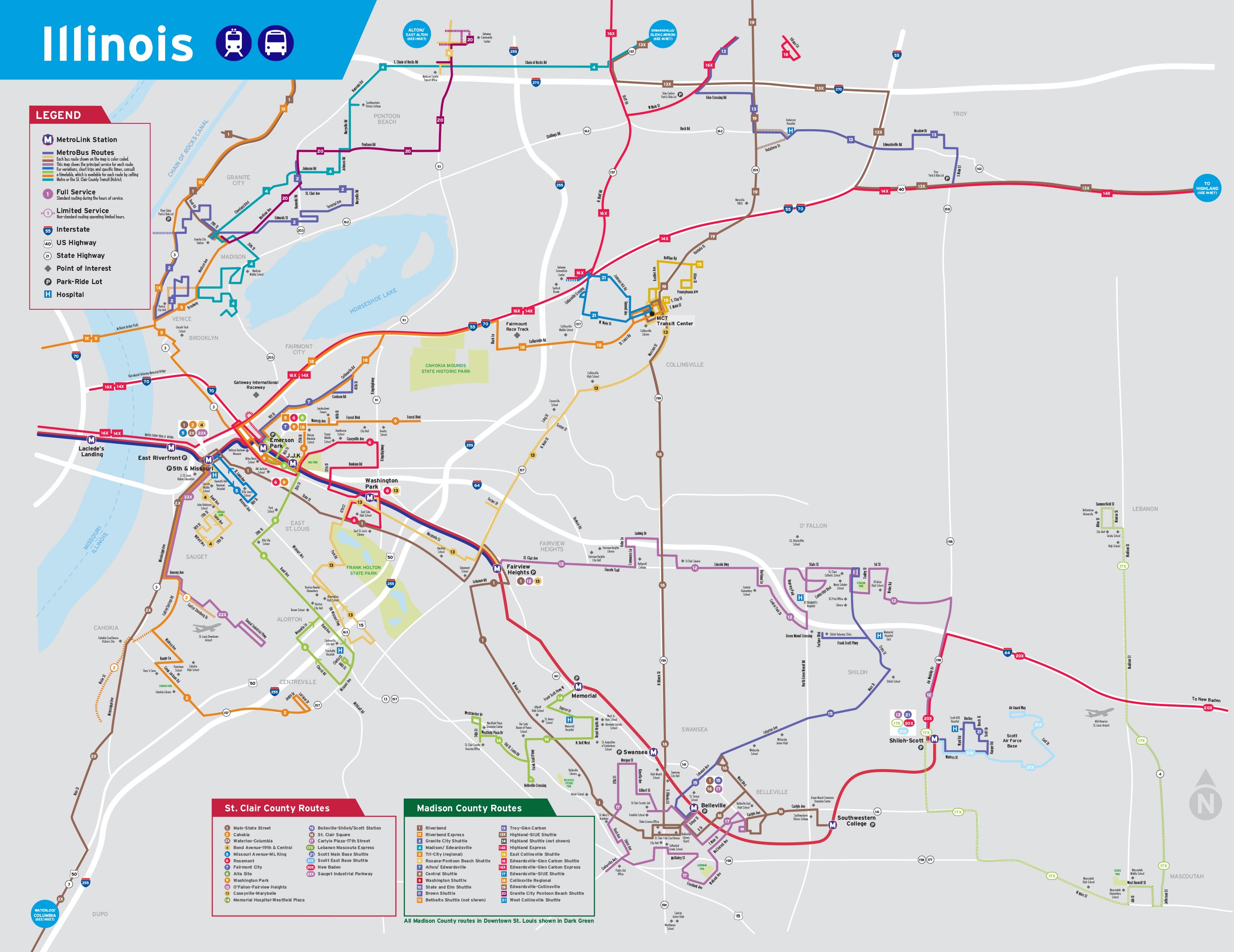
Memorial Hospital station is a light rail station on the Red Line of the St. Louis MetroLink system. [5] This below-grade station is located beneath an overpass on Frank Scott Parkway in Belleville, Illinois and has 431 park and ride spaces across three parking lots.
Memorial Hospital has a connection to the St. Clair County Transit District's 14-mile (23 km) MetroBikeLink shared-use path system. [6]
The island platform is accessed via a single ramp that connects to the MetroBikeLink trail and ramps to Frank Scott Parkway.
Street | Entrance/exit, bus bays, park and ride |
Westbound | ← Red Line toward Lambert Airport (Fairview Heights) |
Island platform, doors will open on the left | |
Eastbound | Red Line toward Shiloh–Scott (Swansea) → |
MetroLink is a light rail system that serves the Greater St. Louis area. Operated by Metro Transit in a shared fare system with MetroBus, the two-line, 38-station system runs from St. Louis Lambert International Airport and Shrewsbury in Missouri to Scott Air Force Base in Illinois. Intermediate destinations include downtown Clayton, Forest Park, and downtown St. Louis. It is the only U.S. light rail system to cross state lines.
The Metro East is an urban area in Southern Illinois, United States that contains the eastern and northern suburbs and exurbs of St. Louis, Missouri. It encompasses eight counties in the Greater St. Louis area and constitutes the second-most populous urban area in Illinois. The region's most populated city is Belleville, with 42,404 residents.
North Hanley station is a light rail station on the Red Line of the St. Louis MetroLink system. This at-grade station is located near the intersection of North Hanley Road and Interstate 70 and primarily serves North County commuters with a large MetroBus transfer and 1,731 park-and-ride spaces.
MidAmerica St. Louis Airport is a public use airport next to Scott Air Force Base. It is located 18 nautical miles [nmi] east of downtown St. Louis and 14 nmi east of the central business district of Belleville in St. Clair County, Illinois, United States. Opened in 1997, MidAmerica is the secondary domestic passenger airport for the Greater St. Louis metropolitan area, after the larger St. Louis Lambert International Airport. It is a joint-use airport and is currently served by one scheduled commercial airline, Allegiant Air.
Grand station is a light rail station on the Red and Blue lines of the St. Louis MetroLink system. This at-grade station is situated beneath the Grand Boulevard viaduct and connects to the region's busiest bus line, the #70 Grand, which runs electric, articulated buses.
Civic Center station is a light rail station on the Red and Blue lines of the St. Louis MetroLink system. This below-grade station is located near 14th and Spruce streets near Interstate 64. It is also the primary transfer station for MetroBus and serves bus routes operated by Madison County Transit. Additionally, the station adjoins the Gateway Multimodal Transportation Center which has intercity services provided by Amtrak, Greyhound, and others.
Skinker station is a light rail station on the Blue Line of the St. Louis MetroLink system. This subway station is located beneath the intersection of Skinker Boulevard and Forest Park Parkway near the boundary of St. Louis and University City, Missouri.
Clayton station is a light rail station on the Blue Line of the St. Louis MetroLink system. This at-grade station is located in the median of Forest Park Parkway between South Central Avenue and South Meramec Avenue in downtown Clayton.
Richmond Heights station is a light rail station on the Blue Line of the St. Louis MetroLink system. This at-grade station is located near the interchange of Interstate 170 and Galleria Parkway in Richmond Heights, Missouri.
College station is a light rail station on the Red Line of the St. Louis MetroLink system. This at-grade station serves Southwestern Illinois College on the eastern edge of Belleville, Illinois. It is also features MetroBus service and 623 park and ride spaces.
Swansea station is a light rail station on the Red Line of the St. Louis MetroLink system. This at-grade station is located in Swansea, Illinois between Illinois State Routes 159 and 161. It is primarily a commuter station with 751 park and ride spaces and MetroBus service.
Emerson Park station is a light rail station on the Red and Blue lines of the St. Louis MetroLink system. This at-grade station is located near 15th Street and Bowman Avenue in East St. Louis, Illinois. It also serves as a transfer for MetroBus and Madison County Transit and features 841 park and ride spaces.
Jackie Joyner-Kersee Center station is a light rail station on the Red and Blue lines of the St. Louis MetroLink system. This at-grade station is adjacent to the Jackie Joyner-Kersee Youth Center and just north of Interstate 64's exit 4B in East St. Louis, Illinois.
Washington Park station is a light rail station on the Red and Blue lines of the St. Louis MetroLink system. This at-grade station is located on the city limit line between East St. Louis, Illinois and Washington Park, Illinois.
Fairview Heights station is a light rail station on the Red and Blue lines of the St. Louis MetroLink system. This at-grade station is located on the western edge of Fairview Heights, Illinois near the intersection of St. Clair Avenue and Illinois Route 161. It is the eastern terminus of the Blue Line and has a pocket track allowing Blue Line trains to reverse directions and layover between runs.
Belleville station is a light rail station on the Red Line of the St. Louis MetroLink system. This at-grade station bisects Scheel Street in the northern section of Belleville, Illinois approximately one-mile (1.6 km) from the center of town. It features a MetroBus transfer and 321 park and ride spaces.
Shiloh–Scott station is a light rail station and current terminus of the Red Line of the St. Louis MetroLink system. This at-grade station is located in Shiloh, Illinois, adjacent to Scott Air Force Base, after which the station is named.
Madison County Transit, or MCT for short, is a bus and bike trail transportation system that serves the citizens of Madison County, which is located in Illinois approximately 20 miles (32 km) northeast of St. Louis. It was created in 1980 by the Madison County Board to improve transportation in Madison County, and is a completely separate transit system from the St. Louis Metro Transit system which includes MetroLink, which doesn't operate into Madison County, though the buses connect with many MetroBus routes and even serve MetroLink stations in East St. Louis, Belleville and Downtown St. Louis.
The Red Line is the older and longer line of the MetroLink light rail system in Greater St. Louis. It serves 29 stations across three counties and two states.
MetroBus is a public bus service operated by Metro Transit that serves the Greater St. Louis area. In 2023, the service had an annual ridership of 12,531,400, or about 37,300 per weekday as of the first quarter of 2024.