Shared-use path

Last updated
A shared-use path in Budapest, with a typical European shared use sign Nagytetenyi Road, shared path sign, 2021 Nagyteteny.jpg
A shared-use path in Budapest, with a typical European shared use sign
Cyclists are often permitted to use rail trails and bridleways, such as this rail trail in Germany. Gottingen rail trail, cyclists.jpg
Cyclists are often permitted to use rail trails and bridleways, such as this rail trail in Germany.

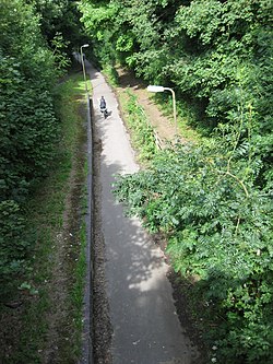
A shared-use path, mixed-use path or multi-use pathway [1] is a path which is "designed to accommodate the movement of pedestrians and cyclists". [2] Examples of shared-use paths include sidewalks designated as shared-use, bridleways and rail trails. A shared-use path typically has a surface that is asphalt, concrete or firmly packed crushed aggregate. Shared-use paths differ from cycle tracks and cycle paths in that shared-use paths are designed to include pedestrians even if the primary anticipated users are cyclists.

Contents

The path may also permit other users such as inline skating. Contrastingly, motorcycles and mopeds are normally prohibited.[ citation needed ][ where? ] Shared-use paths sometimes provide different lanes for users who travel at different speeds to prevent conflicts between user groups on high-use trails. [3] Shared-use paths are criticised for creating conflict between different users. The UK's Department for Transport deprecates this kind of route in denser urban environments. [4]

Types

Bridleways

In the UK, cyclists are legally permitted to cycle on bridleways (paths open to horse riders), but not on public footpaths. Therefore, bridleways are, in effect, a form of shared-use path. [5]

Segregated paths

A segregated path in Birmingham, England. Note the tactile pavings to delianate the pedestrian and cyclist sections of the path. Shared use path alongside Aston Webb Boulevard (Selly Oak New Road- Phase 2) - geograph.org.uk - 2580483.jpg
A segregated path in Birmingham, England. Note the tactile pavings to delianate the pedestrian and cyclist sections of the path.

On segregated or divided paths, the path is split into a section for pedestrians and a section for cyclists. This may be achieved with a painted line or different surface. It may also be delineated with tactile paving for blind and visually impaired pedestrians.

Research by the UK Department for Transport found that cyclists and pedestrians prefer wider non-segregated paths to more narrow segregated paths (e.g. a 3 m wide shared path, compared with a 3 m path split into 1.5 m sections). [6]

Benefits

The principal benefit of a shared-use path is saving space. This may be important in environmentally-sensitive areas or on narrow streets, where a full cycle track may not be feasible. [7]

Issues

Shared use paths are criticised for creating conflict between pedestrians and cyclists and creating complaints from pedestrians and speed. Therefore, the paths do not properly take into account the different needs of different road users. [8] For example a study by the Institute for Chartered Engineers found that users of shared use paths were confused about the nature of the path and who has priority on them. [2]

Pedestrians are sometimes unsure how to behave on shared-use paths. The question arises whether the path is to be treated as a road (therefore pedestrians should face oncoming traffic) or a path (and therefore pedestrians may walk wherever they choose). [2]

Shared-use paths alongside the highway often look like sidewalks to motorists. Therefore, at side roads, in jurisdictions where pedestrians do not have priority at side roads, the priority situation at side roads on shared-use paths can be confusing and often cyclists are required to give way to turning motorists. [6]

By country

United Kingdom

Part of the Milton Keynes redway system runs along the disused track bed of the former Wolverton to Newport Pagnell Line, now a rail trail. Fomer Bradwell Halt, July 2009.JPG
Part of the Milton Keynes redway system runs along the disused track bed of the former Wolverton to Newport Pagnell Line, now a rail trail.

Before the January 2022 revision, the Highway Code gave no advice to pedestrians on how to share space with cyclists; [9] there was is also little guidance given to cyclists. [2] (The 2023 edition covers both aspects. [10] The UK Department for Transport advises local authorities that cyclists and pedestrians should not be expected to share space on or alongside city streets. [4] Sustrans gives advice for cyclists, walkers and runners using shared-use paths on the National Cycle Network. [11]

The Milton Keynes redway system is an example of a city-wide network of shared-use paths. The network consists of over 200 miles (320 km) of shared-use paths that avoid the city's busy and fast grid roads (which run between neighbourhoods rather than through them). [12]

United States

In the US, the 1999 AASHTO Guide for the Development of Bicycle Facilities defines a shared-use path as being physically separated from motor vehicular traffic with an open space or barrier. [13]

See also

Related Research Articles

<span class="mw-page-title-main">Trail</span> Path for mostly non-motorized travel through a natural area

A trail, also known as a path or track, is an unpaved lane or a small paved road not intended for usage by motorized vehicles, usually passing through a natural area. In the United Kingdom and the Republic of Ireland, a path or footpath is the preferred term for a pedestrian or hiking trail. The term is also applied in North America to accompanying routes along rivers, and sometimes to highways. In the US, the term was historically used for a route into or through wild territory used by explorers and migrants. In the United States, "trace" is a synonym for trail, as in Natchez Trace.

<span class="mw-page-title-main">Footpath</span> Thoroughfare for pedestrians

A footpath is a type of thoroughfare that is intended for use only by pedestrians and not other forms of traffic such as motorized vehicles, bicycles and horses. They can be found in a wide variety of places, from the centre of cities, to farmland, to mountain ridges. Urban footpaths are usually paved, may have steps, and can be called alleys, lanes, steps, etc.

<span class="mw-page-title-main">Sustrans</span> British walking and cycling charity

Sustrans is a United Kingdom-based walking, wheeling and cycling charity, and the custodian of the National Cycle Network.

<span class="mw-page-title-main">Bike path</span> Bikeway separated from motorized traffic

A bike path or a cycle path is a bikeway separated from motorized traffic and dedicated to cycling or shared with pedestrians or other non-motorized users. In the US a bike path sometimes encompasses shared use paths, "multi-use path", or "Class III bikeway" is a paved path that has been designated for use by cyclists outside the right of way of a public road. It may or may not have a center divider or stripe to prevent head-on collisions. In the UK, a shared-use footway or multi-use path is for use by both cyclists and pedestrians.

<span class="mw-page-title-main">Taff Trail</span> Walking and cycling track in South Wales

The Taff Trail is a popular walking and cycle path that runs for 55 miles (89 km) between Cardiff Bay and Brecon in Wales. It is so named because it follows the course of the River Taff. Along much of its length, it follows the National Cycle Network Route 8 that continues to Holyhead, and is substantially off-road.

<span class="mw-page-title-main">Bike lane</span> Road traffic lane for cyclists

Bike lanes (US) or cycle lanes (UK) are types of bikeways (cycleways) with lanes on the roadway for cyclists only. In the United Kingdom, an on-road cycle-lane can be firmly restricted to cycles or advisory. In the United States, a designated bicycle lane or class II bikeway (Caltrans) is always marked by a solid white stripe on the pavement and is for 'preferential use' by bicyclists. There is also a class III bicycle route, which has roadside signs suggesting a route for cyclists, and urging sharing the road. A class IV separated bike way (Caltrans) is a bike lane that is physically separate from motor traffic and restricted to bicyclists only.

<span class="mw-page-title-main">Bicycle transportation planning and engineering</span>

Bicycle transportation planning and engineering are the disciplines related to transportation engineering and transportation planning concerning bicycles as a mode of transport and the concomitant study, design and implementation of cycling infrastructure. It includes the study and design of dedicated transport facilities for cyclists as well as mixed-mode environments and how both of these examples can be made to work safely. In jurisdictions such as the United States it is often practiced in conjunction with planning for pedestrians as a part of active transportation planning.

<span class="mw-page-title-main">Bicycle safety</span> Safety practices to reduce risk associated with cycling

Bicycle safety is the use of road traffic safety practices to reduce risk associated with cycling. Risk can be defined as the number of incidents occurring for a given amount of cycling. Some of this subject matter is hotly debated: for example, which types of cycling environment or cycling infrastructure is safest for cyclists. The merits of obeying the traffic laws and using bicycle lighting at night are less controversial. Wearing a bicycle helmet may reduce the chance of head injury in the event of a crash.

<span class="mw-page-title-main">Greenway (landscape)</span> Shared-use path or linear park with vegetation

A greenway is usually a shared-use path along a strip of undeveloped land, in an urban or rural area, set aside for recreational use or environmental protection. Greenways are frequently created out of disused railways, canal towpaths, utility company rights of way, or derelict industrial land. Greenways can also be linear parks, and can serve as wildlife corridors. The path's surface may be paved and often serves multiple users: walkers, runners, bicyclists, skaters and hikers. A characteristic of greenways, as defined by the European Greenways Association, is "ease of passage": that is that they have "either low or zero gradient", so that they can be used by all "types of users, including mobility impaired people".

<span class="mw-page-title-main">Milton Keynes redway system</span> Shared path network in Milton Keynes, England

The Milton Keynes redway system is an over 200 miles network of shared use paths for cyclists and pedestrians in Milton Keynes, Buckinghamshire, England. It is generally surfaced with red tarmac, and criss-crosses most of the city.

<span class="mw-page-title-main">Subway (underpass)</span> Underpass for pedestrians and cycles

A subway, also known as an underpass, is a grade-separated pedestrian crossing which crosses underneath a road or railway in order to entirely separate pedestrians and cyclists from motor traffic or trains respectively.

<span class="mw-page-title-main">Cycle track</span> Cycleway between a road and sidewalk, protected by barriers

A cycle track or cycleway (British) or bikeway, sometimes historically referred to as a sidepath, is a separate route for cycles and not motor vehicles. In some cases cycle tracks are also used by other users such as pedestrians and horse riders. A cycle track can be next to a normal road, and can either be a shared route with pedestrians or be made distinct from both the pavement and general roadway by vertical barriers or elevation differences.

<span class="mw-page-title-main">Bridle path</span> Path that can be used by people riding horses

A bridle path, also bridleway, equestrian trail, horse riding path, ride, bridle road, or horse trail, is a trail or a thoroughfare that is used by people riding on horses. Trails originally created for use by horses often now serve a wider range of users, including equestrians, hikers, and cyclists. Such paths are either impassable for motorized vehicles, or vehicles are banned. The laws relating to allowable uses vary from country to country.

<span class="mw-page-title-main">Cycling in Cardiff</span> Transport by bicycle in Cardiff, Wales

Cycling in Cardiff, capital of Wales, is facilitated by its easy gradients and large parks. In the mid-2000s between 2.7% and 4.3% of people commuted to work by cycling in the city. In 2017 12.4% of workers cycled to work at least 5 days a week. However, cyclists in the city are deterred from cycling by poor facilities and aggressive traffic, according to research by Cardiff University.

<span class="mw-page-title-main">Cycling in Perth</span>

Cycling in Perth, Western Australia is common on the roads and paths for recreation, commuting and sport. Between 1998 and 2009 the number of cyclists in Perth increased 450%.

<span class="mw-page-title-main">Cycling infrastructure</span> Facilities for use by cyclists

Cycling infrastructure is all infrastructure cyclists are allowed to use. Bikeways include bike paths, bike lanes, cycle tracks, rail trails and, where permitted, sidewalks. Roads used by motorists are also cycling infrastructure, except where cyclists are barred such as many freeways/motorways. It includes amenities such as bike racks for parking, shelters, service centers and specialized traffic signs and signals. The more cycling infrastructure, the more people get about by bicycle.

The history of cycling infrastructure starts from shortly after the bike boom of the 1880s when the first short stretches of dedicated bicycle infrastructure were built, through to the rise of the automobile from the mid-20th century onwards and the concomitant decline of cycling as a means of transport, to cycling's comeback from the 1970s onwards.

<span class="mw-page-title-main">Safety of cycling infrastructure</span> Overview of bicycle safety concerns

There is debate over the safety implications of cycling infrastructure. Recent studies generally affirm that segregated cycle tracks have a better safety record between intersections than cycling on major roads in traffic. Furthermore, cycling infrastructure tends to lead to more people cycling. A higher modal share of people cycling is correlated with lower incidences of cyclist fatalities, leading to a "safety in numbers" effect though some contributors caution against this hypothesis. On the contrary, older studies tended to come to negative conclusions about mid-block cycle track safety.

<span class="mw-page-title-main">Bikeway controversies</span>

Controversies have surrounded dedicated cycling routes in cities. Some critics of bikeways argue that the focus should instead be placed on educating cyclists in road safety, and others that safety is better served by using the road space for parking. There is debate over whether cycle tracks are an effective factor to encourage cycling or whether other factors are at play.

References

  1. "Multi-Use Pathways" (PDF). NCDOT. Retrieved 20 June 2021.
  2. 1 2 3 4 Delaney, Hannah; Parkhurst, Graham; Melia, Steve (2017-09-01). "Walking and cycling on shared-use paths: the user perspective". Proceedings of the Institution of Civil Engineers - Municipal Engineer. 170 (3): 175–184. doi: 10.1680/jmuen.16.00033 . ISSN   0965-0903.
  3. "Part II of II: Best Practices Design Guide - Sidewalk2 - Publications - Bicycle and Pedestrian Program - Environment". Federal Highway Administration. 2017. Retrieved 25 March 2019.
  4. 1 2 Cycle Infrastructure Design (Local Transport Note 1/20) (PDF) (Report). Government of the United Kingdom. July 2020. p. 9. Retrieved 25 January 2023. Cycles must be treated as vehicles and not as pedestrians. On urban streets, cyclists must be physically separated from pedestrians and should not share space with pedestrians. Where cycle routes cross pavements, a physically segregated track should always be provided. At crossings and junctions, cyclists should not share the space used by pedestrians but should be provided with a separate parallel route
  5. "Shared use routes - Ramblers". www.ramblers.org.uk. Retrieved 2022-10-12.
  6. 1 2 "New guidance on shared use routes | Cycling UK". www.cyclinguk.org. Retrieved 2022-10-12.
  7. "Sustrans Shared Use Paths". www.hedgehogcycling.co.uk. Retrieved 2022-10-12.
  8. "A view from the cycle path" . Retrieved 2022-10-12.
  9. "The Highway Code UPDATES". Department for Transport, Government of the United Kingdom. 29 January 2022. Retrieved 25 January 2023.
  10. The Highway Code. Department for Transport, Government of the United Kingdom. 27 July 2022. §13, §62, 63. Retrieved 25 January 2023.
  11. "Advice on using shared-use paths". Sustrans. 22 February 2019. Retrieved 30 October 2023.
  12. "Redways". MK Council. Retrieved 23 May 2018.
  13. "A Guide for the Development of Bicycle Facilities (Fourth Edition)" (PDF). National Association of City Transportation Officials. 2012. Retrieved 25 March 2019.