Menan Buttes

Last updated
Menan Buttes
North Menan Butte Idaho.jpg
North Menan Butte
Highest point
Elevation 5,619 ft (1,713 m)
Coordinates 43°47′04″N111°58′23″W / 43.78444°N 111.97306°W / 43.78444; -111.97306
Geography
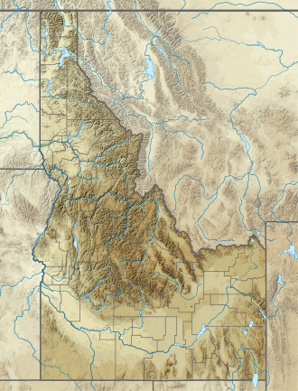
USA Idaho relief location map.svg
Red triangle with thick white border.svg
Menan Buttes
Location in Idaho
Location Madison / Jefferson counties, Idaho, United States
Topo map
Geology
Age of rock late Pleistocene, approximately 10,000 YBP
Mountain type tuff cones
Designated1980

The North and South Menan Buttes in southeastern Idaho are two of the world's largest volcanic tuff cones. The two cones, with four smaller associated cones, align along a north-northwest line and comprise the Menan Complex. The buttes rise about 800 feet (250 m) above the surrounding Snake River plain and are late Pleistocene in age, dating to approximately 10,000 YBP (Years Before Present). The South Menan Butte is currently in private hands, however North Menan Butte is publicly owned and has been designated as a National Natural Landmark and a Research Natural Area by the United States Congress. The US Bureau of Land Management designated the North Butte as an Area of Critical Environmental Concern (ACEC).

Contents

The volcanoes forming the two major Menan Buttes were created when basaltic magma came into contact with a shallow aquifer or with the precursor of the modern Snake River. Particles of volcanic glass called tachylite were created as the water turned to steam and explosively fragmented the hot magma. The cone shaped deposits are fairly uniform and consist primarily of tuff in lapilli-size particles. Some deposit layers preserve indentations, designated as "bomb sags", made as larger pyroclastic particles landed on soft layers of tuff.

The Menan Buttes stand at an elevation of 5,619 feet (1,713 m.) and are very similar in size and shape. North Menan Butte is slightly larger and elliptical, with axes 3.5 and 2.5 km in length. South Menan Butte measures 3 km x 2 km. The crater of the North Menan Butte is about 3,000 feet (900 m) in diameter and the cone is about 6,000 feet (1,800 m) in diameter. The North Butte's volume is 0.16 cubic miles (0.70 cubic km) and the South Butte measures at 0.07 cubic miles (0.30 cubic km). In comparison, the better known tuff cone Diamond Head on Oahu has a volume of 0.15 cubic miles (0.6 cubic km). The larger buttes in the Menan Complex are asymmetrical. Each has a greater accumulation of material on the northeast, presumably due to strong southwest winds during the initial eruption. [1]

The Menan Buttes are located in Madison County, with lower slopes extending westward into Jefferson County. Nearby communities include Menan, Rigby, Rexburg and Idaho Falls, Idaho.
See also

Related Research Articles

<span class="mw-page-title-main">Mono–Inyo Craters</span> Volcanic chain in eastern California, United States

The Mono–Inyo Craters are a volcanic chain of craters, domes and lava flows in Mono County, Eastern California. The chain stretches 25 miles (40 km) from the northwest shore of Mono Lake to the south of Mammoth Mountain. The Mono Lake Volcanic Field forms the northernmost part of the chain and consists of two volcanic islands in the lake and one cinder cone volcano on its northwest shore. Most of the Mono Craters, which make up the bulk of the northern part of the Mono–Inyo chain, are phreatic volcanoes that have since been either plugged or over-topped by rhyolite domes and lava flows. The Inyo volcanic chain form much of the southern part of the chain and consist of phreatic explosion pits, and rhyolitic lava flows and domes. The southernmost part of the chain consists of fumaroles and explosion pits on Mammoth Mountain and a set of cinder cones south of the mountain; the latter are called the Red Cones.

<span class="mw-page-title-main">Geology of the Lassen volcanic area</span> Geology of a U.S. national park in California

The Lassen volcanic area presents a geological record of sedimentation and volcanic activity in and around Lassen Volcanic National Park in Northern California, U.S. The park is located in the southernmost part of the Cascade Mountain Range in the Pacific Northwest region of the United States. Pacific Oceanic tectonic plates have plunged below the North American Plate in this part of North America for hundreds of millions of years. Heat and molten rock from these subducting plates has fed scores of volcanoes in California, Oregon, Washington and British Columbia over at least the past 30 million years, including these in the Lassen volcanic areas.

<span class="mw-page-title-main">Newberry Volcano</span> Shield volcano in Oregon, United States

Newberry Volcano is a large active shield-shaped stratovolcano located about 20 miles (32 km) south of Bend, Oregon, United States, 35 miles (56 km) east of the major crest of the Cascade Range, within the Newberry National Volcanic Monument. Its highest point is Paulina Peak. The largest volcano in the Cascade Volcanic Arc, Newberry has an area of 1,200 square miles (3,100 km2) when its lava flows are taken into account. From north to south, the volcano has a length of 75 miles (121 km), with a width of 27 miles (43 km) and a total volume of approximately 120 cubic miles (500 km3). It was named for the geologist and surgeon John Strong Newberry, who explored central Oregon for the Pacific Railroad Surveys in 1855.

<span class="mw-page-title-main">Mount Jefferson (Oregon)</span> Stratovolcano in the Cascade Range, Oregon, US

Mount Jefferson is a stratovolcano in the Cascade Volcanic Arc, part of the Cascade Range in the U.S. state of Oregon. The second highest mountain in Oregon, it is situated within Linn County, Jefferson County, and Marion County and forms part of the Mount Jefferson Wilderness. Due to the ruggedness of its surroundings, the mountain is one of the hardest volcanoes to reach in the Cascades. It is also a popular tourist destination despite its remoteness, with recreational activities including hiking, backpacking, mountaineering, and photography. Vegetation at Mount Jefferson is dominated by Douglas fir, silver fir, mountain hemlock, ponderosa pine, lodgepole pine, and several cedar species. Carnivores, insectivores, bats, rodents, deer, birds, and various other species inhabit the area.

<span class="mw-page-title-main">Mount Washington (Oregon)</span> Deeply eroded volcano in the Cascade Range of Oregon

Mount Washington is a deeply eroded volcano in the Cascade Range of Oregon. It lies within Deschutes and Linn counties and is surrounded by the Mount Washington Wilderness area.

<span class="mw-page-title-main">Belknap Crater</span> Shield volcano in the U.S. state of Oregon

Belknap Crater is a shield volcano in the Cascade Range in the U.S. state of Oregon. Located in Linn County, it is associated with lava fields and numerous subfeatures including the Little Belknap and South Belknap volcanic cones. It lies north of McKenzie Pass and forms part of the Mount Washington Wilderness. Belknap is not forested and most of its lava flows are not vegetated, though there is some wildlife in the area around the volcano, as well as a number of tree molds formed by its eruptive activity.

<span class="mw-page-title-main">Snake River Plain</span> Geologic feature in Idaho, US

<span class="mw-page-title-main">Island Park Caldera</span> Large caldera in Yellowstone National Park

The Island Park Caldera, in the U.S. states of Idaho and Wyoming, is one of the world's largest calderas, with approximate dimensions of 80 by 65 km. Its ashfall is the source of the Huckleberry Ridge Tuff that is found from southern California to the Mississippi River near St. Louis. This super-eruption of approximately 2,500 km3 (600 cu mi) occurred 2.1 Ma and produced 2,500 times as much ash as the 1980 eruption of Mount St. Helens. Island Park Caldera has the smaller and younger Henry's Fork Caldera nested inside it.

<span class="mw-page-title-main">Yellowstone hotspot</span> Volcanic hotspot in the United States

The Yellowstone hotspot is a volcanic hotspot in the United States responsible for large scale volcanism in Idaho, Montana, Nevada, Oregon, and Wyoming, formed as the North American tectonic plate moved over it. It formed the eastern Snake River Plain through a succession of caldera-forming eruptions. The resulting calderas include the Island Park Caldera, Henry's Fork Caldera, and the Bruneau-Jarbidge caldera. The hotspot currently lies under the Yellowstone Caldera. The hotspot's most recent caldera-forming supereruption, known as the Lava Creek Eruption, took place 640,000 years ago and created the Lava Creek Tuff, and the most recent Yellowstone Caldera. The Yellowstone hotspot is one of a few volcanic hotspots underlying the North American tectonic plate; another example is the Anahim hotspot.

<span class="mw-page-title-main">Boring Lava Field</span> Plio-Pleistocene volcanic field in Oregon, United States

The Boring Lava Field is a Plio-Pleistocene volcanic field with cinder cones, small shield volcanoes, and lava flows in the northern Willamette Valley of the U.S. state of Oregon and adjacent southwest Washington. The field got its name from the town of Boring, Oregon, located 12 miles (20 km) southeast of downtown Portland. Boring lies southeast of the densest cluster of lava vents. The zone became volcanically active about 2.7 million years ago, with long periods of eruptive activity interspersed with quiescence. Its last eruptions took place about 57,000 years ago at the Beacon Rock cinder cone volcano; the individual volcanic vents of the field are considered extinct, but the field itself is not.

<span class="mw-page-title-main">Level Mountain</span> Volcanic complex in British Columbia, Canada

Level Mountain is a large volcanic complex in the Northern Interior of British Columbia, Canada. It is located 50 kilometres north-northwest of Telegraph Creek and 60 kilometres west of Dease Lake on the Nahlin Plateau. With a maximum elevation of 2,164 metres, it is the second-highest of four large complexes in an extensive north–south trending volcanic region. Much of the mountain is gently-sloping; when measured from its base, Level Mountain is about 1,100 metres tall, slightly taller than its neighbour to the northwest, Heart Peaks. The lower, broader half of Level Mountain consists of a shield-like structure while its upper half has a more steep, jagged profile. Its broad summit is dominated by the Level Mountain Range, a small mountain range with prominent peaks cut by deep valleys. These valleys serve as a radial drainage for several small streams that flow from the mountain. Meszah Peak is the only named peak in the Level Mountain Range.

<span class="mw-page-title-main">Pelican Butte</span> Mountain in United States of America

Pelican Butte is a steep-sided dormant shield volcano in the Cascade Range of southern Oregon. It is located 28 miles (45 km) due south of Crater Lake and 12 miles (19 km) northeast of Mount McLoughlin, and rises over 3,800 feet (1,200 m) directly above the shore of Upper Klamath Lake. Ice age glaciers carved a large cirque into the northeast flank of the mountain, forming a steep bowl which is popular in winter with backcountry skiers and snowmobilers. Several proposals have been made over the last few decades for ski area development on the northeast flanks, but none of the proposals has obtained the regulatory approval from the United States Forest Service necessary to proceed with construction. If the ski area is ever built, its skiable vertical of over 3,800 feet (1,200 m) would be the largest in Oregon exceeding the 3,590 feet (1,090 m) of Timberline Lodge ski area on Mount Hood.

<span class="mw-page-title-main">Albuquerque volcanic field</span> Volcanic field in the Albuquerque Basin in New Mexico, United States

The Albuquerque volcanic field is a monogenetic volcanic field in the Albuquerque Basin in New Mexico, United States. It is located about 7 miles (11 km) west of the city of Albuquerque, and is contained within the borders of Petroglyph National Monument. The field was active from 190,000 to 155,000 years ago and includes lava flows, cinder cones, and spatter cones. The oldest lava flows cover about 23 square miles (60 km2). The cones are aligned and possibly formed above two roughly north-south trending fissures. Vulcan is the highest feature. Its base is made of cinder, but the crater contains a lava dome that was cut by an explosive eruption.

<span class="mw-page-title-main">Twin Buttes (California)</span> Group of volcanic cinder cones in Shasta County, California, United States

The Twin Buttes are two volcanic cinder cones located in the Cascade Mountain Range in Shasta County, California. They are part of the Bidwell Spring chain and lie within a region that was active in the Quaternary. Formed during the Pleistocene between 25,000 and 15,000 years ago, the volcanoes erupted lava flows that coursed toward the Burney Mountain lava dome. These lava flows cover an area of 3.9 square miles (10.1 km2) and are made of basalt and dacite. The volcanoes also erupted cinder and volcanic ash that reached eastward.

<span class="mw-page-title-main">Fort Rock–Christmas Lake Valley basin</span> Endorheic pluvial lake in Oregon

Fort Rock–Christmas Lake Valley is a basin of a former inland sea that existed in that region from Pliocene through late Pleistocene time.

<span class="mw-page-title-main">Timeline of volcanism on Earth</span>

This timeline of volcanism on Earth includes a list of major volcanic eruptions of approximately at least magnitude 6 on the Volcanic explosivity index (VEI) or equivalent sulfur dioxide emission during the Quaternary period. Other volcanic eruptions are also listed.

<span class="mw-page-title-main">Pahvant Butte</span> Geographic feature in Utah, United States

Pahvant Butte is a butte formed by a dormant volcano in the west-central portion of Utah, United States.

<span class="mw-page-title-main">Lunar Crater volcanic field</span> Volcanic field in Nye County, Nevada

Lunar Crater volcanic field is a volcanic field in Nye County, Nevada. It lies along the Reveille and Pancake Ranges and consists of over 200 vents, mostly small volcanic cones with associated lava flows but also several maars, including one maar named Lunar Crater. Some vents have been eroded so heavily that the structures underneath the volcanoes have been exposed. Lunar Crater itself has been used as a testing ground for Mars rovers and as training ground for astronauts.

<span class="mw-page-title-main">Middle Butte</span> Cryptodome in the state of Idaho

Middle Butte is a 6,391-foot elevation (1,948 m) summit located in Bingham County, Idaho, United States.

References

  1. Wood, Charles Arthur and Jürgen Kienle, Volcanoes of North America: United States and Canada, Cambridge University Press, 1992, ISBN   0-521-43811-X, 978-0-521-43811-7, p. 251

Additional sources