The Highlands is a historical region of Scotland. Culturally, the Highlands and the Lowlands diverged from the Late Middle Ages into the modern period, when Lowland Scots replaced Scottish Gaelic throughout most of the Lowlands. The term is also used for the area north and west of the Highland Boundary Fault, although the exact boundaries are not clearly defined, particularly to the east. The Great Glen divides the Grampian Mountains to the southeast from the Northwest Highlands. The Scottish Gaelic name of A' Ghàidhealtachd literally means "the place of the Gaels" and traditionally, from a Gaelic-speaking point of view, includes both the Western Isles and the Highlands.

Inverness is a city in the Scottish Highlands. It is the administrative centre for The Highland Council and is regarded as the capital of the Highlands. Historically it served as the county town of the county of Inverness-shire. Inverness lies near two important battle sites: the 11th-century battle of Blàr nam Fèinne against Norway which took place on the Aird, and the 18th century Battle of Culloden which took place on Culloden Moor. It is the northernmost city in the United Kingdom and lies within the Great Glen at its northeastern extremity where the River Ness enters the Beauly Firth. At the latest, a settlement was established by the 6th century with the first royal charter being granted by Dabíd mac Maíl Choluim in the 12th century. Inverness and Inverness-shire are closely linked to various influential clans, including Clan Mackintosh, Clan Fraser and Clan MacKenzie.

The River Ness is a river about 6 miles long, which flows from the northern end of Loch Ness in Scotland, through Loch Dochfour, north-east to Inverness, with a total fall in height of about 16 metres before discharging into the Beauly Firth. The river is the origin of the name of Inverness which is from Scottish Gaelic: Inbhir Nis, meaning "Mouth of the Ness".

The Caledonian Canal connects the Scottish east coast at Inverness with the west coast at Corpach near Fort William in Scotland. The canal was constructed in the early nineteenth century by Scottish engineer Thomas Telford.

The Scottish Highland Football League is a senior football league based in the north of Scotland. The league sits at level 5 on the Scottish football league system, acting as a feeder to the Scottish Professional Football League.

The Moray Firth is a roughly triangular inlet of the North Sea, north and east of Inverness, which is in the Highland council area of north of Scotland. It is the largest firth in Scotland, stretching from Duncansby Head in the north, in the Highland council area, and Fraserburgh in the east, in the Aberdeenshire council area, to Inverness and the Beauly Firth in the west. Therefore, three council areas have Moray Firth coastline: Highland to the west and north of the Moray Firth and Highland, Moray and Aberdeenshire to the south. The firth has more than 800 kilometres of coastline, much of which is cliff.

The North Caledonian Football Association is a football association operating throughout the Highlands and Islands of Scotland and is a Recognised Body of the SFA and as such has its senior football competitions officially registered with the Scottish Football Association.

The Great Glen, also known as Glen Albyn or Glen More, is a glen in Scotland running for 62 miles (100 km) from Inverness on the edge of Moray Firth, in an approximately straight line to Fort William at the head of Loch Linnhe. It follows a geological fault known as the Great Glen Fault, and bisects the Scottish Highlands into the Grampian Mountains to the southeast and the Northwest Highlands to the northwest.

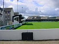
Clachnacuddin Football Club is a Scottish football club based in the city of Inverness, who currently play in the Highland Football League.
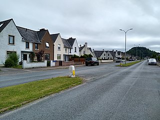
Dalneigh is an area in the city of Inverness in Scotland. Located in the west of the city, it lies between the River Ness and the Caledonian Canal. The name is derived from the Gaelic word Dail an Eich, meaning 'Field of the horse'. As hinted by the name, it was originally a farm, but following the end of the Second World War, it was turned into a residential area to provide housing for the expected increase in demand. Over the following fifty years, successive waves of development saw Dalneigh transformed from farmland into home for thousands of people.

The Beauly Firth is a firth in northern Scotland. It is the outlet for both the River Beauly and River Ness. The Beauly Firth is bounded at its western end by the town of Beauly and its eastern by Inverness, where it empties into the Moray Firth.

South Kessock is an area of the city of Inverness in the Highland council area of Scotland. It is situated to the city's north at the mouth of the River Ness. It is a traditionally working-class area.

The Longman is an area in the city of Inverness, Scotland. Located north of the city centre, it is bounded by the Moray Firth and River Ness and is home to the largest industrial estate in the city.

Scorguie is an area of the city of Inverness in the Highland council area of Scotland. It is situated in the city's north-west, on the west bank of the Caledonian Canal, and is often considered a suburb to the city.

Highland Rugby Football Club is a rugby union amateur club from the city of Inverness that compete in the Scottish National League Division Two, the Highland Alliance League and the Caledonia Regional League. They have a number of teams taken from different age groups including micros and minis, S1 and S2, Under-15, Under-16, Under-18 and senior first and second teams. They play their rugby at Canal park in Inverness.

Loch Ness is a large freshwater loch in the Scottish Highlands extending for approximately 37 kilometres southwest of Inverness. It takes its name from the River Ness, which flows from the northern end. Loch Ness is best known for alleged sightings of the cryptozoological Loch Ness Monster, also known affectionately as "Nessie". It is one of a series of interconnected, murky bodies of water in Scotland; its water visibility is exceptionally low due to a high peat content in the surrounding soil. The southern end connects to Loch Oich by the River Oich and a section of the Caledonian Canal. The northern end connects to Loch Dochfour via the River Ness, which then ultimately leads to the North Sea via the Moray Firth.

Muirtown is an area in the west end of the city of Inverness in the Scottish Highlands. It contains the Muirtown basin and Muirtown Primary School.

Dochgarroch is a settlement that lies at the start of the Caledonian Canal, at the head of Loch Ness in Inverness-shire, Scottish Highlands and is in the Scottish council area of Highland.
Lochend is a settlement that lies at the start of the Caledonian Canal, at the head of Loch Ness in Inverness-shire, Scottish Highlands and is in the Scottish council area of Highland.
Loch Ness Football Club is a Scottish football club playing in the North Caledonian Football League currently based in the town of Fortrose in the Scottish Highlands.