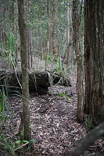
The Kanangra-Boyd National Park is a protected national park that is located in the Central Tablelands region, west of the Southern Highlands and Macarthur regions, in New South Wales, in eastern Australia. The 68,660-hectare (169,700-acre) national park is situated approximately 180 kilometres (110 mi) south-west of Sydney and is contiguous with the Blue Mountains National Park and the Nattai National Park. The park was established in 1969.

Narrabeen is a beachside suburb in northern Sydney, in the state of New South Wales, Australia. Narrabeen is 23 kilometres north-east of the Sydney central business district, in the local government area of Northern Beaches Council and is part of the Northern Beaches region. This area was named Broken Bay by James Cook as he sailed by.

Cranberry Glades — also known simply as The Glades — are a cluster of five small, boreal-type bogs in southwestern Pocahontas County, West Virginia, United States. This area, high in the Allegheny Mountains at about 3,400 feet (1,000 m), is protected as the Cranberry Glades Botanical Area, part of the Monongahela National Forest. This site is the headwaters of the Cranberry River, a popular trout stream, and is adjacent to the nearly 50,000-acre (200 km2) Cranberry Wilderness.
Wallumatta was the original name given to the Ryde-Hunters Hill area of the Lower North Shore of Sydney, Australia. Prior to the time that the area was known as Kissing Point, Wallumatta was the formal title and was named in honour of the area's native inhabitants: The Wallumettagal Aboriginal tribe.

The Manly Dam Reserve, also known as the Manly Warringah War Memorial Park, is a nature reserve of protected urban bushland located in the Northern Beaches region of Sydney, Australia. Located among the suburbs of Allambie Heights, North Balgowlah, Frenchs Forest and Manly Vale in the Northern Beaches Council local government area. The reserve adjoins the south-eastern edge of Garigal National Park.

Karawatha Forest or Karawatha nature reserve is approximately 900 hectares of bushland in the Brisbane suburbs of Karawatha and Stretton, Australia. It is one of the largest areas of remnant bushland within Brisbane. The predominant vegetation types in the forest are dry eucalypt forest and woodland with native heath understories. The Karawatha Forest Protection Society was formed to ensure that the bushland was protected from development and is owned and managed by the Brisbane City Council (BCC). Funds raised from the BCC's Bushland Preservation Levy have enabled the acquisition of land for preservation of Karawatha Forest.

The Sydney Turpentine-Ironbark Forest (STIF) is one of six main indigenous forest communities of Sydney, New South Wales, Australia, that is typically in the Inner West region of Sydney. It is also among the three of these plant communities which have been classified as Endangered, under the New South Wales government's Threatened Species Conservation Act 1995, with only around 0.5% of its original pre-settlement range remaining. As of 26 August 2005, the Australian Government reclassified Sydney Turpentine-Ironbark Forest as a "Critically Endangered Ecological Community", under the Commonwealth's Environment Protection and Biodiversity Conservation Act 1999.

The Grose River, a perennial river that is part of the Hawkesbury-Nepean catchment, is located in the Blue Mountains region of New South Wales, Australia.
Coxs Creek, a watercourse of the Cooks River catchment, is located in the Inner West of Sydney, in New South Wales, Australia.
The Truganina Coastal Parklands are located 15 km west of Melbourne CBD, on the shores of Port Phillip Bay, stretching from Altona to Altona Meadows and adjacent to the Cheetham Wetlands and the Point Cook Coastal Park. They were formed through the 'recycling' of more than 300 hectares of parks and former industrial land and are now the largest cluster of parks on Port Phillip Bay, interlinked by cycling and walking trails and featuring a surprisingly high diversity and abundance of landscapes, natural environment and recreational areas, including beachside recreation, picnic & barbecue facilities, grassfields and wildlife conservation areas. The wetlands form part of the Cheetham and Altona Important Bird Area.

The Wolli Creek Regional Park is a 50 hectares regional park, located adjacent to Wolli Creek within the Wolli Creek Valley, between Bexley North and Tempe in south-west Sydney, New South Wales, Australia.
Woorabinda Bushland Reserves, formerly known as the Stirling Linear Park, is a 34 ha network of four parks and reserves located in the suburbs of Stirling and Heathfield in the Mount Lofty Ranges, South Australia. The parks are part of the Aldgate Creek catchment which feeds into the Onkaparinga River. 4 km of walking trails connect Stirling Park and Woorabinda to Madurta and Hender Reserves, all of which are open to the general public. The parks contain notable natural and early European heritage value and a network of interpretive signage provides information to park visitors.

The Dharawal National Park is a protected national park that is located in the Illawarra region of New South Wales, in eastern Australia. The 6,508-hectare (16,080-acre) national park is situated between the Illawarra Range and the Georges River and is approximately 45 kilometres (28 mi) south west of Sydney. There are three entry points to the park: from the east through Darkes Forest; from the north through Wedderburn; and from the south through Appin.

Beaver Run is a tributary of Catawissa Creek in Columbia County, Pennsylvania, in the United States. It is approximately 6.2 miles (10.0 km) long and flows through Beaver Township. The stream's watershed has an area of 9.60 miles (15.45 km). Wetlands are present in the watershed. The stream was named by Alexander McCauley in 1774.

Central Mountain is a mountain in Columbia County, Sullivan County, and Luzerne County, in Pennsylvania, United States. Its elevation is 2,247 feet (685 m) above sea level. The mountain is part of the Allegheny Front. Rock formations on the mountain include the Pocono Formation and the Duncannon Member of the Catskill Formation. It was historically known as North Mountain, but it was renamed Central Mountain in the late 1800s. The mountain is one of the most important sites on the Columbia County Natural Areas Inventory and it is inhabited by dozens of trees, shrubs, and herbaceous plants. Numerous birds and several amphibians and mammals are also found in the area.

Melaleuca irbyana, commonly known as weeping paperbark, bushhouse paperbark and swamp paperbark is a plant in the myrtle family Myrtaceae and is endemic to New South Wales and Queensland in Australia. It is a shrub or small tree, often growing in pure stands in poorly drained areas. Its distribution is limited and it has been classified as an endangered species under legislation in both states and the forest as critically endangered under Australian government legislation.

The Cambewarra Range Nature Reserve, as part of the Kangaroo Valley Group of Nature Reserves, is a protected area located on the cliffs and plateaus of the Kangaroo Valley in the Southern Highlands and South Coast regions of New South Wales in eastern Australia. The Reserve is situated approximately 150 kilometres (93 mi) south of Sydney, 50 kilometres (31 mi) southwest of Wollongong and 16 kilometres (9.9 mi) northwest of Nowra. The Reserve has a total area of 1684 hectares, and includes 11 privately owned properties. It is critical for it to be pristine for a variety of reasons, not the least the catchment of water, as the Reserve floor flows into the Kangaroo Valley River and the Shoalhaven River, from which the Sydney Water Authority draws water to supply large populations in Sydney and Wollongong.

The swamp communities of the Blue Mountains are a geographically dispersed group of ecologically-endangered peat swamp communities, spanning multiple parts of the World Heritage-listed Blue Mountains National Park in New South Wales, Australia.

The Cumberland Plain Woodland is one of six main indigenous forest communities of Sydney, New South Wales, Australia. Situated in the Cumberland Plain, it is made up of dry sclerophyll woodlands and forests, reminiscent of the Mediterranean forests. Currently, less than 6% of the Woodlands remain in small parts distributed across the western suburbs of Sydney, totaling only around 6400 hectares.

The ecology of Sydney, located in the state of New South Wales, Australia, is diverse for its size, featuring biomes such as wet and dry sclerophyll forests or woodlands, shrublands, subtropical and evergreen temperate rainforests, heathlands, wetlands and grasslands, with the combination of climate, topography, moisture, and soil influencing the dispersion of these ecological communities across a height gradient from 0 to 200 metres. There are many hiking trails, paved and unpaved roads for exploring the many different biomes and ecosystems.


