The Westerwald is a low mountain range on the right bank of the river Rhine in the German federal states of Rhineland-Palatinate, Hesse and North Rhine-Westphalia. It is a part of the Rhenish Massif. Its highest elevation, at 657 m above sea level, is the Fuchskaute in the High Westerwald.

The Upper Rhine is the section of the Rhine in the Upper Rhine Plain between Basel in Switzerland and Bingen in Germany. The river is marked by Rhine-kilometres 170 to 529.

The Lahn is a 245.6-kilometre-long (152.6 mi), right tributary of the Rhine in Germany. Its course passes through the federal states of North Rhine-Westphalia (23.0 km), Hesse (165.6 km), and Rhineland-Palatinate (57.0 km).
Erlenbach may refer to several places:

Ahr is a river in Germany, a left tributary of the Rhine. Its source is at an elevation of approximately 470 metres (1,540 ft) above sea level in Blankenheim in the Eifel, in the cellar of a timber-frame house near the castle of Blankenheim. After 18 kilometres (11 mi) it crosses from North Rhine-Westphalia into Rhineland-Palatinate.
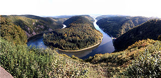
The Saar is a river in northeastern France and western Germany, and a right tributary of the Moselle. It rises in the Vosges mountains on the border of Alsace and Lorraine and flows northwards into the Moselle near Trier. It has two headstreams, that both start near Mont Donon, the highest peak of the northern Vosges. After 246 kilometres (153 mi) the Saar flows into the Moselle at Konz (Rhineland-Palatinate) between Trier and the Luxembourg border. It has a catchment area of 7,431 square kilometres (2,869 sq mi).
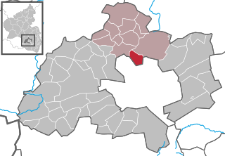
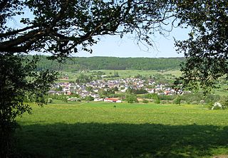
Otterbach is a municipality in the district of Kaiserslautern, in Rhineland-Palatinate, Germany.

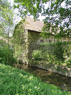
The Swist is a stream, 43.6 kilometres (27.1 mi) long, in the German Rhineland. It rises on the northern edge of the Eifel at 330 metres above sea level and empties rom the right and southeast into the Rhine tributary, the Erft, between Weilerswist and Bliesheim. Occasionally the Swist is also called the Swistbach, and locals often just call it der Bach.

The Speyerbach is a left tributary of the Rhine in the Palatinate part of Rhineland-Palatinate. In Speyer, the river split into Gießhübelbach and Woogbach. The Woogbach changes its name to Nonnenbach, then flows into Gießhübelbach shortly before the latter flows into the Rhine.

The Isenach is a left tributary of the Rhine in the northeastern Palatine region of Rhineland-Palatinate. It is nearly 36 kilometres (22 mi) long.
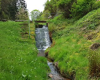
The Erlenbach (help·info) is a river in the Palatinate Forest, in the (Palatinate region of Rhineland-Palatinate. It is the strongest headwater of the Speyerbach, which is the largest river in the Anterior Palatinate.

The Erlenbach is a 34.2 km long, left tributary of the Michelsbach in the German state of Rhineland-Palatinate.
The Klingbach is a stream, just under 38 kilometres (24 mi) long, in South Palatinate, Germany, and a left-hand tributary of the Michelsbach.

The Otterbach is a stream, 42 kilometres long, in South Palatinate in the German state of Rhineland-Palatinate, that flows eastwards and northeastwards towards the Upper Rhine.

The Palatine Ways of St. James are those sections of the Way of St. James in the Palatinate region of Germany and part of the historic pilgrimage route to the northwest Spanish town of Santiago de Compostela. It was there that, according to Christian tradition, the Apostle Saint James the Greater was buried.

Guttenberg Castle is a ruined rock castle near the French border in the German part of the Wasgau, which in turn is part of the Palatine Forest in the state of Rhineland-Palatinate.
Otterbach is a municipality in Rhineland-Palatinate, Germany.
