The South China Sea is a marginal sea of the Western Pacific Ocean. It is bounded in the north by the shores of South China, in the west by the Indochinese Peninsula, in the east by the islands of Taiwan and northwestern Philippines, and in the south by Borneo, eastern Sumatra and the Bangka Belitung Islands, encompassing an area of around 3,500,000 km2 (1,400,000 sq mi). It communicates with the East China Sea via the Taiwan Strait, the Philippine Sea via the Luzon Strait, the Sulu Sea via the straits around Palawan, the Strait of Malacca via the Singapore Strait, and the Java Sea via the Karimata and Bangka Straits. The Gulf of Thailand and the Gulf of Tonkin are also part of South China Sea. The shallow waters south of the Riau Islands are also known as the Natuna Sea.

Kings Point is a village located on the Great Neck Peninsula in the Town of North Hempstead in Nassau County, on the North Shore of Long Island, in New York, United States. The population was 5,005 at the 2010 census.
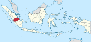
Jambi is a province of Indonesia. It is located on the east coast of central Sumatra and spans to the Barisan Mountains in the west. Its capital and largest city is Jambi. The province has a land area of 49,026.58 km2, and a sea area of 3,274.95 km2. It had a population of 3,092,265 according to the 2010 census and 3,548,228 according to the 2020 census. The official estimate as at mid 2022 was 3,631,136.

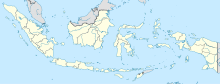
The Riau Islands is a province of Indonesia. It comprises a total of 1,796 islands scattered between Sumatra, Malay Peninsula, and Borneo including the Riau Archipelago. Situated on one of the world's busiest shipping lanes along the Malacca Strait and the South China Sea, the province shares water borders with neighboring countries such as Singapore, Malaysia, and Brunei. The Riau Islands also have relatively large potential mineral resources and energy, as well as marine resources. The capital of the province is Tanjung Pinang and the largest city is Batam.

Banyuwangi Regency is a regency of East Java province in Indonesia. This regency also known as the sun rise of Java because it is located at the easternmost end of Java Island. It serves as a port between Java and Bali. It is surrounded by mountains and forests to the west; by sea to the east and south. Banyuwangi is separated by the Strait of Bali from Bali. With an area of 5,782.4 km2, this regency is the largest in Java. The regency is a tourist destination, and subject to ongoing development as an international tourist destination with relevant infrastructure. Banyuwangi regency has been declared a taman bumi, or national geological park (Geopark) in 2018.

Natuna Regency is an islands regency located in the northernmost part of the Province of Riau Islands, Indonesia. It contains at least 154 islands, of which 127 of them are reported as uninhabited. This archipelago, with 264,198.37 km2 area, contains 15 sub-districts, including the island district of Pulau Laut, Bunguran/Greater Natuna Island, the island district of Pulau Tiga, the island district of Midai, the island district of Subi, and the island district of Serasan.

Batam is the largest city in the province of Riau Islands, Indonesia. The city administrative area covers three main islands of Batam, Rempang, and Galang, as well as Bulang to the west and several small islands. Batam Island is the core urban and industrial zone, while both Rempang Island and Galang Island maintain their rural character and low-density population; they are connected to Batam Island by short bridges. Bulang Island and the islands to its north forming Belakang Padang District lie to the west of Batam Island but are also administratively within the city. Batam is an industrial boomtown, an emerging transport hub, and part of a free trade zone in the Indonesia–Malaysia–Singapore Growth Triangle, located 20 km (12 mi) off Singapore's south coast and also part of the Indonesia–Malaysia–Thailand Growth Triangle.

Simeulue Regency is a regency in the Aceh special region of Indonesia. It occupies the whole island of Simeulue, 150 km off the west coast of Sumatra, with an area of 1,838.09 square kilometres. It had a population of 80,674 at the 2010 census and 92,865 at the 2020 census; the official estimate as at mid 2022 was 94,876.

Ternate, also known as the City of Ternate, is a city in the Indonesian province of North Maluku and an island in the Maluku Islands. It was the de facto provincial capital of North Maluku before Sofifi on the nearby coast of Halmahera became the capital in 2010. It is off the west coast of Halmahera, and is composed of eight islands: Ternate, the biggest and main island of the city, and Moti, Hiri, Tifure, Mayau, Makka, Mano, and Gurida. In total, the city has a land area of 162.17 square kilometres and had a total population of 185,705 according to the 2010 census, and 205,001 according to the 2020 census, with a density of 1,264 people per square kilometre; the official estimate as at mid 2022 was 206,745. It is the biggest and most densely populated city in the province, is the economic, cultural, and education center of North Maluku, and acts as a hub to neighbouring regions. It was the capital of the Sultanate of Ternate in the 15th and 16th centuries, and fought against the Sultanate of Tidore over control of the spice trade in the Moluccas before becoming a main interest to competing European powers.

Samarinda is the capital city of the Indonesian province of East Kalimantan on the island of Borneo. The city lies on the banks of the Mahakam River with a land area of 718 km2 (277 sq mi). Samarinda ranks first on East Kalimantan Human Development Index and it is the most populous city on the entire Borneo island, with a population of 727,500 at the 2010 Census and 827,994 at the 2020 Census; the official estimate as at mid 2021 was 831,460.

Sabang is a city in Aceh province, Indonesia consisting of Weh Island and several smaller islands off the northern tip of Sumatra. The administrative centre is located 17 kilometres (11 mi) north of Banda Aceh. The city covers an area of 122.13 square kilometres (47.15 sq mi) and had a population of 43,391 in the 2020 census although that total was subsequently adjusted to 41,197; the official estimate as at mid 2022 was 43,208. Sabang is known as the northernmost and westernmost city of Indonesia. It also has by far the smallest population of any city in Indonesia.

Weh Island, often known as Sabang after the city of which the island is administrated, is a small active volcanic island to the northwest of Sumatra, 45 minutes by fast regular ship or 2 hours by ferry from mainland, Banda Aceh. It was originally connected to the Sumatran mainland and became separated by sea after the volcano's last eruption in the Pleistocene era. The island is situated in the Andaman Sea.

Kotabaru Regency is one of the eleven regencies in the Indonesian province of South Kalimantan. It consists of two parts; the smaller but more populated part comprises Laut Island, the largest island off the coast of Kalimantan, together with the smaller Sebuku Island off Laut Island's east coast and even smaller islands nearby; the larger but less populated part consists of districts on the mainland of Kalimantan. The regency has an area of 9,442.46 km2, and had a population of 290,142 at the 2010 Census and 325,622 at the 2020 Census. The official estimate as at mid 2021 was 329,483. The regency seat is located at the large town of Kotabaru at the northern tip of Laut Island.
Sabang is a community development block that forms an administrative division in the Kharagpur subdivision of Paschim Medinipur district in the Indian state of West Bengal.
Terengganu Malay is a Malayic language spoken in the Malaysian state of Terengganu all the way southward to coastal Pahang and northeast Johor. It is the native language of Terengganu Malays and highly localised Chinese Peranakan community as well as a second language among the smaller Indian minority. The language has developed a distinct phonetic, syntactic and lexical distinctions which makes it mutually unintelligible for speakers from outside the east coast of Peninsular Malaysia especially those who speak Standard Malay/Malaysian. Terengganu Malay still shares close linguistic ties with neighbouring Kelantan-Pattani and Pahang of which it forms under the umbrella term of "East Coast Peninsular Malayic languages". These similarities have often confused many people outside the region, who usually interchange Terengganu Malay with Kelantan Malay, even though there are major phonological and vocabulary differences between the two.

Malinau Kota is a district and the regency seat of Malinau Regency in North Kalimantan province. The town is the economic center of the regency, largest town in the regency, and serves as a gateway for interior towns and villages around the Heart of Borneo especially neighbouring Krayan region in Nunukan Regency. It has a population of 25,596 or around 31% of the entire regency's population in 2021.

Mendanau is an island in the Bangka Belitung province of Indonesia. Located about 6 km off the west coast of Belitung and 20 km from the town of Tanjung Pandan, it is the fourth largest island in the province after Bangka, Belitung and Lepar with an area of approximately 113 square kilometers. Administratively it forms - with about 27 satellite islands - the Selat Nasik District of Belitung Regency, and it is home to 5,674 people at the 2020 Census, mostly spread in 3 settlements.

On 6 March 2023, a series of landslides were triggered by continuous rain in Serasan Island of Serasan District, Natuna Regency, Riau Islands, Indonesia. Around 50 people were killed and four others are still missing while contact to the Serasan Island was entirely lost. An entire village was reportedly buried.
Serasan is a district in the Natuna Regency, Riau Islands, Indonesia. There are 34 named islands, 4 inhabited islands and 7 villages in the district.
Midai Island is an island in the Natuna Regency, Riau Islands, Indonesia. The island is split between the Midai District and the Suak Midai District. The island is only accessible by boat and has a port on the west side of the island, near Sabang Barat.