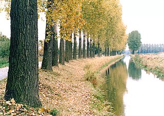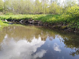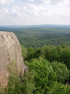
The Aller is a 215-kilometre (134 mi) long river in the states of Saxony-Anhalt and Lower Saxony in Germany. It is a right-hand, and hence eastern, tributary of the Weser and is also its largest tributary. Its last 117 kilometres (73 mi) form the Lower Aller federal waterway (Bundeswasserstraße). The Aller was extensively straightened, widened and, in places, dyked, during the 1960s to provide flood control of the river. In a 20-kilometre (12 mi) long section near Gifhorn, the river meanders in its natural river bed.

The Beaver Kill, sometimes written as the Beaverkill or Beaverkill River, is a tributary of the East Branch Delaware River, a main tributary of the Delaware River, approximately 44 miles (71 km) long, in the U.S. State of New York. The kill drains a 300-square-mile (780 km2) area of the Catskill Mountains and has long been celebrated as one of the most famous trout streams in the United States. Its preservation helped establish many of the basic conservation principles of rivers in the United States.

The Feather River is the principal tributary of the Sacramento River, in the Sacramento Valley of Northern California. The river's main stem is about 73 miles (117 km) long. Its length to its most distant headwater tributary is just over 210 miles (340 km). The main stem Feather River begins in Lake Oroville, where its four long tributary forks join together—the South Fork, Middle Fork, North Fork, and West Branch Feather Rivers. These and other tributaries drain part of the northern Sierra Nevada, and the extreme southern Cascades, as well as a small portion of the Sacramento Valley. The total drainage basin is about 6,200 square miles (16,000 km2), with approximately 3,604 square miles (9,330 km2) above Lake Oroville.

A body of water or waterbody is any significant accumulation of water, generally on a planet's surface. The term most often refers to oceans, seas, and lakes, but it includes smaller pools of water such as ponds, wetlands, or more rarely, puddles. A body of water does not have to be still or contained; rivers, streams, canals, and other geographical features where water moves from one place to another are also considered bodies of water.

The Farmington River is a river, 46.7 miles (75.2 km) in length along its main stem, which is located in northwest Connecticut with major tributaries extending into southwest Massachusetts. Via its longest branch, the Farmington's length increases to 80.4 miles (129.4 km), making it the Connecticut River's longest tributary by a mere 2.3 miles (3.7 km) over the major river directly to its north, the Westfield River. The Farmington River's watershed covers 609 square miles (1,580 km2). The river historically played an important role in small-scale manufacturing in towns along its course, but it is now mainly used for recreation and drinking water. The Farmington River Watershed Association is a non-profit organization for conservation and preservation of this river.

The Oswegatchie River is a 137-mile-long (220 km) river in northern New York that flows from the Adirondack Mountains north to the Saint Lawrence River. The Oswegatchie River begins at Partlow Lake in Hamilton County, New York. The river continues through Cranberry Lake which was 'doubled in size' through construction of a dam in the late 1860s. The river continues from the dam to Gouverneur, to near Talcville in St. Lawrence County, where it joins the West Branch. Much of it is within Adirondack State Park. The city of Ogdensburg developed at the mouth of the river at its confluence with the St. Lawrence.

The Grasse River or Grass River is a 73-mile-long (117 km) river in northern New York, in the United States. The river mainly flows northeast from the foothills of the Adirondack Mountains into the St. Lawrence Valley, making up what is known as the greater St. Lawrence River Drainage Basin along with other tributaries such as the Oswegatchie and Raquette rivers.

The Kettle is an 83.6-mile-long (134.5 km) tributary of the St. Croix River in eastern Minnesota in the United States. Via the St. Croix River, it is part of the watershed of the Mississippi River. The river's English name is due to the large number of large rounded holes (kettles) in the sandstone in and around the river, carved out by the swirling waters of the river. The river's Dakota name Céġa watpa entered into English via the Anishinaabe people's Akiko-ziibi, both meaning "Kettle River".

The River Alre is a short river in the English county of Hampshire. It is a tributary of the River Itchen, which it joins just downstream of the town of New Alresford.
Streamflow, or channel runoff, is the flow of water in streams, rivers, and other channels, and is a major element of the water cycle. It is one component of the runoff of water from the land to waterbodies, the other component being surface runoff. Water flowing in channels comes from surface runoff from adjacent hillslopes, from groundwater flow out of the ground, and from water discharged from pipes. The discharge of water flowing in a channel is measured using stream gauges or can be estimated by the Manning equation. The record of flow over time is called a hydrograph. Flooding occurs when the volume of water exceeds the capacity of the channel.

Yosemite West is an unincorporated community of resort homes located just outside the southern area of Yosemite National Park, just off Wawona Road, a continuation of State Route 41 from Fresno. It is situated one mile (1.6 km) south of the Chinquapin intersection of Wawona Road with Glacier Point Road at an altitude of 5,100–6,300 ft (1,600–1,900 m). The elevation reported by the USGS is 5,866 feet (1,788 m). The community is part of Henness Ridge, nearly 3,000 feet (910 m) above the southern banks of the Merced River and State Route 140 from Mariposa. Addresses in this area are shown as "Yosemite National Park, CA 95389"
A perennial stream or perennial river is a stream or river (channel) that has continuous flow in parts of its stream bed all year round during years of normal rainfall. "Perennial" streams are contrasted with "intermittent" streams which normally cease flowing for weeks or months each year, and with "ephemeral" channels that flow only for hours or days following rainfall. During unusually dry years, a normally perennial stream may cease flowing, becoming intermittent for days, weeks, or months depending on severity of the drought. The boundaries between perennial, intermittent, and ephemeral channels are not defined, and subject to a variety of identification methods adopted by local governments, academics, and others with a need to classify stream-flow permanence.

The Five Ponds Wilderness Area, an Adirondack Park unit of New York's Forest Preserve, is located in the towns of Fine and Clifton in St. Lawrence County, the town of Webb in Herkimer County and the town of Long Lake in Hamilton County. It includes 1,064 acres (4.3 km2) of private inholdings, 99 bodies of water covering 1,964 acres (7.9 km2), 57.9 miles (93.2 km) of trails, and 14 lean-tos.

The Pepperbox Wilderness Area, an Adirondack Park unit of the New York Forest Preserve, lies entirely within the town of Webb in Herkimer County. Stillwater Reservoir and the Beaver River Primitive Area form the southern boundary, while the north bank of the West Branch of the Oswegatchie River generally forms the northern boundary. The western boundary is the county line, and the eastern boundary is the Raven Lake Road and the Five Ponds Wilderness Area.

The Mount Hope River is a river in northeastern section of the U.S. state of Connecticut. The river is formed at the outlet of Morey Pond at the extreme northern end of Ashford, Connecticut, at the border of Union, Connecticut, and flows about 15 miles (24 km) south to Mansfield Hollow Lake, just south of Mansfield, Connecticut.

High Falls is a small but picturesque waterfall on the upper Oswegatchie River in the Five Ponds Wilderness. It is located in the town of Fine, in a remote part of Adirondack State Park in St. Lawrence County. The falls drops about 20 feet (6.1 m). Access is by canoe or by maintained hiking trails. The closest public road, near Wanakena, is almost six miles to the north. Trail access is by a short spur from the High Falls Loop Trail. The most direct canoe access is by way of the Oswegatchie River from the Oswegatchie River Inlet on Inlet Road. The waterfall has been designated a scenic special interest area in the New York State Land Master Plan.

A stream is a body of water with surface water flowing within the bed and banks of a channel. The flow of a stream is controlled by three inputs - surface water, subsurface water and groundwater. The surface and subsurface water are highly variable between periods of rainfall. Groundwater, on the other hand, has a relatively constant input and is controlled more by long-term patterns of precipitation. The stream encompasses surface, subsurface and groundwater fluxes that respond to geological, geomorphological, hydrological and biotic controls.

The Bog River, also called the Bog River Flow is a 18-mile (29 km) river that originates near the sources of the Oswegatchie River, in Hamilton County, New York in the Adirondacks, and flows through Lows Lake and Hitchens Pond, ending at the Bog River Falls at the entrance to Tupper Lake. For much of its length it is flat water owing to two hydroelectric dams built by Abbot Augustus Low early in the 20th century. There are forty established campsites. The stretch from Tupper Lake to Hitchens pond has been designated as a Scenic River by the State of New York. The river is part of the Five Ponds and the Round Lake Wilderness Areas.

The Canajoharie Creek is a river that flows into the Mohawk River in the Village of Canajoharie in the U.S. State of New York. The name "Canajoharie" is a Mohawk language term meaning "the pot that washes itself", referring to the "Canajoharie Boiling Pot", a 20-foot (6.1 m) wide and 10-foot (3.0 m) deep pothole in the Canajoharie Creek, just south of the village of Canajoharie. Bowmans Creek is one main tributary that enters the creek east of the Hamlet of Sprout Brook. The other main tributary is Brimstone Creek which enters the creek north-northwest of the Village of Ames.

The West Branch Oswegatchie River is a river in Herkimer, Lewis, and St. Lawrence counties in New York. It starts at the outlet of Hog Pond and flows into the Oswegatchie River near the hamlet of Talcville. The West Branch Oswegatchie River is slower-moving than the Middle Branch, which flows into it. But the still waters such as Long Pond, Round Pond, Rock Pond, Mud Pond and Long Level are separated by hard-to-traverse rapids and/or waterfalls.


