
The Mohawk River is a 149-mile-long (240 km) river in the U.S. state of New York. It is the largest tributary of the Hudson River. The Mohawk flows into the Hudson in Cohoes, New York, a few miles north of the state capital of Albany. The river is named for the Mohawk Nation of the Iroquois Confederacy. A major waterway, in the early 19th century, the river's east-west valley provided the setting and water for development of the Erie Canal, as a key to developing New York. The largest tributary, the Schoharie Creek, accounts for over one quarter (26.83%) of the Mohawk River's watershed. Another main tributary is the West Canada Creek, which makes up for 16.33% of the Mohawk's watershed.

The Chenango River is a 90-mile-long (140 km) tributary of the Susquehanna River in central New York in the United States. It drains a dissected plateau area in upstate New York at the northern end of the Susquehanna watershed.

The West Branch Delaware River is one of two branches that form the Delaware River. It is approximately 90 mi (144 km) long, and flows through the U.S. states of New York and Pennsylvania. It winds through a mountainous area of New York in the western Catskill Mountains for most of its course, before joining the East Branch along the northeast border of Pennsylvania with New York. Midway or so it is empounded by the Cannonsville Dam to form the Cannonsville Reservoir, both part of the New York City water supply system for delivering drinking water to the City.

The Oswegatchie River is a 137-mile-long (220 km) river in northern New York that flows from the Adirondack Mountains north to the Saint Lawrence River. The Oswegatchie River begins at Partlow Lake in Hamilton County, New York. The river continues through Cranberry Lake which was 'doubled in size' through construction of a dam in the late 1860s. The river continues from the dam to Gouverneur, to near Talcville in St. Lawrence County, where it joins the West Branch. Much of it is within Adirondack State Park. The city of Ogdensburg developed at the mouth of the river at its confluence with the St. Lawrence.

The Sacandaga River is a 64-mile-long (103 km) river in the northern part of New York in the United States. Its name comes from the Native American Sa-chen-da'-ga, meaning "overflowed lands".

Cranberry Lake is a lake on the east branch of the Oswegatchie River in the Adirondack Park in New York in the United States. It is the third largest lake in the Adirondack Park. About 75 percent of the shoreline is owned by the State of New York. The 118,000-acre (480 km2) Five Ponds Wilderness Area abuts its south shore, and the Cranberry Lake Wild Forest covers much of its remaining shoreline.

Stony Brook, also known as Stoney Brook, is a tributary of the Millstone River in Hunterdon and Mercer counties, New Jersey, in the United States.
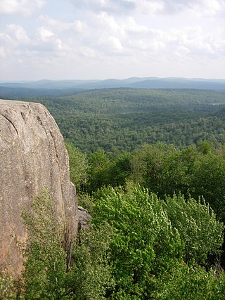
The Five Ponds Wilderness Area, an Adirondack Park unit of New York's Forest Preserve, is located in the towns of Fine and Clifton in St. Lawrence County, the town of Webb in Herkimer County and the town of Long Lake in Hamilton County. It includes 1,064 acres (4.3 km2) of private inholdings, 99 bodies of water covering 1,964 acres (7.9 km2), 57.9 miles (93.2 km) of trails, and 14 lean-tos.

The Little River is a 105-mile-long (169 km) tributary of the Withlacoochee River in the U.S. state of Georgia. Via the Withlacoochee and the Suwannee River its waters flow to the Gulf of Mexico. The Little River was also known historically as the Ockolocoochee River.

The Baker Branch Saint John River is a 48.0-mile-long (77.2 km) river. This river is a tributary of the Saint John River, flowing in the Maine North Woods, in Maine, in the Northeastern United States.
Duck Pond Run is a tributary of the Stony Brook in Mercer County, New Jersey in the United States.

Kinderhook Creek is a 49.0-mile-long (78.9 km) tributary to Stockport Creek, an inlet of the Hudson River in the United States. From its source in Hancock, Massachusetts, the creek runs southwest through the Taconic Mountains into Rensselaer County, New York, and then into Columbia County. It flows through the towns of Stephentown, New Lebanon, Nassau, Chatham, Kinderhook and Stuyvesant to its mouth at Stockport Creek in the town of Stockport.
Middle Branch Oswegatchie River is a river in northern New York. It begins northeast of the Hamlet of Stillwater and flows into the West Branch Oswegatchie River in Harrisville. The Middle Branch mostly consists of shallow and fast-moving waters with only two or three slow-moving sections favorable for canoeists. These include Alder Bed Flow and another still-water section known locally as Moynehan Flow. The latter begins in the area where Lower South Pond Outlet runs into the river. Occasionally, experienced kayakers take advantage of high water conditions to ply its waters – generally from the Bear Pond Road, a few miles upstream of Alder Bed Flow, and downstream to another seasonal access road located near Mullins Flow. However, because they are seasonal roads and the area is so remote – this part of the river is seldom used. Brook trout exist as the primary sport-fish for the entire length of Middle Branch Oswegatchie. Chubs & bullheads are also present in its waters.
The South Branch Grass River flows into the Grass River in Clare, New York. The South Branch Grass River and Middle Branch Grass River combine here and become Grass River.
Long Pond is located by Oswegatchie Camp, New York. Fish species present in the lake are splake, white sucker, and black bullhead. There is a state owned beach launch on Prentice Road, 4 miles northwest of Croghan. There is a 10 horsepower motor limit.
Bear Pond is a lake located northeast of Stillwater, New York. The outflow creek flows into Middle Branch Oswegatchie River. Fish species present in the lake are brown bullhead, and brook trout. Access via trail off Raven Lake Road on the south shore. No motors are allowed on Bear Pond.
Grassy Pond is a small lake north of Stillwater in Herkimer County, New York. It drains south via an unnamed creek which flows into the Middle Branch Oswegatchie River.

