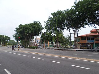
Bukit Katil is a mukim and parliamentary constituency in Central Melaka District, Melaka, Malaysia.
Hołówki Duże is a village in the administrative district of Gmina Juchnowiec Kościelny, within Białystok County, Podlaskie Voivodeship, in north-eastern Poland.

Pożniki is a village in the administrative district of Gmina Czeremcha, within Hajnówka County, Podlaskie Voivodeship, in north-eastern Poland, close to the border with Belarus. It lies approximately 4 kilometres (2 mi) west of Czeremcha, 30 km (19 mi) south-west of Hajnówka, and 67 km (42 mi) south of the regional capital Białystok.
Mysłaków is a village in the administrative district of Gmina Nieborów, within Łowicz County, Łódź Voivodeship, in central Poland. It lies approximately 6 kilometres (4 mi) east of Łowicz and 51 km (32 mi) north-east of the regional capital Łódź.
Karolinów is a village in the administrative district of Gmina Sulejów, within Piotrków County, Łódź Voivodeship, in central Poland. It lies approximately 8 kilometres (5 mi) south-west of Sulejów, 15 km (9 mi) south-east of Piotrków Trybunalski, and 60 km (37 mi) south-east of the regional capital Łódź.
Budy is a village in the administrative district of Gmina Fałków, within Końskie County, Świętokrzyskie Voivodeship, in south-central Poland. It lies approximately 7 kilometres (4 mi) south of Fałków, 27 km (17 mi) south-west of Końskie, and 43 km (27 mi) north-west of the regional capital Kielce.

Chylice-Kolonia is a village in the administrative district of Gmina Jaktorów, within Grodzisk Mazowiecki County, Masovian Voivodeship, in east-central Poland.
Budzyno-Walędzięta is a village in the administrative district of Gmina Czerwonka, within Maków County, Masovian Voivodeship, in east-central Poland. It lies approximately 9 kilometres (6 mi) west of Czerwonka, 4 km (2 mi) north of Maków Mazowiecki, and 76 km (47 mi) north of Warsaw.
Zalesie is a village in the administrative district of Gmina Siennica, within Mińsk County, Masovian Voivodeship, in east-central Poland. It lies approximately 3 kilometres (2 mi) west of Siennica, 11 km (7 mi) south of Mińsk Mazowiecki, and 43 km (27 mi) east of Warsaw.
Czerwonka-Wieś is a village in the administrative district of Gmina Sochaczew, within Sochaczew County, Masovian Voivodeship, in east-central Poland. It lies approximately 5 kilometres (3 mi) south-east of Sochaczew and 48 km (30 mi) west of Warsaw.
Osiny is a village in the administrative district of Gmina Kępno, within Kępno County, Greater Poland Voivodeship, in west-central Poland.
Mścigniew is a village in the administrative district of Gmina Włoszakowice, within Leszno County, Greater Poland Voivodeship, in west-central Poland. It lies approximately 7 kilometres (4 mi) south-west of Włoszakowice, 20 km (12 mi) west of Leszno, and 71 km (44 mi) south-west of the regional capital Poznań.
Krępkowo is a village in the administrative district of Gmina Strzałkowo, within Słupca County, Greater Poland Voivodeship, in west-central Poland.
Piekiełko is a settlement in the administrative district of Gmina Przodkowo, within Kartuzy County, Pomeranian Voivodeship, in northern Poland. It lies approximately 4 kilometres (2 mi) north of Przodkowo, 11 km (7 mi) north-east of Kartuzy, and 23 km (14 mi) west of the regional capital Gdańsk.
Długi Kierz is a Kashubian village in the administrative district of Gmina Sierakowice, within Kartuzy County, Pomeranian Voivodeship, in northern Poland. It lies approximately 8 kilometres (5 mi) south-east of Sierakowice, 16 km (10 mi) west of Kartuzy, and 44 km (27 mi) west of the regional capital Gdańsk.
Kuropatniki is a settlement in the administrative district of Gmina Chojna, within Gryfino County, West Pomeranian Voivodeship, in north-western Poland, close to the German border.
Uniedrożyn is a settlement in the administrative district of Gmina Malechowo, within Sławno County, West Pomeranian Voivodeship, in north-western Poland. It lies approximately 7 kilometres (4 mi) west of Malechowo, 20 km (12 mi) south-west of Sławno, and 155 km (96 mi) north-east of the regional capital Szczecin.
Kaźmierzewo is a village in the administrative district of Gmina Barwice, within Szczecinek County, West Pomeranian Voivodeship, in north-western Poland. It lies approximately 8 kilometres (5 mi) north-west of Barwice, 27 km (17 mi) west of Szczecinek, and 121 km (75 mi) east of the regional capital Szczecin.
Kołątek is a settlement in the administrative district of Gmina Barwice, within Szczecinek County, West Pomeranian Voivodeship, in north-western Poland. It lies approximately 5 kilometres (3 mi) south-west of Barwice, 26 km (16 mi) west of Szczecinek, and 118 km (73 mi) east of the regional capital Szczecin.
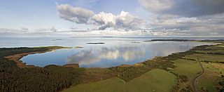
Hellamaa is a village in Muhu Parish, Saare County in western Estonia.