Karolin, is a village in the administrative district of Gmina Giby, within Sejny County, Podlaskie Voivodeship, in north-eastern Poland, close to the borders with Belarus and Lithuania. It lies approximately 6 kilometres (4 mi) west of Giby, 10 km (6 mi) south-west of Sejny, and 104 km (65 mi) north of the regional capital Białystok.
Marcelin is a village in the administrative district of Gmina Rząśnia, within Pajęczno County, Łódź Voivodeship, in central Poland. It lies approximately 7 kilometres (4 mi) north of Rząśnia, 16 km (10 mi) north of Pajęczno, and 63 km (39 mi) south-west of the regional capital Łódź.

Radziwiłłów is a village in the administrative district of Gmina Puszcza Mariańska, within Żyrardów County, Masovian Voivodeship, in east-central Poland. It lies approximately 5 kilometres (3 mi) west of Puszcza Mariańska, 12 km (7 mi) south-west of Żyrardów, and 55 km (34 mi) south-west of Warsaw.
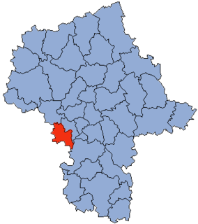
Babskie Budy is a village in the administrative district of Gmina Wiskitki, within Żyrardów County, Masovian Voivodeship, in east-central Poland. It lies approximately 10 kilometres (6 mi) west of Wiskitki, 13 km (8 mi) north-west of Żyrardów, and 52 km (32 mi) west of Warsaw.
Czerwona Niwa is a village in the administrative district of Gmina Wiskitki, within Żyrardów County, Masovian Voivodeship, in east-central Poland. It lies approximately 9 kilometres (6 mi) north-west of Wiskitki, 13 km (8 mi) north-west of Żyrardów, and 49 km (30 mi) west of Warsaw.
Feliksów is a village in the administrative district of Gmina Wiskitki, within Żyrardów County, Masovian Voivodeship, in east-central Poland. It lies approximately 3 kilometres (2 mi) north-east of Wiskitki, 6 km (4 mi) north of Żyrardów, and 41 km (25 mi) west of Warsaw.
Hipolitów is a village in the administrative district of Gmina Wiskitki, within Żyrardów County, Masovian Voivodeship, in east-central Poland. It lies approximately 6 kilometres (4 mi) west of Wiskitki, 9 km (6 mi) north-west of Żyrardów, and 49 km (30 mi) west of Warsaw.
Jesionka is a village in the administrative district of Gmina Wiskitki, within Żyrardów County, Masovian Voivodeship, in east-central Poland. It lies approximately 9 kilometres (6 mi) south-west of Wiskitki, 7 km (4 mi) south-west of Żyrardów, and 50 km (31 mi) south-west of Warsaw.
Kamionka Mała is a village in the administrative district of Gmina Wiskitki, within Żyrardów County, Masovian Voivodeship, in east-central Poland. It lies approximately 8 kilometres (5 mi) west of Wiskitki, 10 km (6 mi) west of Żyrardów, and 51 km (32 mi) west of Warsaw.
Miedniewice is a village in the administrative district of Gmina Wiskitki, within Żyrardów County, Masovian Voivodeship, in east-central Poland. It lies approximately 7 kilometres (4 mi) west of Wiskitki, 10 km (6 mi) west of Żyrardów, and 50 km (31 mi) west of Warsaw.
Nowa Wieś is a village in the administrative district of Gmina Wiskitki, within Żyrardów County, Masovian Voivodeship, in east-central Poland. It lies approximately 11 kilometres (7 mi) west of Wiskitki, 13 km (8 mi) west of Żyrardów, and 54 km (34 mi) west of Warsaw.
Nowe Kozłowice is a village in the administrative district of Gmina Wiskitki, within Żyrardów County, Masovian Voivodeship, in east-central Poland. It lies approximately 3 kilometres (2 mi) east of Wiskitki, 4 km (2 mi) north of Żyrardów, and 42 km (26 mi) west of Warsaw.
Podbuszyce is a village in the administrative district of Gmina Wiskitki, within Żyrardów County, Masovian Voivodeship, in east-central Poland. It lies approximately 6 kilometres (4 mi) north of Wiskitki, 10 km (6 mi) north of Żyrardów, and 41 km (25 mi) west of Warsaw.
Smolarnia is a village in the administrative district of Gmina Wiskitki, within Żyrardów County, Masovian Voivodeship, in east-central Poland. It lies approximately 9 kilometres (6 mi) south-west of Wiskitki, 10 km (6 mi) west of Żyrardów, and 52 km (32 mi) south-west of Warsaw.
Sokule is a village in the administrative district of Gmina Wiskitki, within Żyrardów County, Masovian Voivodeship, in east-central Poland. It lies approximately 3 kilometres (2 mi) south-west of Wiskitki, 5 km (3 mi) west of Żyrardów, and 47 km (29 mi) west of Warsaw.
Starowiskitki is a village in the administrative district of Gmina Wiskitki, within Żyrardów County, Masovian Voivodeship, in east-central Poland. It lies approximately 4 kilometres (2 mi) west of Wiskitki, 7 km (4 mi) north-west of Żyrardów, and 47 km (29 mi) west of Warsaw.
Tomaszew is a village in the administrative district of Gmina Wiskitki, within Żyrardów County, Masovian Voivodeship, in east-central Poland. It lies approximately 5 kilometres (3 mi) south-west of Wiskitki, 5 km (3 mi) west of Żyrardów, and 48 km (30 mi) south-west of Warsaw.
Wola Miedniewska is a village in the administrative district of Gmina Wiskitki, within Żyrardów County, Masovian Voivodeship, in east-central Poland. It lies approximately 8 kilometres (5 mi) west of Wiskitki, 11 km (7 mi) north-west of Żyrardów, and 50 km (31 mi) west of Warsaw.
Lipa is a village in the administrative district of Gmina Szamocin, within Chodzież County, Greater Poland Voivodeship, in west-central Poland. It lies approximately 12 kilometres (7 mi) east of Szamocin, 27 km (17 mi) east of Chodzież, and 77 km (48 mi) north of the regional capital Poznań.
Lubiecz is a village in the administrative district of Gmina Golina, within Konin County, Greater Poland Voivodeship, in west-central Poland. It lies approximately 5 kilometres (3 mi) north-west of Golina, 17 km (11 mi) north-west of Konin, and 79 km (49 mi) east of the regional capital Poznań.