Michałki is a village in the administrative district of Gmina Rokitno, within Biała Podlaska County, Lublin Voivodeship, in eastern Poland, close to the border with Belarus. It lies approximately 5 kilometres (3 mi) south-east of Rokitno, 15 km (9 mi) east of Biała Podlaska, 11 kilometres (7 mi) south of the village of Laɀar, and 107 km (66 mi) north-east of the regional capital Lublin.
Krasne Małe is a village in the administrative district of Gmina Jasionówka, within Mońki County, Podlaskie Voivodeship, in north-eastern Poland. It lies approximately 10 kilometres (6 mi) south of Jasionówka, 21 km (13 mi) south-east of Mońki, and 23 km (14 mi) north of the regional capital Białystok.
Długokąty is a village in the administrative district of Gmina Puszcza Mariańska, within Żyrardów County, Masovian Voivodeship, in east-central Poland. It lies approximately 3 kilometres (2 mi) south-west of Puszcza Mariańska, 13 km (8 mi) south-west of Żyrardów, and 55 km (34 mi) south-west of Warsaw.
Wincentów is a village in the administrative district of Gmina Puszcza Mariańska, within Żyrardów County, Masovian Voivodeship, in east-central Poland. It lies approximately 5 kilometres (3 mi) south-west of Puszcza Mariańska, 14 km (9 mi) south-west of Żyrardów, and 56 km (35 mi) south-west of Warsaw.
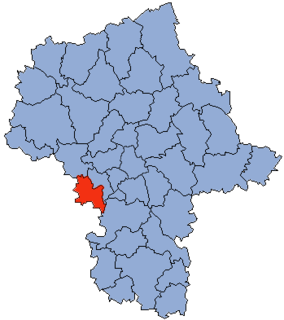
Babskie Budy is a village in the administrative district of Gmina Wiskitki, within Żyrardów County, Masovian Voivodeship, in east-central Poland. It lies approximately 10 kilometres (6 mi) west of Wiskitki, 13 km (8 mi) north-west of Żyrardów, and 52 km (32 mi) west of Warsaw.
Czerwona Niwa is a village in the administrative district of Gmina Wiskitki, within Żyrardów County, Masovian Voivodeship, in east-central Poland. It lies approximately 9 kilometres (6 mi) north-west of Wiskitki, 13 km (8 mi) north-west of Żyrardów, and 49 km (30 mi) west of Warsaw.
Feliksów is a village in the administrative district of Gmina Wiskitki, within Żyrardów County, Masovian Voivodeship, in east-central Poland. It lies approximately 3 kilometres (2 mi) north-east of Wiskitki, 6 km (4 mi) north of Żyrardów, and 41 km (25 mi) west of Warsaw.
Jesionka is a village in the administrative district of Gmina Wiskitki, within Żyrardów County, Masovian Voivodeship, in east-central Poland. It lies approximately 9 kilometres (6 mi) south-west of Wiskitki, 7 km (4 mi) south-west of Żyrardów, and 50 km (31 mi) south-west of Warsaw.
Kamionka Mała is a village in the administrative district of Gmina Wiskitki, within Żyrardów County, Masovian Voivodeship, in east-central Poland. It lies approximately 8 kilometres (5 mi) west of Wiskitki, 10 km (6 mi) west of Żyrardów, and 51 km (32 mi) west of Warsaw.
Miedniewice is a village in the administrative district of Gmina Wiskitki, within Żyrardów County, Masovian Voivodeship, in east-central Poland. It lies approximately 7 kilometres (4 mi) west of Wiskitki, 10 km (6 mi) west of Żyrardów, and 50 km (31 mi) west of Warsaw.
Nowa Wieś is a village in the administrative district of Gmina Wiskitki, within Żyrardów County, Masovian Voivodeship, in east-central Poland. It lies approximately 11 kilometres (7 mi) west of Wiskitki, 13 km (8 mi) west of Żyrardów, and 54 km (34 mi) west of Warsaw.
Nowe Kozłowice is a village in the administrative district of Gmina Wiskitki, within Żyrardów County, Masovian Voivodeship, in east-central Poland. It lies approximately 3 kilometres (2 mi) east of Wiskitki, 4 km (2 mi) north of Żyrardów, and 42 km (26 mi) west of Warsaw.
Podbuszyce is a village in the administrative district of Gmina Wiskitki, within Żyrardów County, Masovian Voivodeship, in east-central Poland. It lies approximately 6 kilometres (4 mi) north of Wiskitki, 10 km (6 mi) north of Żyrardów, and 41 km (25 mi) west of Warsaw.
Popielarnia is a village in the administrative district of Gmina Wiskitki, within Żyrardów County, Masovian Voivodeship, in east-central Poland. It lies approximately 9 kilometres (6 mi) south-west of Wiskitki, 11 km (7 mi) west of Żyrardów, and 53 km (33 mi) west of Warsaw.
Smolarnia is a village in the administrative district of Gmina Wiskitki, within Żyrardów County, Masovian Voivodeship, in east-central Poland. It lies approximately 9 kilometres (6 mi) south-west of Wiskitki, 10 km (6 mi) west of Żyrardów, and 52 km (32 mi) south-west of Warsaw.
Sokule is a village in the administrative district of Gmina Wiskitki, within Żyrardów County, Masovian Voivodeship, in east-central Poland. It lies approximately 3 kilometres (2 mi) south-west of Wiskitki, 5 km (3 mi) west of Żyrardów, and 47 km (29 mi) west of Warsaw.
Starowiskitki is a village in the administrative district of Gmina Wiskitki, within Żyrardów County, Masovian Voivodeship, in east-central Poland. It lies approximately 4 kilometres (2 mi) west of Wiskitki, 7 km (4 mi) north-west of Żyrardów, and 47 km (29 mi) west of Warsaw.
Tomaszew is a village in the administrative district of Gmina Wiskitki, within Żyrardów County, Masovian Voivodeship, in east-central Poland. It lies approximately 5 kilometres (3 mi) south-west of Wiskitki, 5 km (3 mi) west of Żyrardów, and 48 km (30 mi) south-west of Warsaw.
Wola Miedniewska is a village in the administrative district of Gmina Wiskitki, within Żyrardów County, Masovian Voivodeship, in east-central Poland. It lies approximately 8 kilometres (5 mi) west of Wiskitki, 11 km (7 mi) north-west of Żyrardów, and 50 km (31 mi) west of Warsaw.
Strachocin is a village in the administrative district of Gmina Stargard, within Stargard County, West Pomeranian Voivodeship, in north-western Poland. It lies approximately 4 kilometres (2 mi) south-east of Stargard and 36 km (22 mi) east of the regional capital Szczecin.