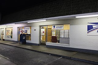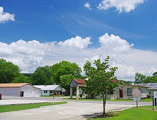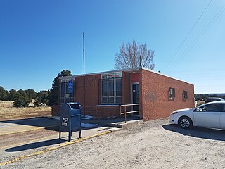
Dothan is an unincorporated community in Fayette County, West Virginia, United States. Dothan is located on West Virginia Route 612 4 miles (6.4 km) west of Oak Hill. Dothan had a post office, which closed on October 5, 1991.

Arcola is an unincorporated community in Upper Providence Township, Montgomery County, Pennsylvania, United States. Arcola is located on Perkiomen Creek 6.5 miles (10.5 km) west-northwest of Norristown. Arcola has a post office with ZIP code 19420, which opened on June 4, 1889.

North is an unincorporated community in Mathews County, Virginia, United States. North is located on Virginia State Route 14 4.75 miles (7.64 km) west of Mathews. North has a post office with ZIP code 23128.

Goodview is an unincorporated community in Bedford County, Virginia, United States. Goodview is 13.9 miles (22.4 km) southwest of Bedford. Goodview has a post office with ZIP code 24095.

Andover is an unincorporated community in Wise County, Virginia, United States. Andover is located along Virginia State Route 78 1.4 miles (2.3 km) northwest of Appalachia. Andover had a post office until it closed on November 3, 2008; it still has its own ZIP code, 24215.

Arjay is an unincorporated community and coal town in Bell County, Kentucky, United States. Arjay is located on Kentucky Route 66 4 miles (6.4 km) northeast of Pineville. Arjay has a post office with ZIP code 40902, which opened on February 23, 1911. The community's name comes from the initials of coal operator R. J. Asher.

Laughlintown is an unincorporated community in Ligonier Township, Westmoreland County, Pennsylvania, United States. Laughlintown is located on U.S. Route 30 3 miles (4.8 km) southeast of Ligonier. Laughlintown has a post office with ZIP code 15655, which opened on May 16, 1825.

Hollytree is an unincorporated community in Jackson County, Alabama, United States. It is located on Alabama State Route 65, 9.7 miles (15.6 km) northeast of Gurley in the Paint Rock Valley. Hollytree has a post office with ZIP code 35751.

Princeton is an unincorporated community in Jackson County, Alabama, United States. Princeton is located on Alabama State Route 65 in the upper Paint Rock Valley. Skyline lies just over 7 miles (11 km) miles to the east atop the Cumberland Plateau, and the Alabama-Tennessee state line passes several miles to the north. Princeton has a post office with ZIP code 35766.

Lapine is an unincorporated community in Montgomery and Crenshaw counties in the U.S. state of Alabama. Lapine is 27.6 miles (44.4 km) south of Montgomery. Lapine has a post office with ZIP code 36046, which opened on July 12, 1887.

Mathews is an unincorporated community in Montgomery County, Alabama, United States, located 18.7 miles (30.1 km) east-southeast of Montgomery. Mathews had a post office until it closed on November 19, 2011; it still has its own ZIP code, 36052. It was named for Revolutionary War hero and Georgia Governor George Mathews.

Quinton is an unincorporated community in Walker County, Alabama, United States, located 4.2 miles (6.8 km) south-southeast of Dora. Quinton has a post office with ZIP code 35130, which opened on March 27, 1888.

Sayre is an unincorporated community in Jefferson County, Alabama, United States. Sayre is 16.5 miles (26.6 km) northwest of downtown Birmingham. Sayre had a post office from October 4, 1904, to November 5, 2011; it still has its own ZIP code, 35139.

Greendell is an unincorporated community located within Green Township, in Sussex County, New Jersey, United States. Greendell is 4.2 miles (6.8 km) west of Andover. Greendell has a post office with ZIP code 07839.

Ironia is an unincorporated community located within Randolph Township, in Morris County, New Jersey, United States. Ironia is 5.4 miles (8.7 km) southwest of Dover. Ironia has a post office with ZIP code 07845.

Swartswood is an unincorporated community located on the border of Hampton and Stillwater townships in Sussex County, New Jersey, United States. Swartswood is 4.4 miles (7.1 km) west-northwest of Newton. Swartswood has a post office with ZIP code 07877.

South Seaville is an unincorporated community located within Dennis Township in Cape May County, New Jersey, United States. South Seaville is 4 miles (6.4 km) northwest of Sea Isle City. South Seaville has a post office with ZIP code 08246.

Continental Divide is an unincorporated community in McKinley County, New Mexico, United States. Continental Divide is located along Interstate 40 25.1 miles (40.4 km) east-southeast of Gallup. Continental Divide has a post office with ZIP code 87312.

Bosque is an unincorporated community in Valencia County, New Mexico, United States. Bosque is located at the junction of New Mexico State Road 116 and New Mexico State Road 346 7.1 miles (11.4 km) south of Belen. Bosque has a post office with ZIP code 87006.

Casa Blanca is an unincorporated community in Cibola County, New Mexico, United States. Casa Blanca is located on New Mexico State Road 23 22.6 miles (36.4 km) east-southeast of Grants. It is part of the Paraje census-designated place. Casa Blanca has a post office with ZIP code 87007, which opened on September 22, 1905.


