Miles, Washington | |
|---|---|
 Aerial view of the area | |
 Miles, Washington | |
| Coordinates: 47°54′39″N118°17′33″W / 47.91083°N 118.29250°W | |
| Country | United States |
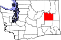
| State | Washington |
| County | Lincoln |
| Elevation | 1,440 ft (440 m) |
| Time zone | UTC-8 (Pacific (PST)) |
| • Summer (DST) | UTC-7 (PDT) |
| ZIP code | 99122 |
| Area code | 509 |
| GNIS feature ID | 1512464 [1] |
Miles is an unincorporated community in Lincoln County, in the U.S. state of Washington. It is located adjacent to Fort Spokane where the Spokane River empties into the Columbia River. [2]