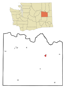
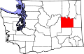
Davenport, Washington

Last updated

Davenport, Washington
City of Davenport
Lincoln County court house, Davenport, WA. (10508086083).jpg
Lincoln County Courthouse
Lincoln County Washington Incorporated and Unincorporated areas Davenport Highlighted.svg
Location of Davenport, Washington
Coordinates: 47°39′4″N118°9′6″W / 47.65111°N 118.15167°W / 47.65111; -118.15167
CountryUnited States
State Washington
County Lincoln
Area
[1]
  Total1.67 sq mi (4.32 km2)
  Land1.67 sq mi (4.32 km2)
  Water0.00 sq mi (0.00 km2)
Elevation
2,375 ft (724 m)
Population
 (2020) [2]
  Total1,703
  Density1,019.7/sq mi (394.2/km2)
Time zone UTC−8 (Pacific (PST))
  Summer (DST) UTC−7 (PDT)
ZIP code
99122
Area code 509
FIPS code 53-16795 [3]
GNIS feature ID1504329 [4]
Website www.davenportwa.us

Davenport is the county seat of and largest city in Lincoln County, Washington, United States. The population was 1,703 at the 2020 census. [2] As the seat of government for the county and its largest population center, Davenport serves as an important hub for business, medical and educational services in Lincoln County. [5]

Contents

History

Prior to European settlement, the area around what would become Davenport was home to the Lower Band of the Spokane. [6] The location was also along a popular east-west trade route, and the spring at present day Davenport was seen as an oasis and place for rest and camping along the journey. [7]

That trail would eventually bring white settlers to the area, with prospectors passing through on their way to goldfields in Montana. Like the Spokane before them, these settlers used the springs at the present site of Davenport to collect water, rest and camp. The setting of the springs in the otherwise semi-arid region attracted some of these new arrivals to settle at the location, and in 1880 Aloysius Harry Harker became the first non-native permanent settler at the location, with John and Emma Eads Nicholls arriving soon after. The settlement was located at the springs and known as Cottonwood Springs. John C. Davenport founded a separate settlement on higher ground nearby in 1883, which was destroyed by fire the following year. Davenport's settlement relocated to Cottonwood Springs, taking Davenport's name with it. [5] The city was made the county seat of Lincoln County on December 15, 1896, after an election that had chosen Davenport over then-seat Sprague, which had been destroyed in a fire, and Harrington. [8]

Grain elevators along the railroad in Davenport Grain elevators, Davenport (36248378303).jpg
Grain elevators along the railroad in Davenport

Davenport gained early prominence in the north central part of the Columbia Basin of eastern Washington with the arrival of the Washington Central branch of the transcontinental Northern Pacific Railway (NP) railroad line, which reached Davenport in February 1889. The Seattle Lake Shore & Eastern Railway (SLS&E) arrived later that year. A branch line of the Great Northern Railway (GN) was built to Davenport from Bluestem in the 1920s. Davenport's train depot, built in 1889 with the arrival of the railroads, lasted almost 100 years before being demolished in 1988. [5]

Primary State Highway #2 (a.k.a. "Sunset Highway") closely followed the CW railroad from Coulee City through Davenport to Spokane. The route is now known as U.S. Route 2, but does not follow the original Sunset Highway in many places. Primary State Highway #7 also intersected with PSH #2 in Davenport, and is now part of State Route 28. PSH #22 ran north from Davenport to the Canada–US border near Northport. This is State Route 25 now.

Geography

Channeled Scabland terrain west of Davenport West of Davenport, WA. (37055922905).jpg
Channeled Scabland terrain west of Davenport

Davenport is located at 47°39′4″N118°9′6″W / 47.65111°N 118.15167°W / 47.65111; -118.15167 (47.651157, -118.151627). [9] Davenport itself is largely flat, lying in the shallow valley of Cottonwood Creek, but the surrounding region is characterized by the Channeled Scablands scoured by the Missoula Floods during the last ice age. Davenport lies on the northern edge of the scablands, with more familiar drainage patterns taking over the terrain a few miles to the north of the city. Cottonwood Creek is an example of those more typical drainage patterns, as it flows northwest into the Columbia River at Hawk Creek Bay. Crystal Spring, which helps feed the creek, is located near the center of town. [10]

Davenport is served by U.S. Route 2, which runs through the heart of the city. U.S. Route 2 connects Davenport with the region's primary city, Spokane, which is located 35 miles to the east. Two state highways also serve Davenport. State Route 28 has its eastern terminus in Davenport, connecting the city the rural areas to its southwest. State Route 25 has its southern terminus in Davenport, from which it stretches north to the Canadian border. [10]

Vintage Harvest Festival in Davenport Vintage Harvest Festival, Davenport, WA. (37083756202).jpg
Vintage Harvest Festival in Davenport

Davenport is centrally located in the northern wheat belt of the Columbia Basin, where dryland wheat farming on the hills not washed away in the great Missoula Floods some 14,000 years ago, is critical to the agricultural economy of the region. Davenport Union Warehouse and Odessa Union Warehouse operate multiple elevators of varying age and design on the southern part of the city. A few of these structures date to the early days of the city. [5] Davenport still serves as a central collection point for wheat, with most of it shipped out by truck or railcar. While most of the wheat goes to export, some of it does find its way to the ADM flour mills in Spokane and Cheney. Locally grown barley also finds its way to various west coast breweries and other users.

According to the United States Census Bureau, the city has a total area of 1.82 square miles (4.71 km2), all of it land. [11]

Climate

Davenport experiences a dry-summer continental climate (Köppen Dsb).

Climate data for Davenport, Washington (1991–2020 normals, extremes 1893–1894, 1909–present)
MonthJanFebMarAprMayJunJulAugSepOctNovDecYear
Record high °F (°C)58
(14)
60
(16)
73
(23)
90
(32)
94
(34)
107
(42)
105
(41)
103
(39)
100
(38)
86
(30)
68
(20)
57
(14)
107
(42)
Mean daily maximum °F (°C)31.7
(−0.2)
37.1
(2.8)
46.7
(8.2)
55.9
(13.3)
65.4
(18.6)
72.1
(22.3)
82.3
(27.9)
82.5
(28.1)
72.6
(22.6)
57.1
(13.9)
41.5
(5.3)
31.2
(−0.4)
56.3
(13.5)
Daily mean °F (°C)25.5
(−3.6)
29.1
(−1.6)
36.8
(2.7)
43.6
(6.4)
52.0
(11.1)
57.7
(14.3)
65.1
(18.4)
65.1
(18.4)
56.5
(13.6)
44.0
(6.7)
33.2
(0.7)
25.2
(−3.8)
44.5
(6.9)
Mean daily minimum °F (°C)19.3
(−7.1)
21.2
(−6.0)
26.9
(−2.8)
31.2
(−0.4)
38.5
(3.6)
43.4
(6.3)
47.9
(8.8)
47.7
(8.7)
40.3
(4.6)
30.9
(−0.6)
25.0
(−3.9)
19.2
(−7.1)
32.6
(0.3)
Record low °F (°C)−28
(−33)
−27
(−33)
−9
(−23)
10
(−12)
16
(−9)
25
(−4)
29
(−2)
29
(−2)
17
(−8)
−1
(−18)
−18
(−28)
−23
(−31)
−28
(−33)
Average precipitation inches (mm)1.73
(44)
0.99
(25)
1.53
(39)
1.11
(28)
1.37
(35)
1.15
(29)
0.42
(11)
0.30
(7.6)
0.49
(12)
1.26
(32)
1.72
(44)
1.90
(48)
13.97
(355)
Average snowfall inches (cm)7.4
(19)
5.5
(14)
2.2
(5.6)
0.2
(0.51)
0.0
(0.0)
0.0
(0.0)
0.0
(0.0)
0.0
(0.0)
0.0
(0.0)
0.3
(0.76)
4.1
(10)
10.6
(27)
30.3
(77)
Average precipitation days (≥ 0.01 in)8.26.28.36.26.66.22.62.13.26.09.29.173.9
Average snowy days (≥ 0.1 in)4.62.71.40.10.00.00.00.00.00.12.45.516.8
Source: NOAA [12] [13]

Demographics

Historical population
CensusPop.Note
1890 396
1900 1,000152.5%
1910 1,22922.9%
1920 1,112−9.5%
1930 987−11.2%
1940 1,33735.5%
1950 1,4176.0%
1960 1,4945.4%
1970 1,363−8.8%
1980 1,55914.4%
1990 1,502−3.7%
2000 1,73015.2%
2010 1,7340.2%
2020 1,703−1.8%
U.S. Decennial Census [14]
2020 [2]

2010 census

As of the census [15] of 2010, there were 1,734 people, 694 households, and 445 families residing in the city. The population density was 952.7 inhabitants per square mile (367.8/km2). There were 750 housing units at an average density of 412.1 per square mile (159.1/km2). The racial makeup of the city was 95.3% White, 0.1% African American, 1.2% Native American, 0.1% Asian, 0.1% Pacific Islander, 0.6% from other races, and 2.6% from two or more races. Hispanic or Latino of any race were 2.7% of the population.

There were 694 households, of which 31.1% had children under the age of 18 living with them, 46.8% were married couples living together, 13.5% had a female householder with no husband present, 3.7% had a male householder with no wife present, and 35.9% were non-families. 31.6% of all households were made up of individuals, and 13.9% had someone living alone who was 65 years of age or older. The average household size was 2.43 and the average family size was 3.03.

The median age in the city was 40 years. 25.5% of residents were under the age of 18; 8.7% were between the ages of 18 and 24; 20.9% were from 25 to 44; 25.9% were from 45 to 64; and 19% were 65 years of age or older. The gender makeup of the city was 47.6% male and 52.4% female.

2000 census

As of the census [3] of 2000, there were 1,730 people, 707 households, and 436 families residing in the city. The population density was 1,143.3 people per square mile (442.4/km2). There were 763 housing units at an average density of 504.3 per square mile (195.1/km2). The racial makeup of the city was 97.17% White, 0.29% African American, 0.98% Native American, 0.29% from other races, and 1.27% from two or more races. Hispanic or Latino of any race were 2.25% of the population. 30.0% were of German, 12.1% American, 10.6% English and 6.2% Irish ancestry according to Census 2000. 98.4% spoke English and 1.6% Spanish as their first language.

There were 707 households, out of which 30.8% had children under the age of 18 living with them, 50.1% were married couples living together, 9.2% had a female householder with no husband present, and 38.3% were non-families. 33.8% of all households were made up of individuals, and 18.0% had someone living alone who was 65 years of age or older. The average household size was 2.34 and the average family size was 3.01.

In the city, the population was spread out, with 25.7% under the age of 18, 5.8% from 18 to 24, 24.7% from 25 to 44, 21.7% from 45 to 64, and 22.0% who were 65 years of age or older. The median age was 41 years. For every 100 females, there were 85.2 males. For every 100 females age 18 and over, there were 79.7 males.

The median income for a household in the city was $37,900, and the median income for a family was $47,708. Males had a median income of $34,531 versus $21,875 for females. The per capita income for the city was $20,090. About 8.5% of families and 11.2% of the population were below the poverty line, including 12.9% of those under age 18 and 9.9% of those age 65 or over.

Community

Davenport Water Tower Water tower (1457013807).jpg
Davenport Water Tower

The Davenport School District Includes Davenport Elementary, Davenport Middle School, and Davenport Senior High School. The mascot is the Davenport Gorilla.

As of 2010, Davenport was served by 12 different churches and was home to a museum, library and city park with a pool. [5] Services in the community include a post office, courthouse, fire station and hospital. [10] The Lincoln County Fairgrounds are located in Davenport, with the annual Lincoln County Fair and Rodeo taking place each summer. [16]

Transportation

Davenport is served by the Davenport Municipal Airport. Eastern Washington Gateway Railroad, U.S. Route 2, State Route 28, and State Route 25.

See also

Related Research Articles

<span class="mw-page-title-main">Adams County, Washington</span> County in Washington, United States

Adams County is a county in the U.S. state of Washington. As of the 2020 census, the population was 20,613. The county seat is at Ritzville, and its largest city is Othello. The county was formed out of Whitman County in November 1883 and is named after John Adams, the second President of the United States.

<span class="mw-page-title-main">Mohave County, Arizona</span> County in Arizona, United States

Mohave County is in the northwestern corner of the U.S. state of Arizona. As of the 2020 census, its population was 213,267. The county seat is Kingman, and the largest city is Lake Havasu City. It is the fifth largest county in the United States.

<span class="mw-page-title-main">Whitman County, Washington</span> County in Washington, United States

Whitman County is a county located in the U.S. state of Washington. As of the 2020 census, the population was 47,973. The county seat is Colfax, and its largest city is Pullman.

<span class="mw-page-title-main">Stevens County, Washington</span> County in Washington, United States

Stevens County is a county located in the U.S. state of Washington along the Canada–US border. At the 2020 census, its population was 46,445. As of July 2021, the population was estimated to be 47,426. The county seat and largest city is Colville. The county was created in 1863 and named after Isaac Stevens, the first governor of Washington Territory.

<span class="mw-page-title-main">Spokane County, Washington</span> County in Washington, United States

Spokane County is a county located in the U.S. state of Washington. As of the 2020 census, its population was 539,339, making it the fourth-most populous county in Washington. The largest city and county seat is Spokane, the second largest city in the state after Seattle. The county is named after the Spokane tribe.

<span class="mw-page-title-main">Pend Oreille County, Washington</span> County in Washington, United States

Pend Oreille County is a county located in the northeast corner of the U.S. state of Washington, along the Canada–US border. As of the 2020 census, the population was 13,401. The county seat and largest city is Newport. The county was created out of Stevens County on March 1, 1911. It is the most recently formed of the state's 39 counties. It is named after the Pend d'Oreilles tribe, who in turn were ostensibly named for large shell earrings that members wore.

<span class="mw-page-title-main">Lincoln County, Washington</span> County in Washington, United States

Lincoln County is a county located in the U.S. state of Washington. As of the 2020 census, the population was 10,876, making it the fifth-least populous county in the state. The county seat and largest city is Davenport.

<span class="mw-page-title-main">Lincoln County, Nevada</span> County in Nevada, United States

Lincoln County is a county in the U.S. state of Nevada. As of the 2020 census, the population was 4,499, making it the fourth-least populous county in Nevada. Its county seat is Pioche. Like many counties in Nevada, it is dry and sparsely populated, though notable for containing the Area 51 government Air Force base.

<span class="mw-page-title-main">Lincolnton, Georgia</span> City in Georgia, United States

Lincolnton is a city and the county seat of Lincoln County, Georgia, United States. The population was 1,480 at the 2020 census. It contains numerous houses and historic districts listed on the National Register of Historic Places. Both the city and the county were named for General Benjamin Lincoln, who served in the Continental Army during the American Revolution.

<span class="mw-page-title-main">Cottonwood, Idaho</span> City in the United States

Cottonwood is a city in Idaho County, Idaho. On the Camas Prairie in north central Idaho, the population was 900 at the 2010 census, down from 944 in 2000. It is just west of U.S. Route 95, between Grangeville and Lewiston.

<span class="mw-page-title-main">Hatton, Washington</span> Town in Washington, United States

Hatton is a small incorporated town in Adams County, Washington, United States. The population was 79 at the 2020 census.

<span class="mw-page-title-main">Ritzville, Washington</span> City in Washington, United States

Ritzville is a city in Adams County, Washington, United States. The population was 1,767 at the 2020 census. It is the county seat of Adams County. The city is part of the Othello, WA Micropolitan Area, which comprises all of Adams County, and is part of the larger Moses Lake-Othello, WA Combined Statistical Area.

<span class="mw-page-title-main">Creston, Washington</span> Town in Washington, United States

Creston is a town in Lincoln County, Washington, United States. The population was 236 at the 2010 census.

<span class="mw-page-title-main">Reardan, Washington</span> Town in Washington, United States

Reardan is a town in Lincoln County, Washington, United States. The population was 637 at the 2020 census.

<span class="mw-page-title-main">Sprague, Washington</span> City in Washington, United States

Sprague is a small city in Lincoln County, Washington, United States. The population was 446 at the 2010 census. The city was platted in 1880 and named for former American Civil War Union general John Wilson Sprague.

<span class="mw-page-title-main">Wilbur, Washington</span> Town in Washington, United States

Wilbur is a town in Lincoln County, Washington, United States. The population was 884 at the 2010 census.

<span class="mw-page-title-main">Airway Heights, Washington</span> City in Washington, United States

Airway Heights is a city in Spokane County, Washington, United States, just west of Spokane. The population was 10,757 at the 2020 census. The city's name was taken from its close proximity to the runways at Fairchild Air Force Base and Spokane International Airport.

<span class="mw-page-title-main">Medical Lake, Washington</span> City in Washington, United States

Medical Lake is a small city in Spokane County, eastern Washington, United States. At the 2020 census, the population was 4,874. The city is the site of a psychiatric hospital, Eastern State Hospital, and of Fairchild Air Force Base, two major employers.

<span class="mw-page-title-main">Town and Country, Washington</span> CDP in Washington, United States

Town and Country is a census-designated place (CDP) in Spokane County, Washington, United States. The population was 5,068 at the 2020 census.

<span class="mw-page-title-main">Pullman, Washington</span> City in Washington, United States

Pullman is the largest city in Whitman County, located in southeastern Washington within the Palouse region of the Pacific Northwest. The population was 29,799 at the 2010 census, and estimated to be 34,506 in 2019. Originally founded as Three Forks, the city was renamed after industrialist George Pullman in 1884.

References

  1. "2019 U.S. Gazetteer Files". United States Census Bureau. Retrieved August 7, 2020.
  2. 1 2 3 "2020 Census State Redistricting Data". census.gov. U.S. Census Bureau. Retrieved May 2, 2022.
  3. 1 2 "U.S. Census website". United States Census Bureau . Retrieved January 31, 2008.
  4. "Davenport". Geographic Names Information System . United States Geological Survey, United States Department of the Interior.
  5. 1 2 3 4 5 Becker, Paula. "Davenport -- Thumbnail History". historylink.org. History Link. Retrieved May 1, 2022.
  6. "Spokane Tribal History". spokanetribe.com. Spokane Tribe of Indians. Retrieved May 1, 2022.
  7. "History — Lincoln County, WA". co.lincoln.wa.us. Lincoln County, Washington. Retrieved May 1, 2022.
  8. Steele, Richard F.; Rose, Arthur P. (1904). An Illustrated History of the Big Bend Country, Embracing Lincoln, Douglas, Adams and Franklin Counties. Spokane, Washington: Western Historical Publishing Company. pp.  106–110. OCLC   8990120 . Retrieved February 2, 2017 via Google Books.
  9. "US Gazetteer files: 2010, 2000, and 1990". United States Census Bureau. February 12, 2011. Retrieved April 23, 2011.
  10. 1 2 3 "Davenport Quadrangle". usgs.gov. U.S. Geological Survey. Retrieved May 2, 2022.
  11. "US Gazetteer files 2010". United States Census Bureau. Archived from the original on January 12, 2012. Retrieved December 19, 2012.
  12. "NOWData - NOAA Online Weather Data". National Oceanic and Atmospheric Administration. Retrieved December 11, 2023.
  13. "Summary of Monthly Normals 1991-2020". National Oceanic and Atmospheric Administration. Retrieved December 11, 2023.
  14. United States Census Bureau. "Census of Population and Housing" . Retrieved August 31, 2014.
  15. "U.S. Census website". United States Census Bureau . Retrieved December 19, 2012.
  16. "Lincoln County Fairgrounds". lincolncountywafair.com. Lincoln County Fairgrounds. Retrieved May 2, 2022.