This article includes a list of general references, but it lacks sufficient corresponding inline citations .(June 2013) |
Milford Township | |
|---|---|
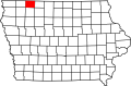
 Location in Dickinson County | |
| Coordinates: 43°17′52″N95°05′25″W / 43.29778°N 95.09028°W | |
| Country | |
| State | |
| County | Dickinson |
| Area | |
• Total | 35.51 sq mi (91.98 km2) |
| • Land | 35.46 sq mi (91.85 km2) |
| • Water | 0.046 sq mi (0.12 km2) 0.13% |
| Elevation | 1,457 ft (444 m) |
| Population (2000) | |
• Total | 869 |
| • Density | 25/sq mi (9.5/km2) |
| Time zone | UTC-6 (CST) |
| • Summer (DST) | UTC-5 (CDT) |
| ZIP codes | 51351, 51364 |
| GNIS feature ID | 0468380 |
Milford Township is one of twelve townships in Dickinson County, Iowa, USA. As of the 2000 census, its population was 869. [1]