Okoboji Township, Dickinson County, Iowa

Last updated

Okoboji Township
Map highlighting Okoboji Township, Dickinson County, Iowa.svg
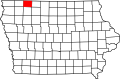
Location in Dickinson County
Coordinates: 43°18′03″N95°12′27″W / 43.30083°N 95.20750°W / 43.30083; -95.20750
Country Flag of the United States.svg United States
State Flag of Iowa.svg Iowa
County Dickinson
Area
  Total
36.12 sq mi (93.54 km2)
  Land36.09 sq mi (93.48 km2)
  Water0.027 sq mi (0.07 km2)  0.07%
Elevation
1,365 ft (416 m)
Population
 (2000)
  Total
2,087
  Density58/sq mi (22.3/km2)
Time zone UTC-6 (CST)
  Summer (DST) UTC-5 (CDT)
ZIP code
51351
GNIS feature ID 0468461

Okoboji Township is one of twelve townships in Dickinson County, Iowa, United States. As of the 2000 census, its population was 2,087. [1]

Contents

History

Okoboji Township was formed in 1859. [2]

Geography

According to the United States Census Bureau, Okoboji Township covers an area of 36.12 square miles (93.54 square kilometers); of this, 36.09 square miles (93.48 square kilometers, 99.94 percent) is land and 0.03 square miles (0.07 square kilometers, 0.07 percent) is water.

Cities, towns, villages

Adjacent townships

Cemeteries

The township contains these two cemeteries: Little Sioux Lutheran and Saint Joseph.

Major highways

Airports and landing strips

Rivers

Landmarks

School districts

Political districts

References

  1. "U.S. Census website" . Retrieved May 6, 2009.
  2. History of Emmet County and Dickinson County, Iowa. Pioneer Publishing Company. 1917. pp.  282.