Waterford Township | |
|---|---|
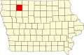
 Location in Clay County | |
| Coordinates: 43°12′51″N095°19′45″W / 43.21417°N 95.32917°W | |
| Country | |
| State | |
| County | Clay |
| Area | |
• Total | 35.56 sq mi (92.11 km2) |
| • Land | 35.55 sq mi (92.08 km2) |
| • Water | 0.012 sq mi (0.03 km2) 0.03% |
| Elevation | 1,381 ft (421 m) |
| Population (2000) | |
• Total | 209 |
| • Density | 6.0/sq mi (2.3/km2) |
| GNIS feature ID | 0468948 |
Waterford Township is a township in Clay County, Iowa, USA. As of the 2000 census, its population was 209.