Herdland Township, Clay County, Iowa

Last updated

Herdland Township
Map highlighting Herdland Township, Clay County, Iowa.svg
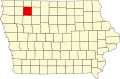
Location in Clay County
Coordinates: 42°56′58″N095°05′00″W / 42.94944°N 95.08333°W / 42.94944; -95.08333
Country Flag of the United States (23px).png  United States
State Flag of Iowa.svg Iowa
County Clay
Area
  Total
35.57 sq mi (92.12 km2)
  Land35.6 sq mi (92.1 km2)
  Water0.0039 sq mi (0.01 km2)  0.01%
Elevation
1,362 ft (415 m)
Population
 (2000)
  Total
210
  Density6.0/sq mi (2.3/km2)
GNIS feature ID 0468029

Herdland Township is a township in Clay County, Iowa, USA. As of the 2000 census, its population was 210.

Contents

History

Herdland Township was created in 1873. [1]

Geography

Herdland Township covers an area of 35.57 square miles (92.1 km2) and contains no incorporated settlements, although the unincorporated community of Cornell is located here. According to the USGS, it contains three cemeteries: Burr Oak, Liberty and Osborn.

The streams of Montgomery Creek and Willow Creek run through this township.

Notes

  1. Gillespie, Samuel (1909). History of Clay County, Iowa: From Its Earliest Settlement to 1909. S. J. Clarke Publishing Company. p. 60.

References