Lone Tree Township, Clay County, Iowa

Last updated

Lone Tree Township
Map highlighting Lone Tree Township, Clay County, Iowa.svg
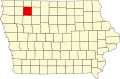
Location in Clay County
Coordinates: 43°07′37″N095°19′41″W / 43.12694°N 95.32806°W / 43.12694; -95.32806
Country Flag of the United States (23px).png  United States
State Flag of Iowa.svg Iowa
County Clay
Area
  Total
35.35 sq mi (91.55 km2)
  Land35.34 sq mi (91.52 km2)
  Water0.012 sq mi (0.03 km2)  0.03%
Elevation
1,398 ft (426 m)
Population
 (2000)
  Total
860
  Density24/sq mi (9.4/km2)
GNIS feature ID 0468302

Lone Tree Township is a township in Clay County, Iowa, USA. As of the 2000 census, its population was 860.

Contents

History

Lone Tree Township was created in 1877. [1] Lone Tree Township takes its name from a large elm tree that was a local landmark on the prairie. [2]

Geography

Lone Tree Township covers an area of 35.35 square miles (91.6 km2) and contains one incorporated settlement, Everly. According to the USGS, it contains one cemetery, Lone Tree.

The stream of Sewer Creek runs through this township.

Notes

  1. Gillespie, Samuel (1909). History of Clay County, Iowa: From Its Earliest Settlement to 1909. S. J. Clarke Publishing Company. pp.  60.
  2. Gillespie, Samuel (1909). History of Clay County, Iowa: From Its Earliest Settlement to 1909. S. J. Clarke Publishing Company. pp.  66.

References