Montgomery, Iowa | |
|---|---|
 Montgomery | |
| Coordinates: 43°26′27″N095°12′10″W / 43.44083°N 95.20278°W | |
| Country | United States |
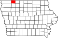
| State | Iowa |
| County | Dickinson County |
| Township | Diamond Lake Township |
| Elevation | 1,457 ft (444 m) |
| Time zone | UTC-6 (Central (CST)) |
| • Summer (DST) | UTC-5 (CDT) |
| ZIP code | 51360 |
| GNIS feature ID | 459192 [1] |
Montgomery is an unincorporated community in Diamond Lake Township, Dickinson County, Iowa, United States.