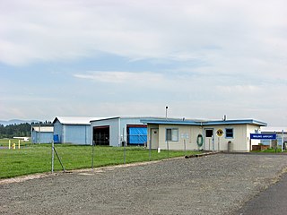
Mulino State Airport is a public airport located at Mulino, Oregon, near the city of Molalla, about 20 nautical miles south of Portland with access from Interstate 205 via Oregon Route 213. Also known as Mulino Airport, it was owned by the Port of Portland from 1988 until it was transferred to the Oregon Department of Aviation on July 1, 2009. It was previously also known as Portland-Mulino Airport.
Greensburg Municipal Airport is a public use airport located two nautical miles (4 km) southwest of the central business district of Greensburg, a city in Decatur County, Indiana, United States. Owned by the Greensburg-Decatur County Board of Aviation Commissioners, it was formerly known as Greensburg-Decatur County Airport. It is included in the National Plan of Integrated Airport Systems for 2017–2021, which categorized it as a general aviation facility.
Heritage Field is a public use airport in Montgomery County, Pennsylvania, United States. It is located three nautical miles (6 km) east of Pottstown, in Limerick Township. The airport is privately owned by Limerick Aviation LP.
Pittsburgh Northeast Airport is a privately owned, public use airport in Allegheny County, Pennsylvania, United States. The airport is located 12 nautical miles north-northeast of the central business district of Pittsburgh, in West Deer Township. The airport is located a few miles north of Pittsburgh Mills shopping mall.
Parker Carson Airport is a privately owned, public use airport located five nautical miles east of the central business district of Carson City, Nevada, United States. It was formerly known as Parker Carson STOLport.
Houston Fort Bend Airport is a privately owned, public use airport located in unincorporated Fort Bend County, Texas, United States. The airport is located east of Beasley and 33 nautical miles (61 km) southwest of the central business district of Houston. It was formerly known as Happy Landings Airport.
Tok Junction Airport is a state-owned public-use airport located one nautical mile east of the central business district of Tok, in the Southeast Fairbanks Census Area of the U.S. state of Alaska.

Saginaw Airport was a public use airport located eight nautical miles (15 km) north of the central business district of Fort Worth, in Tarrant County, Texas, United States. The airport was named for the nearby city of Saginaw, Texas.

Chignik Fisheries Airport was a public-use airport located 6 nautical miles (11 km) northwest of Chignik, a city in the Lake and Peninsula Borough of the U.S. state of Alaska.
Morrison Flight Park is a private use ultralight airport in Greene County, Indiana, United States. It is located two nautical miles (4 km) southwest of the central business district of Linton, Indiana, and was previously a public use airport.
Brundidge Municipal Airport was a city-owned, public-use airport located one nautical mile northeast of the central business district of the Brundidge, a city in Pike County, Alabama, United States. It is currently closed indefinitely.
Reigle Field, also known as Reigle Airport, is a privately owned, public use airport located two nautical miles (4 km) south of the central business district of Palmyra, in Lebanon County, Pennsylvania, United States.
Skyharbor Airport was a privately owned, public-use airport in Dallas County, Alabama, United States. It was located five nautical miles southwest of the central business district of Selma, Alabama. Since 2011, official FAA records state "Airport closed indefinitely."
Erie Aerodrome is a privately owned public-use airport located one nautical mile (2 km) southwest of the central business district of Erie, in Monroe County, Michigan, United States.
Pixley Airport, also known as Harmon Field, was a county-owned public-use airport located in Tulare County, California, United States, one nautical mile southwest of the central business district of Pixley, California.
Paradise Skypark is a private use airport located three nautical miles (6 km) south of the central business district of Paradise, in Butte County, California, United States.

Ephraim–Gibraltar Airport is a public use airport located one nautical mile (2 km) southwest of the central business district of Ephraim, a village in Door County, Wisconsin, United States. The airport is owned by the Village of Ephraim and the Town of Gibraltar. It was formerly known as Ephraim-Fish Creek Airport.

Granbury Regional Airport is a city-owned, public-use airport located two nautical miles (4 km) west of the central business district of Granbury, a city in Hood County, Texas, United States. Formerly known as Granbury Municipal Airport, it is included in the National Plan of Integrated Airport Systems for 2011–2015, which categorized it as a general aviation facility.
Nocona Airport was a public use airport located one nautical mile southwest of the central business district of Nocona, a city in Montague County, Texas, United States. It was owned by the City of Nocona.

Fordyce Municipal Airport, formerly known as H.L. Hopkins–Fordyce Municipal Airport, is a public use airport in Dallas County, Arkansas, United States. It is owned by the City of Fordyce and located three nautical miles (6 km) northeast of its central business district. This airport is included in the National Plan of Integrated Airport Systems for 2011–2015, which categorized it as a general aviation facility.

