Webster Parish is a parish located in the northwestern section of the U.S. state of Louisiana. The seat of the parish is Minden.
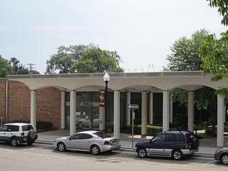
Minden is a city and parish seat in Webster Parish, Louisiana, United States. It is located twenty-eight miles east of Shreveport. As of the 2020 census, the city had a total population of 11,928. The Main Street district of Minden is recognized as a Louisiana Main Street Community, a Louisiana Cultural Products District, and is sited on the National Register of Historic Places. Minden is the core and principal city of the Minden Micropolitan Statistical Area, consisting of all of Webster Parish, which is included in the Shreveport–Bossier City–Minden CSA.

Winton Malcolm Blount, known as Red Blount, was an American philanthropist and politician who served as the United States Postmaster General from January 22, 1969, to January 1, 1972. He founded and served as the chief executive officer of the large construction company, Blount International, based in Montgomery, Alabama.
Gold Hill, also known as Goldhill, Gold Mine, or Gold Ridge, is an unincorporated community north-centrally located in Lee County, Alabama, United States, just a few hundred feet south of the Chambers County line. It is part of the Columbus, Georgia-Alabama Metropolitan Area. Today, Gold Hill lies mostly in the corporate limits of Auburn.
Alabama's 1st congressional district is a United States congressional district in Alabama, which elects a representative to the United States House of Representatives. It includes the entirety of Washington, Mobile, Baldwin and Monroe counties, as well as most of Escambia County. The largest city in the district is Mobile.
Grady is an unincorporated community in Montgomery County, Alabama, United States. Grady is located about 25 miles (40 km) south of Montgomery. It is at the intersection of Montgomery County Road 28 and Montgomery County Road 1.
Gasque is an unincorporated community in Baldwin County, Alabama, United States. Gasque is located on Alabama State Route 180, 7.8 miles (12.6 km) west of Gulf Shores.
Mauvilla is an unincorporated community in Mobile County, Alabama, United States. A post office operated under the name Mauvilla in 1856 and from 1895 to 1912.
The following is an alphabetical list of articles related to the U.S. state of Alabama.

Belforest is a small, unincorporated community in Baldwin County, Alabama, United States. Belforest is located on Alabama State Route 181, 2.9 miles (4.7 km) east of Daphne.

Summerfield is an unincorporated community in northeast Claiborne Parish, Louisiana, United States. It is located sixteen miles northeast of the parish seat of Homer.

Shannon is a small unincorporated community located in Jefferson County, Alabama, United States, between Birmingham and northwest Hoover named after John James Shannon, a mine operator. A post office first opened under the name Shannon in 1915.

Perdido, also known as Perdido Station, is an unincorporated community and census-designated place in Baldwin County, Alabama, United States. Perdido is located along County Route 61, 12.2 miles (19.6 km) northeast of Bay Minette. Perdido has a post office with ZIP code 36562. It has an elementary school, Perdido School, which is part of the Baldwin County Board of Education.
Seminole is an unincorporated community in Baldwin County, Alabama, United States. Seminole is located along U.S. Route 90, 14.4 miles (23.2 km) east of Robertsdale.
Abernant is an unincorporated community in Tuscaloosa County, Alabama, United States. Abernant is located along Alabama State Route 216, 3.6 miles (5.8 km) west of Lake View. Abernant has a post office with ZIP code 35440.
Palmerdale is an area in Jefferson County, Alabama, United States. Most of the community falls within the city limits of Pinson. Palmerdale is located on Alabama State Route 75, 4 miles (6.4 km) north-northeast of the downtown area of Pinson.
Kimbrell is an unincorporated community in Jefferson and Tuscaloosa counties, Alabama, United States. Kimbrell was named in honor of Miles Kimbrell, a storekeeper and sewing machine agent. A post office operated under the name Kimbrel from 1895 to 1905.
Newell is an unincorporated community in Randolph County, Alabama, United States, located 11.5 miles (18.5 km) north-northeast of Wedowee.
Gateswood is an unincorporated community in Baldwin County, Alabama, United States.
Robbins Crossroads, also known as Robbins, is an unincorporated community in Jefferson County, Alabama, United States.