
Missouri is a state in the Midwestern region of the United States. Ranking 21st in land area, it borders Iowa to the north, Illinois, Kentucky and Tennessee to the east, Arkansas to the south and Oklahoma, Kansas, and Nebraska to the west. In the south are the Ozarks, a forested highland, providing timber, minerals, and recreation. At 1.5 billion years old, the St. Francois Mountains are among the oldest in the world. The Missouri River, after which the state is named, flows through the center and into the Mississippi River, which makes up the eastern border. With over six million residents, it is the 19th-most populous state of the country. The largest urban areas are St. Louis, Kansas City, Springfield, and Columbia. The capital is Jefferson City.

Taney County is a county in the southwestern portion of the U.S. state of Missouri. As of the 2020 census, the population was 56,066. Its county seat is Forsyth. It is included in the Branson Micropolitan Statistical Area.

Stone County is located in the southwestern portion of the U.S. state of Missouri. As of the 2020 census, the population was 31,076. Its county seat is Galena.
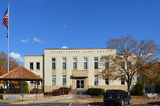
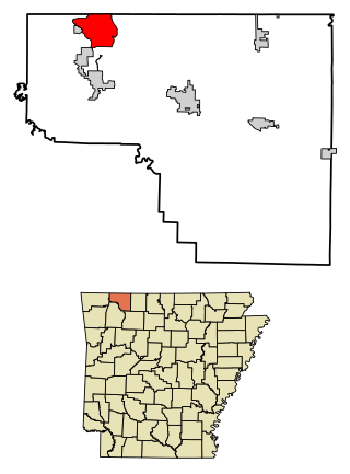
Ozark County is a county in the southern portion of the U.S. state of Missouri. As of the 2020 census, the population was 8,553. The largest city and county seat is Gainesville. The county was organized as Ozark County, named after the Ozark Mountains, on January 29, 1841. It was renamed Decatur County, after Commodore Stephen Decatur, from 1843 to 1845, after which the name Ozark County was restored.

Miller County is a county located in the northern Ozarks region of the U.S. state of Missouri. As of the 2020 United States census, the population was 24,722. Its county seat is Tuscumbia. The county was organized February 6, 1837, and named for John Miller, former U.S. Representative and Governor of Missouri.

Greene County is located in the southwest part of the U.S. state of Missouri. As of the 2020 census, its population was 298,915. making it the fourth most-populous county in Missouri.

Christian County is located in the southwestern part of the U.S. state of Missouri. As of the 2020 census, its population was 88,842. Its county seat is Ozark. The county was organized in 1859 and is named after Christian County, Kentucky, which in turn is named for William Christian, a Kentucky soldier of the American Revolutionary War.

Osage Beach is a city in Camden and Miller counties in the U.S. state of Missouri, near the Lake of the Ozarks. Most of the city is in Camden County, while a small eastern sliver is in Miller County. The population was 4,637 at the 2020 census.

Springfield is the third most populous city in the U.S. state of Missouri and the county seat of Greene County. The city's population was 169,176 at the 2020 census. It is the principal city of the Springfield metropolitan area, which had an estimated population of 487,061 in 2022 and includes the counties of Christian, Dallas, Greene, Polk, and Webster, The city sits on the Springfield Plateau of the Ozarks, which ranges from nearly-level to rolling hills. Springfield is the second-largest urban area in the Ozarks.

Branson is a city in the U.S. state of Missouri. Most of the city is situated in Taney County, with a small portion in the west extending into Stone County. Branson is in the Ozark Mountains. The community was named after Reuben Branson, postmaster and operator of a general store in the area in the 1880s. The population was 12,638 at the 2020 census, and its population constitutes nearly one fourth of the Taney County population.

Music of Missouri has a storied musical history. Missouri has had major developments in several popular music genres and has been the birthplace or career origin of many musicians. St. Louis was an important venue for early blues, jazz, country, and bluegrass. Kansas City has had famous performers such as Charlie Parker, Count Basie, Lester Young, and the distinct style of Kansas City jazz. Ragtime made influence in the city of Sedalia, Missouri, due to Scott Joplin and his publisher John Stark, and through Missouri native James Scott.

The Springfield, Missouri, metropolitan area, as defined by the United States Census Bureau, is an area consisting of five counties in southwestern Missouri, anchored by the city of Springfield, the state's third largest city. Other primary population centers in the metro area include Nixa, Ozark, Republic, Bolivar, Marshfield and Willard. Currently, the city limits of Springfield reach the Nixa, and Ozark city limits at the Christian County line on US 160, and US 65 respectively, the city limits of Republic at James River Freeway on the southwest side of the city, and the Strafford city limits on Route 744 on the northeast side of the city.
Missouri's 7th congressional district consists of Southwest Missouri. The district includes Springfield, the home of Missouri State University, the Joplin, Missouri, metropolitan area, Missouri's 5th largest, and the popular tourist destination city of Branson. Located along the borders of Kansas, Oklahoma, and Northwest Arkansas, the district occupies part of the Bible Belt with a strong socially conservative trend. George W. Bush defeated John Kerry here 67% to 32% in the 2004 election. Republican John McCain defeated Democrat Barack Obama 63.1% to 35.3% in the 2008 election. Republican and Former Massachusetts Governor Mitt Romney defeated Barack Obama 67.6% to 30.3% in the 2012 election. In the 2020 election, Republican Donald Trump defeated Democrat Joe Biden 69.91% to 28.93%. As of 2020, this district is the second most strongly Republican district in Missouri and is one of the most strongly Republican districts in the United States.

Missouri's 6th congressional district takes in a large swath of land in northern Missouri, stretching across nearly the entire width of the state from Kansas to Illinois. Its largest voting population is centered in the northern portion of the Kansas City metropolitan area and the town of St. Joseph. The district includes much of Kansas City north of the Missouri River.
Missouri's 8th congressional district is one of 435 congressional districts in the United States and one of eight congressional districts in the state of Missouri. The district encompasses rural Southeast Missouri and South Central Missouri as well as some counties in Southwest Missouri. The district stretches from the Bootheel in the south to the St. Louis southern exurbs of Festus, Hillsboro, and surrounding areas in the Lead Belt; it ranges in the east to counties along the Mississippi River and in the west to counties along the Ozark Plateau near Branson. With a Cook Partisan Voting Index rating of R+28, it is the most Republican district in Missouri.

Pawhuska Township is one of eleven townships in Camden County, Missouri, USA. As of the 2000 census, its population was 5,617.

Casey Guernsey is an American politician. A Republican, he is a former member of the Missouri House of Representatives. Guernsey represented the 3rd, and then the 2nd District, encompassing all or portions of Daviess, Gentry, Grundy, Harrison, Mercer, Sullivan, and Worth counties in north central Missouri. Due to Missouri House redistricting following the 2010 U.S. Census, much of the current 3rd District was renamed the 2nd District effective January, 2013. The new boundaries include all of Daviess, DeKalb, Gentry, and Harrison counties, but no longer all or parts of Grundy, Mercer, Sullivan, or Worth counties. Guernsey ran for the newly created 2nd District and won in the November, 2012 general election. On January 31, 2014, Guernsey announced he would not be a candidate for re-election in the 2014 Missouri House races nor would he be running for any seat in the Missouri Senate.
Missouri's 29th Senatorial District is one of 34 districts in the Missouri Senate. The district is currently represented by Republican Mike Moon of Ash Grove.
Holiday Island is a 4,500-acre planned retirement and vacation community in Carroll County, Arkansas, United States. Formerly an unincorporated community and census-designated place, it voted to incorporate in November 2020. As of the 2020 census, the population was 2,533. Holiday Island is located in the Ozark Mountains on Table Rock Lake, near Eureka Springs, Arkansas and approximately an hour's drive from Branson, Missouri, Fayetteville, Arkansas, and Bentonville, Arkansas. Community growth has been fueled by the expansion of corporate giants headquartered in Northwest Arkansas, namely Walmart, Tyson Foods, and J.B. Hunt; the entertainment attractions in Eureka Springs, AR and Branson, MO; the visitor traffic from the Crystal Bridges Museum of American Art, the Pea Ridge National Military Park, and the Roaring River State Park; and the influence of University of Arkansas, the state's largest university.

The 2024 Missouri Senate election took place on Tuesday, November 5, 2024, with the primary election held on Tuesday, August 6, 2024. Missouri voters elected state senators in the 17 odd-numbered districts of the Senate to serve four-year terms.