
U.S. Route 54 is an east–west United States Highway that runs northeast–southwest for 1,197 miles (1,926 km) from El Paso, Texas, to Griggsville, Illinois. The Union Pacific Railroad's Tucumcari Line runs parallel to US 54 from El Paso to Pratt, Kansas, which comprises about two-thirds of the route.
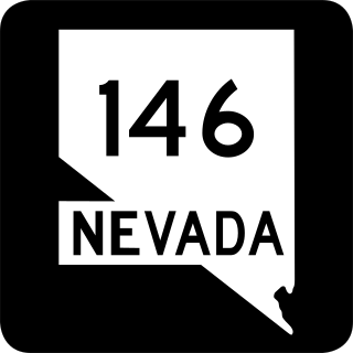
State Route 146 (SR 146) is a 6.673-mile-long (10.739 km) major east–west state highway in the southern part of the U.S. state of Nevada. It begins at the exit 27 interchange on Interstate 15 (I-15) south of the Las Vegas Strip and ends at the Pecos Road interchange on I-215 in Henderson. The highway is currently known as Saint Rose Parkway, but was known as Lake Mead Drive prior to 2001.
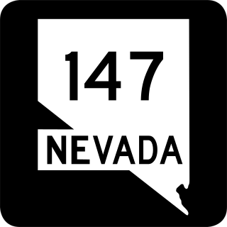
State Route 147 is a state highway serving the Las Vegas Valley in southern Nevada. It is signed as Lake Mead Boulevard and runs from Interstate 15 (I-15) and U.S. Route 93 in North Las Vegas east to the border of the Lake Mead National Recreation Area. It is not to be confused with Lake Mead Parkway, which also goes to Lake Mead but mainly runs in southern Las Vegas Valley and carries the designation of State Route 564.

Route 86 is a highway in southwest Missouri. The eastern terminus is at U.S. Route 65 just north of Ridgedale. From there, the road crosses the Long Creek arm of Table Rock Lake and continues to Blue Eye west between the Arkansas state line on the south and Table Rock Lake on the north. This section is also in the Mark Twain National Forest, and is recommended as a scenic drive by the Missouri Department of Transportation. From Eagle Rock the road turns north to join with Route 76 at Bates Corner with which it is runs concurrent through Cassville to just east of Rocky Comfort. The road continues north and west towards Neosho, then goes further west before turning north towards Joplin where the road ends at the interchange of Interstate 44 and Route 43. Except for a short section in Neosho, the road is a two-lane highway for its entire length.

State Route 28 (SR 28) is a 16.3-mile (26.2 km) state highway in Douglas County, Carson City, and Washoe County in western Nevada, United States, that runs along the northeastern shore of Lake Tahoe. SR 28 connects U.S. Route 50 (US 50) in Douglas County with California State Route 28 at Crystal Bay. SR 28 has been part of the Nevada scenic byway system since June 1994 and the National Scenic Byway system since September 1996.

Route 122 is a short highway in central Missouri. Its eastern terminus is at Route 41 in Fairville, which is halfway between Miami and Marshall. The western terminus is at Van Meter State Park. The total length of the highway is about five miles (8 km).
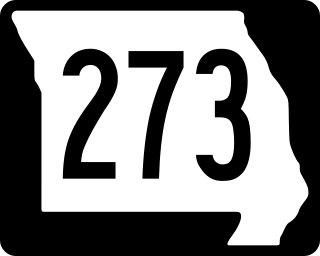
Route 273 is a highway in northwestern Missouri. Its northern terminus is at the Kansas state line halfway across the Missouri River near Atchison, Kansas. At this point it is concurrent with U.S. Route 59 and Route 45. The southern terminus is at Route 92 in Tracy. All but the southeasternmost six miles (10 km) overlap Route 45. The road runs through Platte and Buchanan Counties.

Route 103 is a short highway in southeastern Missouri. Its southern terminus is at Route Z inside the Ozark National Scenic Riverways. The route travels north and intersects a few county roads as it leaves the national park. The road ends at U.S. Route 60 in a three-way junction. After being proposed in 1930, a road was built from the national park to US 60 in 1933. The gravel road was designated as Route 103, and it was paved five years later.
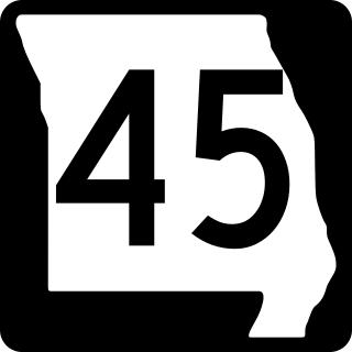
Route 45 is a highway in northwest Missouri, US in Buchanan County and Platte County which is largely in the bottom land alongside the Missouri River.

Route 107 is a highway in northeastern Missouri. Its northern terminus is at U.S. Route 24 southwest of Monroe City; its southern terminus is at Route 154 about nine miles (14 km) south of the northern terminus in Mark Twain State Park. No towns are on the route, but the Mark Twain Birthplace State Historic Site is less than a mile to the east in Florida. The highway crosses Mark Twain Lake twice.
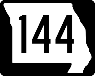
Route 144 is a 2.956-mile-long (4.757 km) state route in Ste. Genevieve County, Missouri. Its western terminus is at Route 32 near the village of Millers. The route travels southeastward toward Hawn State Park. The road then turns east and ends at Bauer Road and Park Drive, inside the state park. The route was designated in 1972, and has kept the same alignment since.

U.S. Route 41 (US 41) in the U.S. state of Illinois runs north from the Indiana border beneath the Chicago Skyway on Indianapolis Boulevard to the Wisconsin border north of the northern terminus of the Tri-State Tollway with Interstate 94. It is the only north–south U.S. Route to travel through a significant portion of the city of Chicago, carrying Lake Shore Drive through the central portion of the city along the lakefront. US 41 in Illinois is 64.81 miles (104.30 km) in length.

South Dakota Highway 20 (SD 20) is a 385.079-mile (619.725 km) state highway in northern South Dakota, United States, that connects the Montana state line, west-southwest of Camp Crook, with the Minnesota state line, east-southeast of Revillo, via Buffalo, Bison, Timber Lake, Mobridge, Selby, and Watertown. From Mobridge to the Walworth–Potter county line, this highway is part of the Lewis and Clark Trail. From about Timber Lake to just west of Mobridge, this highway is part of the Native American Scenic Byway. From the Montana state line to Camp Crook, the highway is a dirt road.

State Route 503 (SR 503) is a 54.11-mile-long (87.08 km) state highway serving Clark and Cowlitz counties in the U.S. state of Washington. The highway travels north from a short concurrency with SR 500 in Orchards through Battle Ground, the eastern terminus of SR 502, and communities in rural Clark County before crossing the Lewis River on the Yale Bridge. SR 503 intersects its spur route and turns west to parallel the Lewis River downstream to Woodland, where the highway ends at an interchange with Interstate 5 (I-5). The highway was part of the Lewis River Road, signed as State Road 15, from 1909 until 1919. The current route of SR 503 was split between Secondary State Highway 1S (SSH 1) from Woodland to Battle Ground and SSH 1U from Battle Ground to Orchards in 1937, combined to form SR 503 during the 1964 highway renumbering. A spur route, established in 1991, travels northeast into the Gifford Pinchot National Forest along Yale Lake, serving the community of Cougar.

State Route 124 (SR 124) is a state highway in Walla Walla County, Washington, United States. It spans 45 miles (72 km) from Burbank in the west to Waitsburg in the east, intersecting U.S. Route 12 (US 12) at both ends. The highway generally follows the Snake and Touchet rivers and intersects SR 125 near Prescott.

Recreational Road 3 (RE 3) is a Recreational Road located in Fannin County in North Texas. The 2-mile (3.2 km) long highway connects Bonham City Lake Recreation Area to Farm to Market Road 273 (FM 273) and the city of Bonham. The road travels in a generally west-east alignment through mixed rural-residential land along the southern shore of Lake Bonham. Its eastern terminus is at County Road 2619 (CR 2610) on the eastern border of the recreation area. The highway was designated in 1970 when the City of Bonham requested the Texas State Highway Commission build a highway to connect its newly-created City Lake park to the state highway network. The road was constructed in 1972 after two years of delays over right-of-way issues largely over the route of an existing dirt track.

South Dakota Highway 1806 is a state highway in the U.S. state of South Dakota. It exists in four distinct sections. Its longest section begins at SD 273 and runs along the Missouri River nearly its whole length, serving Pierre. SD 1806 along with SD 1804 are numbered from the years of the Lewis and Clark Expedition.

