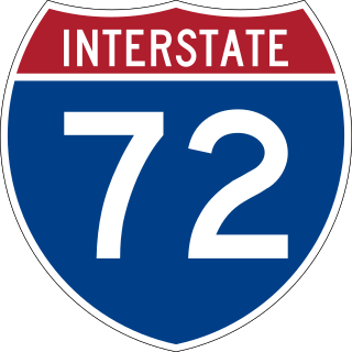
Interstate 72 (I-72) is an Interstate Highway in the midwestern United States. Its western terminus is in Hannibal, Missouri, at an intersection with U.S. Route 61 (US 61); its eastern terminus is at Country Fair Drive in Champaign, Illinois. The route runs through the major cities of Decatur, Illinois, and Springfield, Illinois. In 2006, the Illinois General Assembly dedicated all of I-72 as Purple Heart Memorial Highway. The stretch between Springfield and Decatur is also called Penny Severns Memorial Expressway, and the section between mile 35 and the Mississippi River is known as the Free Frank McWorter Historic Highway.

U.S. Route 290 is an east–west U.S. Highway located entirely within the state of Texas. Its western terminus is at Interstate 10 southeast of Segovia, and its eastern terminus is at Interstate 610 in northwest Houston. It is the main highway between Houston and Austin and is a cutoff for travelers wanting to bypass San Antonio on Interstate 10. Throughout its length west of Austin, US 290 cuts across mountainous hills comprising the Texas Hill Country and the Edwards Plateau; between Austin and Houston, the highway then travels through gradually hilly grasslands and pine forests comprising the Gulf Coastal Plains.
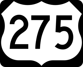
U.S. Route 275 (US 275) is a north–south United States highway that is a branch of US 75. It originally terminated at US 75 in Council Bluffs, Iowa. The highway's northern terminus is in O'Neill, Nebraska, at an intersection with U.S. Highway 20 and U.S. Highway 281. Its southern terminus is near Rock Port, Missouri, at an intersection with U.S. Highway 136.
The Avenue of the Saints is a 563-mile-long (906 km) highway in the Midwestern United States that connects St. Louis, Missouri and St. Paul, Minnesota.

U.S. Route 68 is a United States highway that runs for 560 miles (900 km) from northwest Ohio to Western Kentucky. The highway's western terminus is at US 62 in Reidland, Kentucky. Its present northern terminus is at Interstate 75 in Findlay, Ohio, though the route once extended as far north as Toledo. US 68 intersects with US 62 three times during its route.

U.S. Route 117 (US 117) is a north-south United States Highway located completely within the state of North Carolina. A spur route of US 17, the highway runs for 114 miles (183 km) from the Port of Wilmington, south of downtown Wilmington, to US 301 near Wilson. From its southern terminus, US 117 runs along Shipyard Boulevard and College Road, concurrent with North Carolina Highway 132 (NC 132) through Wilmington. US 117 intersects the eastern terminus of Interstate 40 (I-40) and parallels the interstate until reaching Faison, passing through Burgaw, Wallace, and Warsaw. The highway diverges from I-40 in Faison, running north-northeast through Mount Olive, Goldsboro, and Pikeville to its northern terminus. US 117 meets the southern end of I-795 in Goldsboro, and parallels that route before reaching its northern terminus at US 301 south of Wilson.
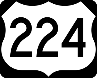
U.S. Route 224 (US 224) is a spur of US 24 that runs through the states of Indiana, Ohio and Pennsylvania. It currently runs for 289 miles (465 km) from US 24 in Huntington, Indiana, east to US 422 Business and Pennsylvania Route 18 (PA 18) in New Castle, Pennsylvania. It goes through the cities of Canfield, Ohio, Akron, Ohio, and Findlay, Ohio. In Northeast Ohio, US 224 is located a short distance north of the Western Reserve's southern boundary.

U.S. Route 158 (US 158) is an east–west United States highway that runs for 350 miles (560 km) from Mocksville to Whalebone Junction in Nags Head, entirely in the state of North Carolina. It is also a critical route that connects the cities of Winston-Salem, Summerfield, and Reidsville with one another.

Route 43 is a highway in western Missouri. Its northern terminus is at U.S. Route 54 midway between Nevada and Deerfield. Its southern terminus is at the corner of Missouri, Arkansas, and Oklahoma where it continues down the Arkansas/Oklahoma state line as both Arkansas Highway 43 and Oklahoma State Highway 20.

Route 13 is a highway in Missouri which runs almost the entire north–south length of the state. Its northern terminus is at U.S. Route 69/136 in Bethany. Its southern terminus is at the Arkansas state line in downtown Blue Eye, Missouri–Arkansas where it continues as Highway 21. It is one of the original state highways of Missouri.

Route 7 is a state highway with its northern terminus at U.S. Route 24 in northeast Independence and its southern terminus at Interstate 44 southeast of Richland. The section between Harrisonville and Clinton provides an important link for traffic between Springfield and Kansas City.

State Route 309 is an east–west highway in central Ohio. Its western terminus is at its interchange with U.S. Route 30 (US 30) near Delphos, and its eastern terminus is at its interchange with US 30 in Mansfield. Its current route takes it through the cities of Lima, Kenton, Marion, Galion, and Ontario; as well as the villages of Elida and Caledonia.

Route 154 is a highway in northeastern Missouri. Its eastern terminus is at U.S. Route 54 north of Vandalia; its western terminus is at U.S. Route 24) west of Paris, where Business US 24 also has its western terminus. Route 154 passes through Mark Twain State Park and over Mark Twain Lake.

North Carolina Highway 24 (NC 24) is the longest primary state highway in the U.S. state of North Carolina. Traveling east–west between the Charlotte metropolitan area and the Crystal Coast, connecting the cities of Charlotte, Fayetteville, Jacksonville and Morehead City.

State Route 183 is a north/south state Highway in eastern Ohio. Its southern terminus is SR 800 in Sandy Township, approximately 0.5 miles (0.80 km) east of Sandyville and less than two miles (3.2 km) south of East Sparta. Its northern terminus is SR 14 in Edinburg Township near Interstate 76, about 10 miles (16 km) southeast of Ravenna. The current route was commissioned in 1962.

State Route 446 is an east–west state highway in the northeastern portion of the U.S. state of Ohio. The western terminus of SR 446 is at a T-intersection with U.S. Route 224 (US 224) in Canfield, approximately one mile (1.6 km) west of the downtown area. Its eastern terminus is at a Y-intersection with SR 46 about one mile (1.6 km) south of Canfield.

State Route 424 was an east–west state highway in the northwestern portion of the U.S. state of Ohio. The route was a former section of US 24 that ran parallel to the Maumee River and Miami and Erie Canal between the cities of Defiance and Napoleon. First designated in 1964, the western terminus of the route for most of its history was at an intersection with US 24 west of Defiance, though between 2008 and when the route was fully removed from the state highway system in 2012, it was at the Defiance County/Henry County line. Its eastern terminus was at a dead end near the US 6 / US 24 interchange east of Napoleon.

U.S. Route 24 (US 24) is a United States Numbered Highway that runs from Minturn, Colorado, to Independence Township, Michigan. In Ohio, it is an expressway and freeway for much of its length, from the Indiana state line to Maumee. From there northeast to the Michigan state line at Toledo, it is a surface highway.

Several special routes of U.S. Route 54 exist, from Texas to Missouri. In order from southwest to northeast, separated by type, they are as follows.
Several special routes of U.S. Route 24 (US 24) currently exist, while some are now decommissioned. These special routes include alternate, business and bypass routes that branch from U.S. Route 24.

