| Barangay Mobo | |
|---|---|
| Barangay | |
| Nickname(s): Agri Island | |
| Country | |
| Region | Western Visayas (Region VI) |
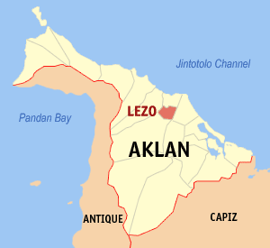
| Province | Aklan |
| District | Lone district |
| Government [1] | |
| • Barangay Chairman | Cesar S Goopio Jr |
| Population (2010) [2] | |
| • Total | 1,939 |
| Demonym(s) | Kalibonhon |
| Time zone | PST (UTC+8) |
| ZIP code | 5600 |
| Dialing code | 36 |
| Income class | urban |
Coordinates: 11°42′08″N122°21′09″E / 11.70225°N 122.35242°E Mobo is the inland part of the Aklan River delta and a barangay of Kalibo, Aklan, Philippines which is considered as the food basket of Kalibo.

A geographic coordinate system is a coordinate system that enables every location on Earth to be specified by a set of numbers, letters or symbols. The coordinates are often chosen such that one of the numbers represents a vertical position and two or three of the numbers represent a horizontal position; alternatively, a geographic position may be expressed in a combined three-dimensional Cartesian vector. A common choice of coordinates is latitude, longitude and elevation. To specify a location on a plane requires a map projection.

A barangay or baranggay (, formerly referred to as barrio, is the smallest administrative division in the Philippines and is the native Filipino term for a village, district or ward. In metropolitan areas, the term often refers to an inner city neighbourhood, a suburb or a suburban neighborhood. The word barangay originated from balangay, a kind of boat used by a group of Austronesian peoples when they migrated to the Philippines.

The Philippines, officially the Republic of the Philippines, is an archipelagic country in Southeast Asia. Situated in the western Pacific Ocean, it consists of about 7,641 islands that are categorized broadly under three main geographical divisions from north to south: Luzon, Visayas, and Mindanao. The capital city of the Philippines is Manila and the most populous city is Quezon City, both part of Metro Manila. Bounded by the South China Sea on the west, the Philippine Sea on the east and the Celebes Sea on the southwest, the Philippines shares maritime borders with Taiwan to the north, Vietnam to the west, Palau to the east, and Malaysia and Indonesia to the south.