Beijing possesses multiple ring roads.

Interstate 676 (I-676) is an Interstate Highway that serves as a major thoroughfare through Center City Philadelphia, where it is known as the Vine Street Expressway, and Camden, New Jersey, where it is known as the northern segment of the North–South Freeway, as well as the Martin Luther King Jr. Memorial Highway in honor of civil rights leader Martin Luther King Jr. Its western terminus is at I-76 in Philadelphia near the Philadelphia Museum of Art and Fairmount Park. From there, it heads east and is then routed on surface streets near Franklin Square and Independence National Historical Park, home of the Liberty Bell, before crossing the Delaware River on the Benjamin Franklin Bridge. On the New Jersey side of the bridge, the highway heads south to its southern terminus at I-76 in Gloucester City near the Walt Whitman Bridge. Between the western terminus and downtown Camden, I-676 is concurrent with U.S. Route 30 (US 30).

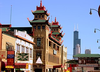
Armour Square is a Chicago neighborhood on the city's South Side, as well as a larger, officially defined community area, which also includes Chinatown and the CHA Wentworth Gardens housing project. Armour Square is bordered by Bridgeport to the west, Pilsen to the northwest, Douglas and Grand Boulevard to the east and southeast, and with the Near South Side bordering the area to the north, and Fuller Park bordering its southernmost boundary, along Pershing Road.

Interstate 395 (I-395) in Virginia and Washington, D.C., is a 13.79-mile-long (22.19 km) spur route of I-95 that begins at an interchange with I-95 in Springfield and ends at an interchange with US Route 50 (US 50) in Northwest Washington, D.C. It passes underneath the National Mall near the US Capitol and ends at a junction with US 50 at New York Avenue, roughly one mile (1.6 km) north of the 3rd Street Tunnel. Despite its proximity to I-395 in Maryland, the route is unrelated and unconnected.

Azadi Square, formerly known as Shahyad Square, is a mainly green city square in Tehran, Iran. It hosts as its centerpiece the Azadi Tower. The tower and square were commissioned by Mohammad Reza Pahlavi, the last Shah of Iran, to mark the 2,500th year of the foundation of the Imperial State of Iran.
The Central Artery is a section of freeway in downtown Boston, Massachusetts; it is designated as Interstate 93, US 1 and Route 3.

Vanak is a neighbourhood in the northern part of Tehran, capital of Iran and there is a square and a street named after it. The word Vanak means "Small (ash) Tree" in Persian.

Honghe Hani and Yi Autonomous Prefecture is an autonomous prefecture in Southeast-Central Yunnan Province, China, bordering Vietnam's Lào Cai and Lai Châu provinces to the south. Its name is derived from the Hong (Red) River and the two major ethnic minority groups who live there: the Yi and the Hani. Honghe has an area of 32,929 square kilometres (12,714 sq mi) and its seat is Mengzi. The total population is 4.8 million, of which 61.3% belong to ethnic minorities.

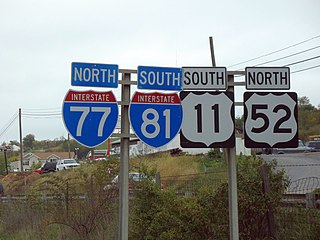
A highway shield or route marker is a sign denoting the route number of a highway, usually in the form of a symbolic shape with the route number enclosed. As the focus of the sign, the route number is usually the sign's largest element, with other items on the sign rendered in smaller sizes or contrasting colors. Highway shields are used by travellers, commuters, and all levels of government for identifying, navigating, and organising routes within a given jurisdiction. Simplified highway shields often appear on maps.

Shahid Chamran Expressway, Also known as Parkway Expressway is an expressway in Tehran, Iran, leading from Tohid Square to Parkway Junction. Chamran is the oldest expressway in Tehran, and is unofficially called Parkway Expressway or just Parkway for short. The expressway is named after Mostafa Chamran.
The city of Karachi is a major transport hub of Pakistan. The Karachi port and airport are major gateways to Pakistan. The Karachi Railway stations transports the major part of Pakistan's trade with other countries.

Freeway 7 is a freeway in central Iran. It starts from Jahad Square at the south end of Kazemi Expressway and Azadegan Expressway in Tehran. It then passes Behesht-e Zahra, Imam Khomeini Int'l, Qom, Kashan, Natanz, Shahinshahr, Najafabad and currently ends at the northeast of Zarrinshahr in a junction with Road 51 and Zobahan Freeway. However, there has been construction after the junction and so far, 7 kilometres (4.3 mi) has been completed. In recent years, construction has been made in order to connect this freeway to Shiraz under the name Esfahan-Shiraz Freeway, which starts from Izadkhast and currently ends at the northwest of Shiraz in a junction with Road 67, and it is planned to end in Hosseini Al-Hashemi Expressway. It was opened in Mehr 1402. The Freeway from Isfahan to Izadkhast is currently planned, but yet to start construction. There are also plans to connect the freeway to Bushehr.

Sheikh Fazlollah Nouri Expressway starts from the end of Tehran-Karaj Freeway. It passes Bakeri Expressway, Shahid Sattari Expressway, Mohammad Ali Jenah Expressway, Yadegar-e-Emam Expressway, Jalal-e-Ale Ahmad Expressway, Resalat Expressway and Hemmat Expressway and reaches Sanat Square in West Town.

Modarres Expressway, prior to 1979 Iranian Revolution known as the Shahanshahi Expressway is an expressway in Tehran. It starts from north of Tehran at the end of Chamran Expressway in Elahiyeh and goes south and ends in Haft-e Tir Square. It is named after Hassan Modarres.

Sayyad Expressway is an expressway in Tehran. It starts from Babayi Expressway and ends in Sabalan Street.

Port of Jebel Ali, also known as Mina Jebel Ali, is a deep port located in Jebel Ali, Dubai, United Arab Emirates. Jebel Ali is the world's ninth busiest port, the largest man-made harbour, and the biggest and by far the busiest port in the Middle-East. Port Jebel Ali was constructed in the late 1970s to supplement the facilities at Port Rashid.
Douglas Road, also West 37th Avenue on the greater Miami grid plan and Northwest 88th Avenue in Miramar, is a 20.4-mile (32.8 km) north–south thoroughfare running west of downtown Miami in Miami-Dade County and Broward County, Florida. It changes names and becomes Pine Island Road, at the intersection with Sheridan Street.

Sayyad Shirazi Expressway is an expressway in eastern Isfahan, Iran.

Macri Triangle is a 0.57 acres park located at the intersection of Meeker Avenue, Union Avenue, and Metropolitan Avenue in Williamsburg, Brooklyn, New York City. The property was designated as a park in 1946 during the construction of the Brooklyn-Queens Expressway, which resulted in the demolition of buildings along its route and the extension of Meeker Avenue from Richardson Street south to Metropolitan Avenue, serving as the expressway's service road. As the highway ran through the street grid, triangular parcels that were too small to be developed were designated as public plazas, including this one.


