Tehran province is one of the 31 provinces of Iran. It covers an area of 18,814 square kilometres (7,264 sq mi) and is located to the north of the central plateau of Iran.
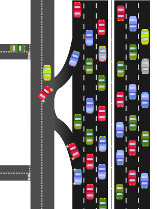
A frontage road is a local road running parallel to a higher-speed, limited-access road. A frontage road is often used to provide access to private driveways, shops, houses, industries or farms. Where parallel high-speed roads are provided as part of a major highway, these are also known as local lanes. Sometimes a similar arrangement is used for city roads; for example, the collector portion of Commonwealth Avenue in Boston, Massachusetts, is known as a carriage road.

A limited-access road, known by various terms worldwide, including limited-access highway, dual-carriageway, expressway, and partial controlled-access highway, is a highway or arterial road for high-speed traffic which has many or most characteristics of a controlled-access highway, including limited or no access to adjacent property, some degree of separation of opposing traffic flow, use of grade separated interchanges to some extent, prohibition of slow modes of transport, such as bicycles, (draught) horses, or self-propelled agricultural machines; and very few or no intersecting cross-streets or level crossings. The degree of isolation from local traffic allowed varies between countries and regions. The precise definition of these terms varies by jurisdiction.

A controlled-access highway is a type of highway that has been designed for high-speed vehicular traffic, with all traffic flow—ingress and egress—regulated. Common English terms are freeway, motorway and expressway. Other similar terms include throughway and parkway. Some of these may be limited-access highways, although this term can also refer to a class of highways with somewhat less isolation from other traffic.
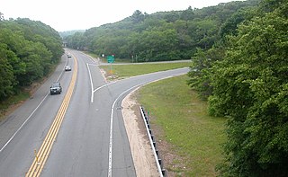
A two-lane expressway or two-lane freeway is an expressway or freeway with only one lane in each direction, and usually no median barrier. It may be built that way because of constraints, or may be intended for expansion once traffic volumes rise. The term super two is often used by roadgeeks for this type of road, but traffic engineers use that term for a high-quality surface road. Most of these roads are not tolled.

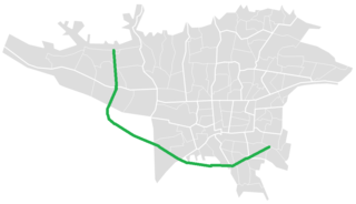
Freeway 7 is a freeway in central Iran. It starts from Jahad Square at the south end of Kazemi Expressway and Azadegan Expressway in Tehran. It then passes Behesht-e Zahra, Imam Khomeini Int'l, Qom, Kashan, Natanz, Shahinshahr, Najafabad and ends northeast of Zarrinshahr in a junction with Road 51 and Zobahan Freeway. However, there has been construction after the junction and so far, 7 kilometres (4.3 mi) has been completed. There are also plans to connect the freeway to Shiraz.

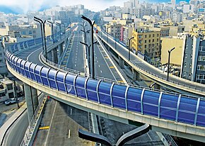
Hemmat Expressway is a route in Tehran, Iran. It starts from Pasdaran Avenue junction and goes towards west. It passes Haghani Expressway, Kordestan Expressway, Milad Tower, Ashrafi Esfahani Expressway and Ziba Shahr in Western Tehran and ends into a two-way road that goes south to Tehran–Karaj Freeway.

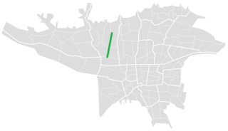
Sheikh Fazlollah Nouri Expressway starts from the end of Tehran-Karaj Freeway. It passes Bakeri Expressway, Shahid Sattari Expressway, Mohammad Ali Jenah Expressway, Yadegar-e-Emam Expressway, Jalal-e-Ale Ahmad Expressway, Resalat Expressway and Hemmat Expressway and reaches Sanat Square in West Town.
Northern Behesht-e-Zahra Highway is an expressway in northern part of Behesht-e Zahra Cemetery connecting Tehran-Qom Highway to Freeway.
Azadegan Expressway or Tehran Ringway is an expressway in southern Tehran. It connects Tehran-Mashhad Highway to Tehran-Karaj-Tabriz Freeway and Tehran-Shomal Freeway.
Shahid Sattari Expressway (Nur) (Persian: بزرگراه شهید ستّاری (نور)) is from Iranpars Expressway to Tehran-Karaj Freeway.

Tehran (Sadeghiyeh) Metro Station is the junction of Tehran Metro Line 2 and Tehran Metro Line 5. It is located in Sadeghiye neighborhood near Mohammad Ali Jenah Expressway and Tehran-Karaj Freeway. It is the west end of Line 2 and the east end of Line 5. The next station in Line 2 is Tarasht Metro Station and the next station in Line 5 is Eram-e Sabz Metro Station. It also has a big parking lot and is considered as the most crowded Tehran metro station. It is currently the only above ground station on Tehran Metro Line 2.
Lieutenant General Qasem Soleimani is a freeway in Iran connecting two cities of Tehran and Bandar Imam via Saveh, Arak, Borujerd, Khorramabad, Andimeshk and Ahvaz. This freeway is part of North-South Corridor. It starts from Azadegan Expressway and ends at Bandar Imam. It runs along Road 65, Road 56 and Road 37. The AADT of the section from Ahvaz to Bandar Imam is 15,000, of which 2,500 are Iraqi tankers.

Tehran Metro Line 2, which opened between Sadeghieh and Imam Khomeini in February 2000, is 20.4 kilometers (12.7 mi) long, with 19 km (12 mi) as a subway and 1.4 kilometers (0.87 mi) elevated. At this time, there were 19 stations along the line, of which Imam Khomeini Station was shared by Line 1. Line 2 is coloured blue on system maps and runs mostly east–west through the city.

Line 4 is one of several lines of the Tehran Metro. The line is 24.4 km (15.2 mi) with 20 main stations, 3 stations along a domestic airport-serving branch line and a terminal (depôt).

Freeway 3, or more commonly known as Tehran-Shomal Freeway will be a freeway in Northern Iran, connecting Tehran to cities of western Mazandaran. Currently, sections 1 & 4 are in service and section 2 is under construction. Construction process at section 3 is not started yet. The freeway runs parallel to Road 59, the old road connecting Karaj to Chalus.
Iran route numbering system is a network of highways and roads in Iran that is managed by Iran Road Maintenance & Transportation Organization. The network comprises main highways and several major and minor country roads.

Tabriz–Urmia Freeway is a partially built freeway project in Northwestern Iran, East Azerbaijan and West Azerbaijan provinces, connecting the two cities of Tabriz and Urmia. It serves as a major link, with the bridge over Urmia Lake, connecting Urmia to the rest of the country via Tabriz and Freeway 2. The project consists of several segments.