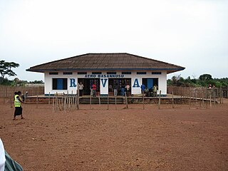
Basankusu Airstrip is an airport serving Basankusu, a city on the Lulonga River in Équateur Province, Democratic Republic of the Congo.
Pepa Airport is an airstrip 3 kilometres (2 mi) east of the village of Pepa in Tanganyika Province, Democratic Republic of the Congo.
Banga Airport is an airstrip serving the village of Banga in Kasai Province, Democratic Republic of the Congo.
Bibanga Airport is an airstrip serving the village of Bibanga in Kasai-Oriental Province, Democratic Republic of the Congo.
Bonkita Airport is an airstrip serving Bonkita, a village on the Lukenie River in the Mai-Ndombe Province, Democratic Republic of the Congo.
Busala Airport is a rural airstrip serving the village of Busala in Kwilu Province, Democratic Republic of the Congo.
Diboko Airport is an airstrip serving Diboko, a village in Kasaï Province, Democratic Republic of the Congo.
Ingende Airport is an airstrip serving Ingende, a village on the Ruki River in Équateur Province, Democratic Republic of the Congo. The runway is 2 kilometres (1.2 mi) west of Ingende.
Ipeke Airport is an airstrip serving Ipeke, a village on the western shore of Lake Mai-Ndombe in Mai-Ndombe Province, Democratic Republic of the Congo. The runway is 2 kilometres (1.2 mi) southwest of the village.
Wembo-Nyama Airport is an airstrip serving the village of Wembo Nyama in Sankuru Province, Democratic Republic of the Congo.
Moma Airport is an airstrip serving the village of Moma in Kasaï-Central Province, Democratic Republic of the Congo.
Nzamba Airport is an airstrip serving the village of Nzamba in Kwango Province, Democratic Republic of the Congo. The runway is 1.6 kilometres (1 mi) west of the village.
Nzovu Airport is an airstrip serving the village of Nzovu in Sud-Kivu Province, Democratic Republic of the Congo. The runway is 2.5 kilometres (1.6 mi) south of the village, across the Lubimbi river.
Yemo Airport is an airstrip serving the village of Yemo in Tshuapa Province, Democratic Republic of the Congo. The narrow runway also serves as a road within the village, and tapers off to a trail at the southern end.
Wamba Airport is an airstrip serving the village of Kikongo Sur Wamba in Kwilu Province, Democratic Republic of the Congo. The runway lies between the village and the Wamba River.
Nyanga Airport is an airstrip serving the village of Nianga in Kasaï Province, Democratic Republic of the Congo.
Mvula Sanda Airport is a grass airstrip serving the village of Kizulu in Kongo Central Province, Democratic Republic of the Congo. The runway is poorly marked, but corner markers are visible on the northeastern end.
Luishi Airport is an airport serving the village of Luishi in Katanga Province, Democratic Republic of the Congo. The runway is 4 kilometres (2.5 mi) southeast of the village.
Obaye Airport is an airstrip serving Obaye, a village in the North Kivu Province of the Democratic Republic of the Congo.
Lubondaie Airport is an airstrip serving Lubondaie, a village in the Kasaï-Central Province of the Democratic Republic of the Congo.
