Kisangani Bangoka International Airport

Last updated • a couple of secsFrom Wikipedia, The Free Encyclopedia
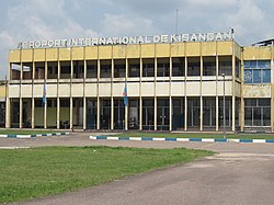
Kisangani Bangoka
International Airport
Aéroport international de Kisangani-Bangoka
Natsional'nii kontingent u DR Kongo otrimav novu vertolitnu tekhniku (31860558211).jpg
Summary
Airport typePublic
Serves Kisangani, Democratic Republic of the Congo
Elevation  AMSL 1,417 ft / 432 m
Coordinates 00°28′54″N025°20′17″E / 0.48167°N 25.33806°E / 0.48167; 25.33806
Map
Democratic Republic of the Congo adm location map.svg
Airplane silhouette.svg
FKI
Location of Bangoka International Airport in DRC
Kisangani Bangoka International Airport
Runways
Direction LengthSurface
mft
13/313,50011,483Asphalt
Sources: GCM [1] Google Maps [2]

Kisangani Bangoka International Airport( IATA : FKI, ICAO : FZIC) is an airport serving Kisangani, Democratic Republic of the Congo. The airport is 12 kilometres (7.5 mi) east of the city. The Bangoka VOR/DME (Ident: KGI) is 1.7 nautical miles (3.1 km) west of the airport. [3]

Contents

Airlines and destinations

AirlinesDestinations
Air Congo Goma, Kinshasa–N'djili [4]
Compagnie Africaine d'Aviation Bumba, [5] Goma, Kindu, Kinshasa–N'djili
Congo Airways Goma, Kindu, Kinshasa–N'djili
Ethiopian Airlines Addis Ababa [6]

Accidents and incidents

See also

References

  1. Airport information for Bangoka International Airport at Great Circle Mapper.
  2. "Bangoka Airport". Google Maps. Google. Retrieved 19 April 2018.
  3. "Bangoka VOR-DME (KGI) @ OurAirports". ourairports.com. Retrieved 2018-08-20.
  4. "Air Congo 1Q25 Network Expansion". Aeroroutes. Retrieved 23 January 2025.
  5. 2014 March Timetable,http://www.caacongo.com/horaires-20-mars-2014.pdf Archived 2016-03-03 at the Wayback Machine
  6. Ethiopian changes - RoutesOnline
  7. Hradecky, Simon (17 August 2011). "Crash: Hewa Bora B721 at Kisangani on Jul 8th 2011, missed runway on landing". The Aviation Herald . Retrieved 16 May 2019.