Mokihinui River

Last updated
Mokihinui River
Mokihinui River.jpg
Mokihinui River by the Rough n' Tumble Bush Lodge
Location
CountryNew Zealand
Physical characteristics
Mouth  
Tasman Sea
 - elevation
0 m (0 ft)
Basin size670.36 km2 (258.83 sq mi)

The Mokihinui River is a river located on the West Coast of New Zealand's South Island, about 40 kilometres north of Westport. [1] Meridian Energy had proposed the Mokihinui Hydro project on the river in 2007 [2] but it was cancelled in May 2012.[ citation needed ] In 2019, it was announced that large parts of the river catchment, including 15km of river bed, would be added to Kahurangi National Park. [2]

West Coast, New Zealand Region in South Island, New Zealand

The West Coast is a region of New Zealand on the west coast of the South Island that is administered by the West Coast Regional Council. It comprises the territorial authorities of Buller District, Grey District and Westland District. The principal towns are Westport, Greymouth, and Hokitika. The region is one of the more remote and most sparsely populated areas of the country.

South Island Southernmost of the two main islands in New Zealand

The South Island, also officially named Te Waipounamu, is the larger of the two major islands of New Zealand in surface area; the other being the smaller but more populous North Island. It is bordered to the north by Cook Strait, to the west by the Tasman Sea, and to the south and east by the Pacific Ocean. The South Island covers 150,437 square kilometres (58,084 sq mi), making it the world's 12th-largest island. It has a temperate climate.

Westport, New Zealand Place in West Coast, New Zealand

Westport is a town in the West Coast region of the South Island of New Zealand. It is on the northern bank and at the mouth of the Buller River, close by the prominent headland of Cape Foulwind. It is connected via State Highway 6 with Greymouth, 100 kilometres (62 mi) to the south, and with Nelson 222 kilometres (138 mi) in the northeast, via the Buller Gorge.

Contents

Geography

The Mokihinui River's headwaters are located in the Glasgow Range and its mouth is on the Tasman Sea. There is little human habitation near the river: the localities of Mokihinui and Summerlea are near the river's mouth, Seddonville is a few kilometres up the river, and just prior to its terminus, State Highway 67 crosses the river outside Mokihinui. In the rugged back country behind Seddonville at the Mokihinui Forks, the river splits into two branches, north and south. [1] The catchment of these two branches is a large inland basin of almost wholly unmodified forest. [3]

Glasgow Range mountains in New Zealand

The Glasgow Range is a mountain range on the northern West Coast of New Zealand's South Island. It is north of the Papahaua Range and its most significant river is the Mokihinui River.

Tasman Sea A marginal sea of the South Pacific between Australia and New Zealand

The Tasman Sea is a marginal sea of the South Pacific Ocean, situated between Australia and New Zealand. It measures about 2,000 kilometres (1,200 mi) across and about 2,800 kilometres (1,700 mi) from north to south. The sea was named after the Dutch explorer Abel Janszoon Tasman, who was the first recorded European to encounter New Zealand and Tasmania. The British explorer Captain James Cook later extensively navigated the Tasman Sea in the 1770s as part of his first voyage of exploration.

Mokihinui Place in West Coast, New Zealand

Mokihinui is a lightly populated locality on the West Coast of New Zealand's South Island.

Culture

Ngāi Tahu and Ngāti Waewae are the manawhenua tribes of the area. [2]

Ngāi Tahu Māori iwi (tribe) in Aotearoa New Zealand

Ngāi Tahu, or Kāi Tahu, is the principal Māori iwi (tribe) of the southern region of New Zealand. Its takiwā is the largest in New Zealand, and extends from Blenheim, Mount Mahanga and Kahurangi Point in the north to Stewart Island in the south. The takiwā comprises 18 rūnanga corresponding to traditional settlements.

Recreation

A tramping track runs along the south bank of the river giving access to Kahurangi National Park.

Kahurangi National Park national park

Kahurangi National Park in the northwest of the South Island of New Zealand is the second largest of the thirteen national parks of New Zealand. It was gazetted in 1996 and covers 4,529 square kilometres (1,749 sq mi), ranging to near Golden Bay in the north. Much of what was the North-west Nelson Forest Park formed the basis of the new park. Kahurangi Point, regarded as the boundary between the West Coast and Tasman Regions, is located in the park, as are the Heaphy Track and Mount Owen.

The river of interest for recreation and commercial whitewater activities. There is three hours of grade III water downstream from where the north and south forks meet. A river level of 1-1.5 metres is an optimum flow. [4]

Whitewater bubbly, or aerated and unstable current

Whitewater is formed in a rapid, when a river's gradient increases enough to generate so much turbulence that air is entrained into the water body, that is, it forms a bubbly or aerated and unstable current; the frothy water appears white. The term is also loosely used to refer to less turbulent, but still agitated, flows.

Railway

The last few kilometres of the former Seddonville Branch railway roughly followed the Mokihinui River near its mouth. The Branch opened on 23 February 1895 and closed on 3 May 1981, while a further extension beyond Seddonville to Mokihinui Mine closed in February 1974. [5]

The Seddonville Branch, later truncated as the Ngakawau Branch, is a branch line railway in the West Coast region of New Zealand's South Island. Construction began in 1874 and it reached its terminus at the Mokihinui Mine just beyond Seddonville in 1895. In 1981 it was closed past Ngakawau and effectively became an extension of the Stillwater–Westport Line, since formalised as the Stillwater Ngakawau Line.

During this period, the New Zealand Railways Department dumped two old steam locomotives along the river's banks between Seddonville and Mokihinui Mine to protect against erosion. The first of these locomotives, WB 292, was dumped in 1958, while sister WB 299 was dumped in January 1960. Both were recovered from the Mokihinui River in 1989 by the Baldwin Steam Trust, and are under restoration at the Rimutaka Incline Railway. [6] [7]

Related Research Articles

Bealey River river

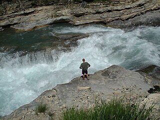
The Bealey River is a small river located in the Southern Alps of New Zealand. It is a tributary of the Waimakariri River. Its valley forms the eastern approach to Arthur's Pass. The river and the Bealey settlement are named for Samuel Bealey, a 19th-century Superintendent of Canterbury Province and pastoralist.

Westfield railway station railway station

Westfield railway station was a station of the Auckland railway network in New Zealand. The station closed to all services on 12 March 2017, following an announcement by Auckland Transport on 17 January 2017, because fewer than 330 passengers used it daily and it required a costly upgrade.

NZR T class class of 6 New Zealand 2-8-0 locomotives

The NZR T class was a class of steam locomotive used in New Zealand. They of the "Consolidation" type, popular in North America, especially with the narrow gauge Denver and Rio Grande Western Railroad.

NZR W<sup>B</sup> class class of 12 New Zealand 2-6-2T locomotives

The NZR WB class was a class of tank locomotives that operated in New Zealand. Built in 1898 by the Baldwin Locomotive Works, the twelve members of the class entered service during the first five months of 1899. Eight were withdrawn by the end of 1935, while four others survived with new boilers until the mid-1950s.

NZR W<sup>D</sup> class class of 18 New Zealand 2-6-4T locomotives

The NZR WD class was a class of tank locomotive built by Baldwin Locomotive Works to operate on New Zealand's national rail network.

NZR N class class of 12 New Zealand 2-6-2 locomotives

The N class were 12 steam locomotives that operated on the national rail network of New Zealand. They were built in three batches, including one batch of two engines for the private Wellington and Manawatu Railway Company, the WMR, by the Baldwin Locomotive Works in 1885, 1891, and 1901. Previously the N class designation had been applied between 1877 and 1879 to Lady Mordaunt, a member of the B class of 1874.

Wellington and Manawatu Railway Trust

The Wellington and Manawatu Railway Trust is a charitable trust based in Wellington, New Zealand, and is actively restoring former Wellington and Manawatu Railway locomotive No.9, to full working order.

Summerlea, New Zealand Place in West Coast, New Zealand

Summerlea is a lightly populated locality on the West Coast of New Zealand's South Island.

Hector and Ngakawau Place in West Coast, New Zealand

Hector and Ngakawau are two lightly populated settlements located at the mouth of the Ngakawau River in the West Coast region of New Zealand. Both settlements are situated on State Highway 67 between Westport and Karamea. The 2001 New Zealand census found that Hector and Ngakawau have a combined population of 300, a drop of 16% or 57 people since the 1996 census. This has dropped further in 2006 to 234 people. Despite a low population, many of the workers at New Zealand's largest open-cut coal mine at Stockton choose to live at these places and shuttles frequently operate between the two places.

The Conns Creek Branch was a 2.7 kilometre branch line railway in the West Coast region of New Zealand's South Island. It diverged from the Seddonville Branch at Waimangaroa and followed the southern bank of the Waimangaroa River to the line's terminus at Conns Creek at the foot of the Denniston Incline. The line operated from 1877 until 1967 and existed for the sole purpose of conveying coal from mines to the port of Westport.

The Mokihinui Hydro was a proposed hydroelectric dam and power station planned for conservation land on the Mokihinui River on the West Coast of New Zealand. The project by Meridian Energy was expected to cost $300 million.

The Hemphill River is a river of the northwestern South Island of New Zealand. It flows through rugged country to the south of Kahurangi National Park, forming two small lakes on its route south to join with the Mokihinui River.

Omoto locomotive dump

Omoto locomotive dump is a New Zealand Railways locomotive and rolling stock dump site located near Greymouth, New Zealand. The dump site is located on the southern bank of the Grey River, close to the Midland Line and State Highway 6.

Oamaru locomotive dump

Oamaru locomotive dump was created in New Zealand so that obsolete locomotives and rolling stock could be used to stabilize loose ground where rivers and the coast were eroding the ground where the railway lines were built. This was done at a time when scrap steel was an uneconomic proposition. It was located on the coastline in the North Otago town of Oamaru to stabilise land used by New Zealand Railways for their freight yards. Here the coastline of the Pacific Ocean pounded heavily against the land causing major erosion.

References

  1. 1 2 "Place name detail: Mokihinui River". New Zealand Gazetteer. Land Information New Zealand . Retrieved 23 June 2007.
  2. 1 2 3 https://www.maoritelevision.com/news/regional/addition-kahurangi-national-park-largest-history-nz
  3. Buller District Council, Buller District Plan: Part 3 - The Management Environment Archived 2007-09-27 at the Wayback Machine , 17, accessed 24 June 2007.
  4. Egarr, Graham (1988). Whitewater River Running in New Zealand. Auckland: Reed Methuen. ISBN   0-474-00302-7.
  5. David Leitch and Brian Scott, Exploring New Zealand's Ghost Railways, revised edition (Wellington: Grantham House, 1998 [1995]), 52-3.
  6. Baldwin Steam Trust, "Salvage Scheme", accessed 23 June 2007.
  7. "Steam locomotive Wb 299", accessed 17 January 2017

Coordinates: 41°31′S171°56′E / 41.517°S 171.933°E / -41.517; 171.933