
Nakodar is a town and a municipal council in Jalandhar district in the Indian state of Punjab.
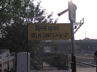
Delhi Cantonment is a Class I Cantonment Board established in 1914. The area of the Cantonment is 10,452 acres (42.30 km2) and the population of the Cantonment as per the 2011 census is 110,351.
Amlai is a census town in Shahdol district in the state of Madhya Pradesh, India.
Barahiya is a town and nagar parishad in Lakhisarai district in the Indian state of Bihar. It has a total population of 43,032. It lies on the southern bank of the river Ganges, about 116.8 km east of Patna
Chilla Saroda Bangar is a census town in East Delhi District in the National Capital Territory of Delhi, India.

Dadri is a town and a municipal board in Gautam Buddha Nagar District in the state of Uttar Pradesh, India. Dadri Railway Station is a complex yard in North Central Railway spread over six kilometers on busiest route of Delhi–Kanpur–Patna–Howrah section of Indian Railways and also having connectivity with National Thermal Power Corporation and Container Depot.
Dundahera is a census town in Gurgaon district in the state of Haryana, India. It lies near Udyog Vihar Industrial Area adjacent to Delhi-Gurgaon Border. It has a population of about 122016 persons living in around 2739 households.
Etmadpur is a town (tehsil) in Agra district in the state of Uttar Pradesh, India. It is located eastward 19 km from Agra. It is 274 km far from state capital Lucknow.
Gogapur is a census town in tehsil Mehidpur City and Ujjain district in the Indian state of Madhya Pradesh.This town is commonly known as Mehidpur Road and Mehidpur Mandi.
Gulaothi is a town, near Bulandshahr city in the Bulandshahr district that falls under the Meerut division of the Indian state of Uttar Pradesh.
Jakhal Mandi is a city and a municipal council, near Fatehabad town in Fatehabad district in the Indian state of Haryana.
Jattari is a town and a Nagar Panchayat in Khair Tehsil of Aligarh district in the Indian state of Uttar Pradesh. It lies on Aligarh – Palwal road 45 km ahead from Aligarh towards Palwal. Jattari chairman is Mr. Pradeep Bansal.
Kesrisinghpur is a town and a municipality in Ganganagar district in the Indian state of Rajasthan.
Muradnagar is a city and a municipal board in Ghaziabad district, Uttar Pradesh, India. It lies about 22 km (14 mi) from Ghaziabad, the district headquarters, and 55 km (34 mi) from Delhi.
Nangloi Jat or popularly known as "Nangloi" is a locality in West district in the Union Territory of Delhi in India, surrounded by Paschim Vihar, Delhi Outer Ring road, Najafgarh
Phulera is a town in Jaipur district in the Indian state of Rajasthan. It is lies nearly by Jaipur city, state capital. The DMIC project runs through Phulera. It is a major railway junction.
Pilibanga is a town and a municipality in Hanumangarh district in the Indian state of Rajasthan.
Siwani is a town and a municipality in Bhiwani district in the north Indian state of Haryana. It is the administrative headquarters of Siwani tehsil.
Tigri is a census town in South district in the National Capital Territory of Delhi, India.
Banga is a town and Municipal council in the Shahid Bhagat Singh Nagar district of Punjab, India. Banga is also one of the sub-division (tehsil) headquarters of the district. Banga located on Phagwara-Rupnagar section of National Highway 344A. It is currently estimated to have a population of about 23,000 and is classified as a class 2 Municipality. The town also incorporates the former village of Jindowal apart from Banga town.
