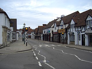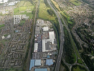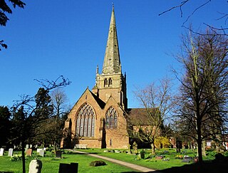
Warwick is a market town, civil parish and the county town of Warwickshire in the Warwick District in England, adjacent to the River Avon. It is 9 miles (14 km) south of Coventry, and 19 miles (31 km) south-east of Birmingham. It is adjoined with Leamington Spa and Whitnash.

Knowle is a large village situated 3 miles (5 km) east-southeast of the town of Solihull, in the county of the West Midlands, England. Knowle lies within the Arden area of the historic county boundaries of Warwickshire, and since 1974 it has been part of the Metropolitan Borough of Solihull. It lies 2.5 miles from the Warwickshire border and had a recorded population of 10,678.

North Warwickshire is a local government district with borough status in Warwickshire, England. The borough includes the two towns of Atherstone and Coleshill, and the large villages of Hartshill, Kingsbury, Mancetter, Polesworth and Water Orton along with smaller villages and surrounding rural areas.

Hampton in Arden is a village and civil parish located in the Forest of Arden in the Metropolitan Borough of Solihull, in the West Midlands of England. Hampton in Arden was part of Warwickshire until the 1974 boundary changes. It lies within the Meriden Gap which is an area of countryside between Solihull and Coventry.

The Metropolitan Borough of Solihull is a metropolitan borough in West Midlands county, England. It is named after its largest town, Solihull, from which Solihull Metropolitan Borough Council is based. For Eurostat purposes it is a NUTS 3 region and is one of seven boroughs or unitary districts that comprise the "West Midlands" NUTS 2 region. Much of the large residential population in the north of the borough centres on the communities of Castle Bromwich, Kingshurst, Marston Green and Smith's Wood as well as the towns of Chelmsley Wood and Fordbridge. In the south are the towns of Shirley and Solihull, as well as the large villages of Knowle, Dorridge, Meriden and Balsall Common.

Shirley is a town in the Metropolitan Borough of Solihull, in the West Midlands, England. Historically a rural settlement within the county of Warwickshire, it is now contiguous with nearby Solihull and Birmingham.

Castle Bromwich is a large suburban village and civil parish in the Metropolitan Borough of Solihull in the West Midlands, England. It borders the rest of the borough to the south east, Sutton Coldfield to the east and north east, Shard End to the south west, Castle Vale, Erdington and Minworth to the north and Hodge Hill to the west.

Chelmsley Wood, sometimes called just Chelmsley, is a town and civil parish in the Metropolitan Borough of Solihull, West Midlands, England, with a population of 12,453. It is located near Birmingham Airport and the National Exhibition Centre. It lies about eight miles east of Birmingham and 5 miles to the north of Solihull. The town is also close to both Coleshill and Water Orton in Warwickshire, the county the area was historically part of.

Bickenhill is a small village in the civil parish of Bickenhill and Marston Green, in the Metropolitan Borough of Solihull, in the West Midlands county, England, on the eastern fringe of the West Midlands conurbation. Bickenhill is also a ward and was within the historic county of Warwickshire. Birmingham Airport is also located within the civil parish.
Kingshurst is a post-war village and civil parish in the Metropolitan Borough of Solihull, in the West Midlands, England. Historically part of the county of Warwickshire in the Meriden Rural District, It lies about 7 miles (11 km) north of Solihull town centre, 10 miles (16 km) east of Birmingham and 12 miles (16km) west of Coventry, it borders North Warwickshire to the east. The village is encompassed within the electoral ward Kingshurst & Fordbridge which had a population of 7,868 in the 2011 census.

Hockley Heath is a village and civil parish within the Metropolitan Borough of Solihull, West Midlands, England. The village is to the south of the West Midlands conurbation, 12 miles (19 km) southeast of Birmingham 5.5 miles (8.9 km) from Solihull town centre and 13 miles (21 km) north of Stratford-upon-Avon. Hockley Heath is in the Arden area and borders Warwickshire and the District of Stratford-on-Avon to the south, with some parts of the village on either side of the border. It incorporates the hamlet of Nuthurst, and has a history dating back to the year 705 AD as a wood owned by Worcester Cathedral. The 2011 Census gives the population of Hockley Heath civil parish as 2,038.

Solihull is a market town and the administrative centre of the Metropolitan Borough of Solihull, in the West Midlands, England. Solihull is situated on the River Blythe in the Forest of Arden area. The town had a population of 126,577 at the 2021 Census, and its wider borough had a population of 216,240. The town is located 8 miles (12 km) southeast of Birmingham and 14 miles (21 km) west of Coventry.

Sutton Coldfield Town Hall is a former hotel and council building in Sutton Coldfield, Birmingham, England. The building is Grade A locally listed.

Warwickshire County Council is the county council that governs the non-metropolitan county of Warwickshire in England. Its headquarters are at Shire Hall in the centre of Warwick, the county town. The council's principal functions are county roads and rights of way, social services, education and libraries, but it also provides numerous other local government services in its area.

Monkspath is a large residential community and light-industrial area of Solihull, West Midlands, England, southeast of the town's Shirley district. Monkspath is in the Blythe ward of the Metropolitan Borough of Solihull.
Earlswood is a village split between the counties of Warwickshire and the West Midlands in England. Most of the village is located in the Tanworth-in-Arden civil parish of the Stratford-on-Avon District, Warwickshire, while the northern part is in the Tidbury Green parish in the Metropolitan Borough of Solihull. A hamlet called Warings Green lies to the south east of the village, with the northernmost point crossing into the parish of Cheswick Green in the borough of`Solihull. The village is surrounded by farmland and forests and it gives its name to Earlswood Lakes as well as to Earlswood railway station, even though The Lakes railway station is located closer to the main part of the village.
Monkspath Meadow is a 1.2 ha ancient hay-meadow and a biological site of Special Scientific Interest in the West Midlands. The site was notified in 1986 under the Wildlife and Countryside Act 1981. It is on the south-eastern edge of Monkspath. The site has recently been targeted for development for houses but these plans have been met with uproar from locals in Monkspath and nearby villages, such as Cheswick Green and Hockley Heath, as it would destroy such a special natural site.

Reading Civic Centre was a civic centre in the town of Reading, itself in the English county of Berkshire. The centre dated from the mid-1970s.

Elmdon Park is a park and local nature reserve in Elmdon, Solihull, West Midlands. It was established in 1944 when the house and grounds of the derelict Elmdon Hall were bought up by the then Solihull Urban District Council. The house was used by the Home Guard during the war years, but the building subsequently became derelict, suffering from a rotten staircase and roof, and was demolished in 1956.

Nuneaton Town Hall is a municipal building on Coton Road in the town of Nuneaton, Warwickshire, England. The building is the headquarters of Nuneaton and Bedworth Borough Council.


