Monroe Township | |
|---|---|
 Cosby Zion Methodist Church | |
 | |
| Coordinates: 39°50′48″N94°40′31″W / 39.846587°N 94.6752701°W | |
| Country | |
| State | |
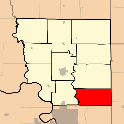
| County | Andrew |
| Area | |
• Total | 34.16 sq mi (88.5 km2) |
| • Land | 33.63 sq mi (87.1 km2) |
| • Water | 0.53 sq mi (1.4 km2) 1.55% |
| Elevation | 909 ft (277 m) |
| Population | |
• Total | 845 |
| • Density | 25.1/sq mi (9.7/km2) |
| FIPS code | 29-00349286 [1] |
| GNIS feature ID | 766226 [2] |

Monroe Township is a township in Andrew County, Missouri, United States. [2] At the 2020 census, its population was 845. [3]
Contents
The township was named after President James Monroe. [4]
