Mont-Aux-Sources

Last updated
Mont-Aux-Sources

Mont-Aux-Sources pano.JPG

Mont-Aux-Sources, taken from Crows Nest peak, showing the source of the Tugela at right
Highest point
Elevation 3,282 m (10,768 ft)
Listing List of mountains in South Africa
Coordinates 28°46′21.07″S28°52′21.72″E / 28.7725194°S 28.8727000°E / -28.7725194; 28.8727000 Coordinates: 28°46′21.07″S28°52′21.72″E / 28.7725194°S 28.8727000°E / -28.7725194; 28.8727000
Geography
South Africa relief location map.svg
Red triangle with thick white border.svg
Mont-Aux-Sources
Location of Mafadi in South Africa (on border with Lesotho)
Location South Africa and Lesotho
Parent range Drakensberg

Mont-aux-Sources is a mountain in Southern Africa, forming one of the highest portions of the Drakensberg Range. It is mostly within Lesotho, with parts in the KwaZulu-Natal and Free State provinces of South Africa.

Mountain A large landform that rises fairly steeply above the surrounding land over a limited area

A mountain is a large landform that rises above the surrounding land in a limited area, usually in the form of a peak. A mountain is generally steeper than a hill. Mountains are formed through tectonic forces or volcanism. These forces can locally raise the surface of the earth. Mountains erode slowly through the action of rivers, weather conditions, and glaciers. A few mountains are isolated summits, but most occur in huge mountain ranges.

Southern Africa southernmost region of the African continent

Southern Africa is the southernmost region of the African continent, variably defined by geography or geopolitics, and including several countries. The term southern Africa or Southern Africa, generally includes Angola, Botswana, Eswatini (Swaziland), Lesotho, Malawi, Mozambique, Namibia, South Africa, Zambia, and Zimbabwe, though Angola may be included in Central Africa and Malawi, Mozambique, Zambia and Zimbabwe in East Africa. From a political perspective the region is said to be unipolar with South Africa as a first regional power.

Lesotho kingdom in southern Africa

Lesotho, officially the Kingdom of Lesotho, is an enclaved country–the only one in the world outside of the Italian peninsula–within the border of South Africa. It is just over 30,000 km2 (11,583 sq mi) in size and has a population of around 2 million. Its capital and largest city is Maseru.

Contents

The peak is accessible from the Sentinel Car Park near Witsieshoek, via chain ladders.

Description

The Mont-Aux-Sources is part of a basalt plateau which lies at an average elevation of about 3,050 meters (10 000 ft). Among the many escarpments that surround the plateau is a sheer wall of 330 vertical meters, known as the Amphitheatre and the Sentinel. [1] The highest point is a peak 3 km from the Drakensberg escarpment, attaining an altitude of 3,282 metres (10,768 ft).

Basalt A magnesium- and iron-rich extrusive igneous rock

Basalt is a mafic extrusive igneous rock formed from the rapid cooling of magnesium-rich and iron-rich lava exposed at or very near the surface of a terrestrial planet or a moon. More than 90% of all volcanic rock on Earth is basalt. Basalt lava has a low viscosity, due to its low silica content, resulting in rapid lava flows that can spread over great areas before cooling and solidification. Flood basalt describes the formation in a series of lava basalt flows.

Hydrography

Since important rivers have their sources in the range, the mountainous area was named mont aux Sources (‘fountains mountain’) by French missionaries who visited the region in 1836.

Several rivers originate in the Mont-Aux-Sources, foremost of which is the Tugela, which flows eastwards into the Indian Ocean on the KwaZulu-Natal coast. Some 7 km from the Mont-Aux-Sources, the Tugela plunges 947 m in a series of falls in the Royal Natal National Park. This is the second-highest series of falls in the world. [2]

Indian Ocean The ocean between Africa, Asia, Australia and Antarctica (or the Southern Ocean)

The Indian Ocean is the third largest of the world's oceanic divisions, covering 70,560,000 km2 (27,240,000 sq mi). It is bounded by Asia on the north, on the west by Africa, on the east by Australia, and on the south by the Southern Ocean or, depending on definition, by Antarctica.

Tugela Falls waterfall

Tugela Falls is a complex of seasonal waterfalls located in the Drakensberg of Royal Natal National Park in KwaZulu-Natal Province, Republic of South Africa. It is generally accepted as the world's second-tallest waterfall but there is an argument that it is actually the tallest waterfall in the world, rather than Venezuela's Angel Falls.

Royal Natal National Park national park

The Royal Natal National Park is in the KwaZulu Natal province of South Africa and forms part of the uKhahlamba Drakensberg Park World Heritage Site. Notwithstanding the name, it is actually not a South African National Park managed by the SANParks, but rather a Provincial Park managed by Ezemvelo KZN Wildlife.

The Caledon River, one of the main tributaries of the Orange River, has its sources in this massif and flows along the border with Lesotho. Also the Seati (Khubedu), one of the headwater streams of the Orange River, has its origin near Mont-aux-Sources further to the north. [3]

Caledon River river

The Caledon River is a major river located in central South Africa, rising in the Drakensberg Mountains on the Lesotho border, flowing southwestward and then westward before joining the Orange River near Bethulie in the southern Free State.

Orange River river

The Orange River is the longest river in South Africa and the Orange River Basin extends extensively into Namibia and Botswana to the north. It rises in the Drakensberg mountains in Lesotho, flowing westwards through South Africa to the Atlantic Ocean. The river forms part of the international borders between South Africa and Namibia and between South Africa and Lesotho, as well as several provincial borders within South Africa. Except for Upington, it does not pass through any major cities. The Orange River plays an important role in the South African economy by providing water for irrigation and hydroelectric power. The river was named the Orange River in honour of the Dutch ruling family, the House of Orange, by the Dutch explorer Robert Jacob Gordon. Other names include Gariep River, Groote River or Senqu River.

Another important river is the Elands, named the Namahadi in its uppermost section in the area of the Fika-Patso Dam. The Elands flows roughly northwards into the Wilge River, one of the major tributaries of the Vaal. [4] The Vaal River flows westwards eventually into the Orange River, which in turn flows into the Atlantic Ocean on the West coast of Southern Africa.

Elands River (Wilge) river in South Africa

The Elands River is a northward-flowing tributary of the Wilge River, part of the Vaal River basin, South Africa. Its sources are in the Mont-Aux-Sources.

Fika-Patso Dam is a combined earth-fill/rock-fill type dam located on the Namahadi River, the uppermost section of the Elands River, a tributary of the Wilge River.

Wilge River River in Free State, South Africa, tributary of Vaal River

The Wilge River is a tributary of the Vaal River in central South Africa. This river is important as part of the Tugela-Vaal Water Transfer Scheme where water is transferred from the Tugela River basin to the Vaal River basin.

See also

Related Research Articles

Geography of South Africa geography of South Africa

South Africa occupies the southern tip of Africa, its coastline stretching more than 2,850 kilometres from the desert border with Namibia on the Atlantic (western) coast southwards around the tip of Africa and then northeast to the border with Mozambique on the Indian Ocean. The low-lying coastal zone is narrow for much of that distance, soon giving way to a mountainous escarpment that separates the coast from the high inland plateau. In some places, notably the province of KwaZulu-Natal in the east, a greater distance separates the coast from the escarpment. Although most of the country is classified as semi-arid, it has considerable variation in climate as well as topography.

Vaal River river in South Africa

The Vaal River is the largest tributary of the Orange River in South Africa. The river has its source near Breyten in Mpumalanga province, east of Johannesburg and about 30 kilometres (19 mi) north of Ermelo and only about 240 kilometres (150 mi) from the Indian Ocean. It then flows westwards to its conjunction with the Orange River southwest of Kimberley in the Northern Cape. It is 1,120 kilometres (700 mi) long, and forms the border between Mpumalanga, Gauteng and North West Province on its north bank, and the Free State on its south.

KwaZulu-Natal Province of South Africa

KwaZulu-Natal is a province of South Africa that was created in 1994 when the Zulu bantustan of KwaZulu and Natal Province were merged. It is located in the southeast of the country, enjoying a long shoreline beside the Indian Ocean and sharing borders with three other provinces and the countries of Mozambique, Eswatini and Lesotho. Its capital is Pietermaritzburg and its largest city is Durban. It is the 2nd most populous province in South Africa, with slightly fewer residents than Gauteng.

Drakensberg mountain range in South Africa

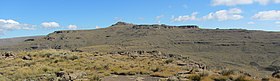
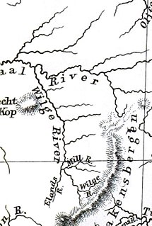
The Drakensberg is the name given to the eastern portion of the Great Escarpment, which encloses the central Southern African plateau. The Great Escarpment reaches its greatest elevation in this region – 2,000 to 3,482 metres. It is located in South Africa and Lesotho.

Tugela River river in South Africa

The Tugela River is the largest river in KwaZulu-Natal Province, South Africa. It is one of the most important rivers of the country.

Maloti-Drakensberg Park International park in Lesotho and South Africa

Maloti-Drakensberg Park was established on 11 June 2001 by linking the Sehlabathebe National Park in the Kingdom of Lesotho and the uKhahlamba Drakensberg Park in KwaZulu-Natal, South Africa. The highest peak is Thaba Ntlenyana rising to 3.482 m.

Winterton, KwaZulu-Natal Place in KwaZulu-Natal, South Africa

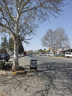
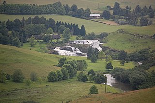
Winterton is a small town situated on the banks of the Tugela River in the foothills of the Drakensberg mountains, KwaZulu-Natal, South Africa. It was founded in 1905 as Springfield when the Natal Government built a weir across the Little Tugela River. The town later changed its name to Winterton in honour the secretary for agriculture, HD Winter. Winterton is a small town with only a primary school. It is close to the Second Boer War battle sites of Battle of Vaal Krantz and Spioenkop.

Harrismith Place in Free State, South Africa

Harrismith is a large town in the Free State province of South Africa. It was named for Sir Harry Smith, a 19th-century British governor of the Cape Colony. It is situated by the Wilge River, alongside the N3 highway, about midway between Johannesburg, about 300 km to the north-west, and Durban to the southeast. The town is located at the junction of the N5 highway, which continues westward towards the provincial capital Bloemfontein, some 340 km to the south-west. This important crossroads in South Africa's land trade routes is surrounded by mesas and buttes. It is located at the base of one of these called Platberg.

Highveld Natural region in South Africa

The Highveld is the portion of the South African inland plateau which has an altitude above roughly 1500 m, but below 2100 m, thus excluding the Lesotho mountain regions to the south-east of the Highveld. It is home to some of the country's most important commercial farming areas, as well as its largest concentration of metropolitan centres, especially the Gauteng conurbation, which accommodates one-third of South Africa's population.

Maloti Mountains mountain in Lesotho

The Maloti Mountains are a mountain range of the highlands of the Kingdom of Lesotho. They extend for about 100 km into the Free State. The Maloti Range is part of the Drakensberg system that includes ranges across large areas of South Africa. “Maloti” is also the plural for Loti, the currency of the Kingdom of Lesotho. The range forms the northern portion of the boundary between the Butha-Buthe District in Lesotho and South Africa’s Free State.

Great Escarpment, Southern Africa Major topographical feature in southern Africa

The Great Escarpment is a major topographical feature in Africa that consists of steep slopes from the high central Southern African plateau downward in the direction of the oceans that surround Southern Africa on three sides. While it lies predominantly within the borders of South Africa, in the east it extends northwards to form the border between Mozambique and Zimbabwe, continuing on beyond the Zambezi River valley to form the Muchinga Escarpment in eastern Zambia. In the west, it continues northwards into Namibia and Angola.

Amphitheatre (Drakensberg) geographical features of the Northern Drakensberg, South Africa

The Amphitheatre is one of the geographical features of the Northern Drakensberg, South Africa, and is widely regarded as one of the most impressive cliff faces on earth. The cliff face of the Amphitheatre is roughly three times the size of the total combined area of all the cliff faces in Yosemite's famous El Capitan, and more than 10 times the size of El Capitan's most famous face. It is part of the Royal Natal National Park.

Mooi River may refer to:

Mooi River (Tugela) river in South Africa

The Mooi River is a river in KwaZulu-Natal Province, South Africa. It rises in the Mkomazi Nature Reserve in the Drakensberg Mountains, and empties into the Tugela River near Muden. The town of Mooi River lies on the river.

uKhahlamba-Drakensberg Park

The uKhahlamba-Drakensberg Park is in the KwaZulu-Natal province of South Africa, covering 2,428.13 km2 (938 sq mi) of area. The park includes Royal Natal National Park, a provincial park, and covers part of the Drakensberg, the highest mountain range in Southern Africa.

Bushmans River river in South Africa

The Bushman's River is an east to north-easterly flowing tributary of the Tugela River, in the KwaZulu-Natal province of South Africa. It rises in the Drakensberg Mountain range, with its upper catchment in the Giant's Castle Game Reserve, north of the Giant's Castle promontory. It feeds the Wagendrift Dam and then flows past the town of Estcourt to join the Tugela River near the town of Weenen.

Lesotho–South Africa border international border between Lesotho and South Africa

The border between Lesotho and South Africa is 909 kilometres (565 mi) long and forms a complete loop, as Lesotho is an enclave entirely surrounded by South Africa. The border follows the Caledon River, the drainage divide of the Drakensberg mountains, the Tele River, the Orange River, the Makhaleng River, and a series of hills joining the Makhaleng back to the Caledon.

References

  1. "Mont-Aux-Sources". Britannica. Retrieved 2013-05-19.
  2. "Royal Natal National Park, Drakensberg, KwaZulu-Natal, South Africa" . Retrieved 2013-05-19.
  3. "Orange River". Britannica. Retrieved 2013-05-19.
  4. "Upper Vaal WMA 8" . Retrieved 2013-05-19.