Monte Cavanero | |
---|---|
Highest point | |
Elevation | 854 m (2,802 ft) [1] |
Prominence | 153 m (502 ft) |
Isolation | 6.95 km (4.32 mi) [2] |
Coordinates | 44°19′22″N7°41′27″E / 44.322784°N 7.690915°E |
Geography | |
Parent range | Ligurian Alps |
Monte Cavanero is a mountain in the Ligurian Alps that is 854m high. [3]
The mountain's name may derive from the Latin Mons Capanerium, or Mount of the Huts, [4] perhaps in turn related to a pre-Celtic toponym that also referred to the presence of a protohistoric settlement. [5]
The mountain lies on the right side of the Pesio river, at the outlet of its valley onto the plain, and overlooks the village of Chiusa di Pesio to the east. A coastline of wooded relief connects it eastward to the Bric Barelllo and Costa Neranotte, while to the southeast the Colle del Mortè (711 m) connects this wide semicircle of low mountains with the rest of the Marguareis Alps. [6] Its topographic prominence is 15m. [7]
The mountain is characterized by schistose rocks of Triassic origin, structurally related to the reliefs located west of Villanova Mondovì, such as Mount Calvario and Costa Neranotte. [8]
On a secondary relief of Mount Cavanero, overlooking the village of Chiusa Pesio, stands Mirabello Castle. An early medieval fortified building was built by reusing materials from an earlier Roman fortification located a little further upstream. After the mid-16th century the pre-existing structures were dismantled by Agamemnon III, lord of Chiusa, to build a more modern castle. Only a few ruins remain of the castle today, following damage from abandonment and an earthquake on 23 February 1887. [9]
The area was inhabited even before Roman times, and a necropolis used between the 11th and 9th centuries B.C. was found on the mountain, that is, between the Bronze Age and the early Iron Age period. [10] To the Iron Age presumably also date back the Monte Cavanero Bronzes, a series of 319 objects discovered in 1991 [4] in the so-called Cavanero hoard [11] and now preserved in the "Cav. G. Avena" Museum Complex in Chiusa Pesio. [12] The artifacts, which are of considerable archaeological importance, have also been temporarily exhibited abroad. [13]
The summit of Mount Cavanero can be easily reached on foot, in about an hour's walk, passing near Mirabello Castle. The start of the hike can be made after parking the car beside the road that connects the center of Chiusa with the Mortè hill. [10]
Monte Bignone is a mountain in Liguria, northern Italy, part of the Ligurian Alps. It is located in the province of Imperia near Sanremo. It lies at an altitude of 1299 metres and lies within the San Romolo Natural Park.
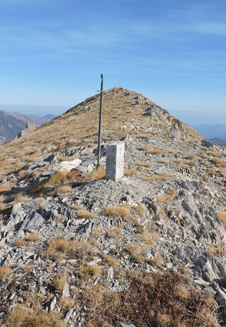
Monte Frontè is a mountain in Liguria, northern Italy, part of the Alps. It is located in the province of province of Imperia. It lies at an altitude of 2,152 metres. After Monte Saccarello it is the second highest peak in the Ligurian region.
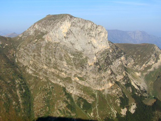
Monte Saccarello (Italian) or Mont Saccarel (French) is a mountain located on the French-Italian border between Liguria, Piedmont and Provence-Alpes-Côte d'Azur.
Monte Orsiera is a mountain in the Cottian Alps belonging to the Province of Turin (Italy).
Monte Tanarello (Italian) or Mont Tanarel (French) is a 2094 metres high mountain located on the French-Italian border.
Cima di Pertegà (Italian) or Cime de la Pertègue (French) is a mountain located on the French-Italian border between Piemonte and Provence-Alpes-Côte d'Azur.
The Cime de Capoves (French) or Cima Capoves (Italian) is a mountain of the Ligurian Alps located in the French region of Provence-Alpes-Côte d'Azur, close to the French-Italian border.
Monte Monega is a 1,882-metre (6,175 ft) mountain of the Ligurian Alps, in Italy.
Carmo di Brocchi is a 1,610-metre (5,282 ft) mountain of the Ligurian Alps, in Italy.
Monte Spinarda is a 1,357-metre (4,452 ft) mountain of the Ligurian Prealps in Italy.
Monte Bertrand (Italian) or Mont Bertrand (French) is a mountain located on the French-Italian border between Piemonte and Provence-Alpes-Côte d'Azur.
The Cime de Mussun (French) or Cima Missun (Italian) is a mountain of the Ligurian Alps.
The Bric Costa Rossa is a mountain of the Ligurian Alps located in Piedmont.
The Cima della Fascia is a mountain of the Ligurian Alps located in Piedmont.
The Monte Mongioie is a mountain of the Ligurian Alps located in Piedmont.
The Monte Antoroto is a mountain of the Ligurian Alps located in Piedmont.
The Cima delle Saline is a mountain of the Ligurian Alps located in Piedmont.
The Punta Mirauda is a mountain of the Ligurian Alps located in Piedmont.
The Cima Cars is a mountain of the Ligurian Alps located in Piedmont.
The Monte Fantino is a mountain of the Ligurian Alps located in Piedmont.