The geography of Italy includes the description of all the physical geographical elements of Italy. Italy, whose territory largely coincides with the homonymous geographical region, is located in southern Europe and comprises the long, boot-shaped Italian Peninsula crossed by the Apennines, the southern side of Alps, the large plain of the Po Valley and some islands including Sicily and Sardinia. Italy is part of the Northern Hemisphere. Two of the Pelagie Islands are located on the African continent.

Gallura is a region in North-Eastern Sardinia, Italy.
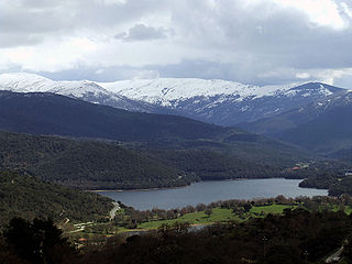
Gennargentu is a large massif in central-southern Sardinia, Italy, encompassing the provinces of Nuoro and Ogliastra. It includes the highest peaks on the island, such as Punta La Marmora, Monte Spada, Punta Erbas Virdes, Bruncu Spina and Punta Paulinu.

Monte Rosa is a mountain massif in the eastern part of the Pennine Alps, on the border between Italy and Switzerland (Valais). The highest peak of the massif, amongst several peaks of over 4,000 m (13,000 ft), is the Dufourspitze, the second highest mountain in the Alps and western Europe, after Mont Blanc. The east face of the Monte Rosa towards Italy has a height of about 2,400 metres (7,900 ft) and is the highest mountain wall of the Alps.
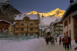
Alagna Valsesia is a comune and small village high in the Valsesia alpine valley in the province of Vercelli, Piedmont, northern Italy, a UNESCO World heritage site since 2013. It is a tourist place for mountaineering and winter sports, and it is internationally renowned for the freeride off-piste skiing. It is also the traditional starting point for the Margherita Hut climb, at 4,554 metres (14,941 ft) above sea level, the highest building in Europe. It was originally settled by Walser at the beginning of the 12th century. It is located at an elevation of 1,191 metres (3,907 ft) just south of the Monte Rosa, elevation 4,638 metres (15,217 ft) ; It is very close to Milan and to the international Milan–Malpensa Airport.

The Susa Valley is a valley in the Metropolitan City of Turin, Piedmont region of northern Italy, located between the Graian Alps in the north and the Cottian Alps in the south. It is one of the longest valleys of the Italian Alps. It extends over 50 kilometres (31 mi) in an east-west direction from the French border to the outskirts of Turin. The valley takes its name from the city of Susa which lies in the valley. The Dora Riparia river, a tributary of the Po, flows through the valley.

Gavia Pass (el. 2621 m.) is a high mountain pass in the Italian Alps. It is the tenth highest paved road in the Alps.
The Gennargentu National Park is a national park on the east coast of Sardinia.

Portoscuso is a comune (municipality) in the Province of South Sardinia in the Italian region Sardinia, located about 75 kilometres (47 mi) west of Cagliari and about 14 kilometres (9 mi) northwest of Carbonia. The languages used here are Italian and Sardinian Campidanese.
Punta La Marmora is a mountain in the Gennargentu range, Sardinia located in Italy.

Monte Baldo is a mountain range in the Italian Alps, located in the provinces of Trento and Verona. Its ridge is orientated in a northeast-southwest direction and it is bounded to the south by the highland ending at Caprino Veronese, to the west by Lake Garda, to the north by the valley joining Rovereto to Nago-Torbole and, to the east, the Val d'Adige.

The Península de Almina is a peninsula making up much of the eastern part of the Spanish city of Ceuta in Africa. It is dominated by the peak of Monte Hacho. The peninsula contains Ceuta's easternmost point, Punta Almina, and is connected to the rest of Ceuta by an isthmus barely 100 metres (330 ft) in width.
The 203rd Coastal Division was an infantry division of the Royal Italian Army during World War II. Royal Italian Army coastal divisions were second line divisions formed with reservists and equipped with second rate materiel. Recruited locally, they were often commanded by officers called out of retirement.

Monte Rasu is a mountain in the Goceano's range, in the province of Sassari, central west Sardinia, Italy. Its summit, called sa Punta Manna, is the highest peak in the province of Sassari.

Mount Limbara is a rocky granitic massif in northeastern Sardinia, Italy. It is located in the geographical and historical region of Gallura.

The Sulcis Mountains is a mountain chain in Sardinia, Italy. Together with the Monte Linas massif, from which they are separated by the flood plain of the Cixerri River, they form the Sulcis-Iglesiente Mountains, one of the most ancient geological formations in the island.
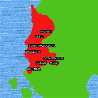
The Iglesiente is a traditional and geographical subdivision of Sardinia, Italy. It encompasses the northern province of Carbonia-Iglesias and the south-western one of the province of Medio Campidano, and its main center is Iglesias.

The Metropolitan City of Cagliari is a metropolitan city in Sardinia, Italy. Its capital is the city of Cagliari and includes 17 comuni. It was established by law in 2016 and replaced the province of Cagliari. The current president is the mayor of Cagliari, Massimo Zedda. The resident population is approximately 432,000. This figure can rise due to commuting into the functional urban area to approximately 477,000.

The Vincent Pyramid is a mountain of the Pennine Alps, located on the border between the Italian regions of Aosta Valley and Piedmont. The Vincent Pyramid makes up a large buttress of the huge multi-summited Monte Rosa. It lies south of the Ludwigshöhe on the border with Switzerland, between the Lysgletscher and the Piode Glacier. A secondary summit of the Vincent Pyramid, the Punta Giordani/Giordanispétz, lies to the southeast. Both Vincent Pyramid and Punta Giordani are on the official UIAA list of Alpine four-thousanders.

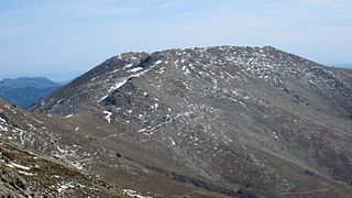
The Punta Lunella is a mountain of the Graian Alps, with an elevation of 2,772 m.

