Barbagia is a geographical, cultural and natural region of inner Sardinia, contained for the most part in the province of Nuoro and Ogliastra and located alongside the Gennargentu massif.

Nuoro is a city and comune (municipality) in central-eastern Sardinia, Italy, situated on the slopes of Mount Ortobene. It is the capital of the province of Nuoro. With a population of 36,347 (2011), it is the sixth-largest city in Sardinia. Its frazione (borough) of Lollove is one of I Borghi più belli d'Italia.

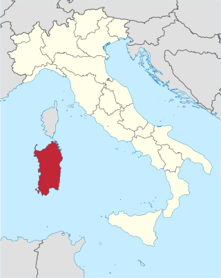
Sardinia is the second-largest island in the Mediterranean Sea, after Sicily, and one of the twenty regions of Italy. It is located west of the Italian Peninsula, north of Tunisia and 16.45 km south of the French island of Corsica.

Tempio Pausania is a town of about 14,000 inhabitants in the Gallura region of northern Sardinia, Italy, in the province of Sassari. It is one of I Borghi più belli d'Italia.

Olbia is a city and commune of 60,346 inhabitants in the Italian insular province of Sassari in northeastern Sardinia, Italy, in the historical region of Gallura. Called Olbia in the Roman age, Civita in the Middle Ages and the Terranova Pausania until the 1940s, Olbia has again been the official name of the city since the fascist period.

Gallura is a region in North-Eastern Sardinia, Italy.

Mont Blanc is the highest mountain in the Alps and Western Europe, and the highest mountain in Europe outside the Caucasus Mountains, rising 4,805.59 m (15,766 ft) above sea level, located on the Franco-Italian border. It is the second-most prominent mountain in Europe, after Mount Elbrus, and the 11th most prominent mountain in the world.

Cagliari is an Italian municipality and the capital and largest city of the island of Sardinia, an autonomous region of Italy. It has about 155,000 inhabitants, while its metropolitan city has about 420,000 inhabitants. According to Eurostat, the population of the functional urban area, the commuting zone of Cagliari, rises to 476,975. Cagliari is the 26th largest city in Italy and the largest city on the island of Sardinia.

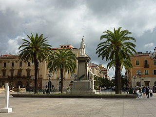
Sassari is an Italian city and the second-largest of Sardinia in terms of population with 127,525 inhabitants, and a Functional Urban Area of about 260,000 inhabitants. One of the oldest cities on the island, it contains a considerable collection of art.

Arbus is a comune (municipality) in the Province of South Sardinia in the Italian region of Sardinia.

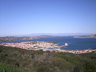
Palau is a comune (municipality) in the province of Sassari, in the Italian region of Sardinia, about 220 kilometres (140 mi) north of Cagliari and about 30 kilometres (19 mi) northwest of Olbia. It was a frazione of the comune of Tempio Pausania until 1959.
Associazione Sportiva Dilettantistica S.E.F. Tempio Pausania is an Italian association football club located in Tempio Pausania, Sardinia. Its colours are all-blue.
Eccellenza Sardinia is the regional Italian Eccellenza football division for clubs in Sardinia and is the main football championship played on the island. Formerly called Prima Categoria and Promozione, it usually involves the participation of 17 teams. Whoever scores the most points wins the title of Regional Champion and is directly promoted to the Serie D, the highest amateur championship. The teams ranked second to fifth enter the play-offs. The winner advances to the national phase, which includes inter-regional play-offs for a place in Serie D. The twelfth and thirteenth placed clubs face each other in the play-outs to decide the team that will participate in the inter-divisional play-offs against the winners of the promotion play-offs to avoid relegation. The last three placed teams are automatically relegated to the Promozione.

Lega Sardegna, whose complete name is Lega Sardegna per Salvini Premier, is a regionalist and Sardinian nationalist political party active in Sardinia, Italy.

Volotea is a Spanish low-cost airline registered in Castrillón and headquartered in Barcelona.

Sardinia is the second-largest island in the Mediterranean Sea and an autonomous region of Italy. Tourism in Sardinia is one of the fastest growing sectors of the regional economy. The island attracts more than a million tourists from both Italy, from the rest of Europe, and, to a lesser degree, from the rest of the world. According to statistics, tourist arrivals in 2016 were 2.9 million people.

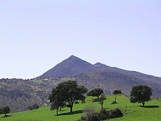
Montiferru is a historical region of central-western Sardinia, Italy. It takes its name from the eponymous extinct volcano massif, whose main peak is the Monte Urtigu (1,050 m). Extending for some 700 km2, the massif had originally a maximum elevation of c. 1,600/1,700 m, later reduced due to erosion.
The Balares were one of the three major groups among which the Nuragic Sardinians considered themselves divided.

The Cammino 100 Torri is a multi-day trekking route that begins and ends in Cagliari (Sardinia). The path is named after the 105 historical coastal towers along the route.

Mount Gonare is a mountain formation in central Sardinia, in the province of Nuoro. It is located in the administrative territory of Orani and Sarule and rises to an elevation of 1,083 m above sea level.


