
Interstate 24 (I-24) is an Interstate Highway in the Midwestern and Southeastern United States. It runs diagonally from I-57, 10 miles (16 km) south of Marion, Illinois, to Chattanooga, Tennessee, at I-75. It travels through Illinois, Kentucky, Tennessee, and Georgia. As an even-numbered Interstate, it is signed as an east–west route, though the route follows a more southeast–northwest routing, passing through Nashville, Tennessee. The numbering deviates from the standard Interstate Highway System grid, lying further north than its number would indicate west of Nashville. The short segment within Georgia bears the unsigned designation State Route 409 (SR 409).

Monteagle is a town in Franklin, Grundy, and Marion counties in the U.S. state of Tennessee, in the Cumberland Plateau region of the southeastern part of the state. The population was 1,238 at the 2000 census – 804 of the town's 1,238 residents (64.9%) lived in Grundy County, 428 (34.6%) in Marion County, and 6 (0.5%) in Franklin County. The population at the 2020 census was 1,393.

U.S. Route 72 (US 72) is an east–west United States highway that travels for 317.811 miles (511.467 km) from southwestern Tennessee, throughout North Mississippi, North Alabama, and southeastern Tennessee. The highway's western terminus is in Memphis, Tennessee and its eastern terminus is in Chattanooga. It is the only U.S. Highway to begin and end in the same state, yet pass through other states in between. Prior to the U.S. Highway system signage being posted in 1926, the entire route was part of the Lee Highway.

Interstate 290 (I-290) is an auxiliary Interstate Highway that runs westward from the Jane Byrne Interchange near the Chicago Loop. The portion of I-290 from I-294 to its east end is officially called the Dwight D. Eisenhower Expressway. In short form, it is known as "the Ike" or the Eisenhower. Before being designated the Eisenhower Expressway, the highway was called the Congress Expressway because of the surface street that was located approximately in its path and onto which I-290 runs at its eastern terminus in the Loop.

Interstate 840 (I-840), formerly State Route 840 (SR 840), is a freeway that serves as an outer bypass route around Nashville, Tennessee. Built by the Tennessee Department of Transportation (TDOT), it is also designated as Tennessee National Guard Parkway. At 77.28 miles (124.37 km) long, it is the tenth-longest auxiliary Interstate Highway in the nation. The route serves the cities of Lebanon, Murfreesboro, Franklin, and Dickson, all suburbs of Nashville.

Interstate 640 (I-640) is an east–west auxiliary Interstate Highway in Knoxville, Tennessee. It serves as a bypass for I-40 around Downtown Knoxville and is also an alternative route for traffic passing between I-40 and I-75. All trucks carrying hazardous cargo through Knoxville are required to use I-640. It has a total length of 10.80 miles (17.38 km) and runs approximately three miles (4.8 km) north of downtown through the northern neighborhoods of Knoxville.
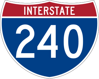
Interstate 240 (I-240) is a 19.27-mile-long (31.01 km) auxiliary Interstate Highway in the US state of Tennessee that forms a bypass around the southern and eastern neighborhoods of Memphis. Combined, I-240 and its parent, I-40, form a contiguous beltway around most of Memphis. I-240 runs from I-40 in Midtown Memphis to I-40 and Sam Cooper Boulevard in East Memphis. Throughout its length, it provides access to I-55, multiple U.S. and state routes, and the Memphis International Airport. The segment between the western terminus and I-55 is a north–south route, and the segment between I-55 and the eastern terminus runs east to west. Throughout its length, I-240 is designated as the Dr. Martin Luther King Jr. Expressway, the W.B. Fowler Sr. Expressway, and the Avron B. Fogelman Expressway.

The Cherokee Turnpike is a controlled-access toll road in eastern Oklahoma. Opened in 1991, the route is a four-lane freeway carrying US-412 from east of Kansas, Oklahoma to east of Chouteau, and has a total length of 32.8 miles (52.8 km) and a speed limit of 80 mph (130 km/h). An alternate route, US-412 Alternate, provides a free but not controlled-access route through the towns bypassed by the Turnpike with only a 55 mph (89 km/h) speed limit.
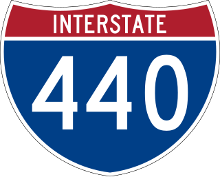
Interstate 440 (I-440) is an east–west auxiliary Interstate Highway that runs through Nashville, Tennessee. It serves as a southern bypass around downtown Nashville, and is located on average about three miles (4.8 km) from the center of the city. I-440 is also known locally as the Four-Forty Parkway, and is designated as the Debra K. Johnson Memorial Parkway. At a length of 7.64 miles (12.30 km), I-440 runs between I-40 and I-24, and connects to I-65 and multiple U.S. Routes. Combined, I-440 and Briley Parkway, a controlled-access segment of State Route 155 (SR 155), form a noncontiguous inner beltway around downtown Nashville.

Maryland Route 144 is a collection of state highways in the U.S. state of Maryland. These highways are sections of old alignment of U.S. Route 40 between Cumberland and Baltimore. Along with US 40 Scenic, US 40 Alternate, and a few sections of county-maintained highway, MD 144 is assigned to what was once the main highway between the two cities, connecting those endpoints with Hancock, Hagerstown, Frederick, New Market, Mount Airy, Ellicott City, and Catonsville. MD 144 has seven disjoint sections of mainline highway that pass through the Appalachian Mountains in Allegany and Washington counties and the rolling Piedmont of Frederick, Carroll, Howard, and Baltimore counties.
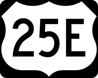
U.S. Route 25E (US 25E) is the eastern branch of US 25 from Newport, Tennessee, where US 25 splits into US 25E and US 25W, to North Corbin, Kentucky, where the two highways rejoin. The highway, however, continues as US 25E for roughly two miles (3.2 km) until it joins Interstate 75 (I-75) in the Laurel County community of North Corbin at exit 29. The highway serves the Appalachia regions of Kentucky's Cumberland Plateau and the Ridge-and-Valley section of East Tennessee, including the urbanized areas of Corbin and Middlesboro in Kentucky and Morristown in Tennessee.

Interstate 70 (I-70) is an Interstate Highway that is located in the Commonwealth of Pennsylvania in the United States. It runs east to west across the southwest part of Pennsylvania and serves the southern fringe of the Pittsburgh metropolitan area.
The Great Smoky Mountains Expressway is a four-lane divided highway that serves as the main east–west corridor through Southwestern North Carolina; connecting the towns of Bryson City, Sylva and Waynesville to Interstate 40. Its establishment and funding was made possible by the Appalachian Development Highway System (ADHS), designed to generate economic development in previously isolated areas, supplement the interstate system and provide access to areas within the region as well as to markets in the rest of the nation.

U.S. Route 460 (US 460) in Virginia runs west-east through the southern part of the Commonwealth. The road has two separate pieces in Virginia, joined by a relatively short section in West Virginia. Most of US 460 is a four-lane divided highway and is a major artery in the southern third of the state. From Petersburg to Suffolk, US 460 is a four-lane non-divided highway. It is a popular alternative to Interstate 64 (I-64) when going from Richmond and other points in central Virginia to the Currituck Sound and Outer Banks of North Carolina, avoiding the congestion and tunnels of the more northerly I-64 corridor. The road passes through several small towns that built up at stops along the railroad line.

U.S. Route 40 in the U.S. state of Maryland runs from Garrett County in Western Maryland to Cecil County in the state's northeastern corner. With a total length of 221 miles (356 km), it is the longest numbered highway in Maryland. Almost half of the road overlaps or parallels with Interstate 68 (I-68) or I-70, while the old alignment is generally known as US 40 Alternate, US 40 Scenic, or Maryland Route 144. West of Baltimore, in the Piedmont and Appalachian Mountains / Blue Ridge region of the Western Maryland panhandle of the small state, the portions where it does not overlap an Interstate highway are mostly two-lane roads. The portion northeast of Baltimore going toward Wilmington in northern Delaware and Philadelphia in southeastern Pennsylvania is a four-lane divided highway, known as the Pulaski Highway. This section crosses the Susquehanna River at the north end of the Chesapeake Bay on the Thomas J. Hatem Memorial Bridge.

Interstate 40 (I-40) is part of the Interstate Highway System that runs 2,556.61 miles (4,114.46 km) from Barstow, California, to Wilmington, North Carolina. The highway crosses Tennessee from west to east, from the Mississippi River at the Arkansas border to the Blue Ridge Mountains at the North Carolina border. At 455.28 miles (732.70 km), the Tennessee segment of I-40 is the longest of the eight states through which it passes and the state's longest Interstate Highway.

Interstate 75 (I-75) in the US state of Tennessee runs from Chattanooga to Jellico by way of Knoxville. I-75 enters the East Tennessee region from Georgia, following the Tennessee Valley all the way through Knoxville to near Rocky Top, then climbs into the Cumberland Mountains before crossing over into Kentucky at Jellico.
James River Freeway is a 14-mile-long (23 km) freeway located largely on the south side of Springfield, Missouri. Its western terminus is at Interstate 44 (I-44) north of Brookline and its eastern terminus is at U.S. Route 65 (US 65) in southeastern Springfield. It is named for the James River, which passes near the highway at the freeway's eastern terminus. A total of four highways are routed on the highway: Route 360, US 60, US 160, Route 13, and Business US 65.

Interstate 26 (I-26) is a South Carolina Interstate highway running generally east–west from near Landrum, in Spartanburg County, to U.S. Route 17 (US 17), in Charleston, South Carolina. It is also the longest Interstate Highway in South Carolina.
U.S. Route 40 Scenic (US 40 Scenic) is a scenic route of US 40 in the U.S. state of Maryland. US 40 Scenic, which is known for most of its route as National Pike, is the old alignment of US 40 over Town Hill in eastern Allegany County and Sideling Hill in far western Washington County. The highway was originally constructed as part of a turnpike connecting Baltimore with the eastern end of the National Road at Cumberland in the early 19th century. The highway was paved as a modern road in the mid-1910s and designated US 40 in the late 1920s. US 40 was relocated over Sideling Hill in the early 1950s and over Town Hill in the mid-1960s. The US 40 Scenic designation was first applied to the old highway over Town Hill in 1965. Following the completion of Interstate 68 (I-68) at Sideling Hill, US 40 Scenic was extended east along old US 40's crossing of the mountain in the late 1980s. US 40 Scenic is the only scenic route in the U.S. Highway System; formerly, there was a second, US 412 Scenic in Oklahoma, but this has since been redesignated to a more conventional "Alternate" route.
