Montezuma Marsh

Last updated
Montezuma National Wildlife Refuge four miles northeast of Seneca Falls Montezuma Marsh-NY right.jpg
Montezuma National Wildlife Refuge four miles northeast of Seneca Falls

Montezuma Marsh is a marsh at the northern end of Cayuga Lake in the Finger Lakes region of New York. Much of the marsh is part of the Montezuma National Wildlife Refuge, which is a major point on the route of many migratory birds, such as Canada geese and mallard ducks.

Marsh A wetland that is dominated by herbaceous rather than woody plant species

A marsh is a wetland that is dominated by herbaceous rather than woody plant species. Marshes can often be found at the edges of lakes and streams, where they form a transition between the aquatic and terrestrial ecosystems. They are often dominated by grasses, rushes or reeds. If woody plants are present they tend to be low-growing shrubs. This form of vegetation is what differentiates marshes from other types of wetland such as swamps, which are dominated by trees, and mires, which are wetlands that have accumulated deposits of acidic peat.

Cayuga Lake lake in central New York, USA

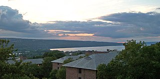
Cayuga Lake is the longest of central New York's glacial Finger Lakes, and is the second largest in surface area and second largest in volume. It is just under 40 miles (64 km) long. Its average width is 1.7 miles (2.7 km), and it is 3.5 mi wide (5.6 km) at its widest point near Aurora. It is approximately 435 ft deep (133 m) at its deepest point.

Finger Lakes group of lakes in New York, USA

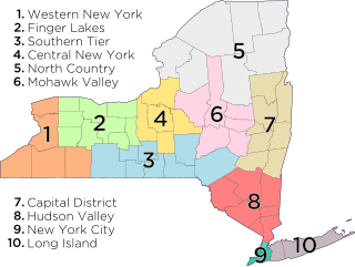
The Finger Lakes are a group of 11 long, narrow, roughly north–south lakes in an area informally called the Finger Lakes region in Central New York, in the United States. This region straddles the northern and transitional edge, known as the Finger Lakes Uplands and Gorges ecoregion, of the Northern Allegheny Plateau and the Ontario Lowlands ecoregion of the Great Lakes Lowlands.

The Cayuga valley is an old preglacial valley, which once drained northward into the Ontario Valley. Cayuga Lake and Montezuma Marsh were partially created by the damming effect of huge quantities of glacial drift brought from the Laurentian Shield of Canada and the deepened Ontario valley. (Cayuga Lake was also deepened southward of the area of the marsh.) The valley is completely buried by a drumlin field between the marsh and Lake Ontario.

Ice age Period of long-term reduction in temperature of Earths surface and atmosphere

An ice age is a long period of reduction in the temperature of the Earth's surface and atmosphere, resulting in the presence or expansion of continental and polar ice sheets and alpine glaciers. Earth is currently in the Quaternary glaciation, known in popular terminology as the Ice Age. Individual pulses of cold climate are termed "glacial periods", and intermittent warm periods are called "interglacials" or "interstadials" with both climatic pulses part of the Quaternary or other periods in Earth's history.

The Ontarian River is the term used for the pre-glacial river that began the creation of the valley in Silurian age shales and limestones now occupied by Lake Ontario. The valley was greatly deepened by glacial action during the Ice age.

Canada Country in North America

Canada is a country in the northern part of North America. Its ten provinces and three territories extend from the Atlantic to the Pacific and northward into the Arctic Ocean, covering 9.98 million square kilometres, making it the world's second-largest country by total area. Its southern border with the United States, stretching some 8,891 kilometres (5,525 mi), is the world's longest bi-national land border. Canada's capital is Ottawa, and its three largest metropolitan areas are Toronto, Montreal, and Vancouver.

The marsh was a barrier to westward travel in colonial times as roads could not be built across it, with the technology of the time. The first major passageway was the Erie Canal, which was completed in 1825 but the digging of the section that crossed the marsh was one of the most difficult, with great loss of life due to mosquito borne fevers (possibly malaria). The cut was finally finished by digging it in the winter (also with great suffering, due to frostbite) when mosquitoes were dormant.

Erie Canal Waterway in New York, USA

The Erie Canal is a canal in New York, United States that is part of the east–west, cross-state route of the New York State Canal System. Originally, it ran 363 miles (584 km) from where Albany meets the Hudson River to where Buffalo meets Lake Erie. It was built to create a navigable water route from New York City and the Atlantic Ocean to the Great Lakes. When completed in 1825, it was the second longest canal in the world and greatly affected the development and economy of New York, New York City, and the United States.

Mosquito family of insects

Mosquitoes are a group of about 3500 species of small insects that are flies. Within Diptera they constitute the family Culicidae. The word "mosquito" is Spanish for "little fly". Mosquitoes have a slender segmented body, a pair of wings, three pairs of long hair-like legs, feathery antennae, and elongated mouthparts.

Fever common medical sign characterized by elevated body temperature

Fever, also known as pyrexia and febrile response, is defined as having a temperature above the normal range due to an increase in the body's temperature set point. There is not a single agreed-upon upper limit for normal temperature with sources using values between 37.5 and 38.3 °C. The increase in set point triggers increased muscle contractions and causes a feeling of cold. This results in greater heat production and efforts to conserve heat. When the set point temperature returns to normal, a person feels hot, becomes flushed, and may begin to sweat. Rarely a fever may trigger a febrile seizure. This is more common in young children. Fevers do not typically go higher than 41 to 42 °C.

Bibliography

International Standard Book Number Unique numeric book identifier

The International Standard Book Number (ISBN) is a numeric commercial book identifier which is intended to be unique. Publishers purchase ISBNs from an affiliate of the International ISBN Agency.

OCLC global library cooperative

OCLC Online Computer Library Center, Incorporated d/b/a OCLC is an American nonprofit cooperative organization "dedicated to the public purposes of furthering access to the world's information and reducing information costs". It was founded in 1967 as the Ohio College Library Center. OCLC and its member libraries cooperatively produce and maintain WorldCat, the largest online public access catalog (OPAC) in the world. OCLC is funded mainly by the fees that libraries have to pay for its services. OCLC also maintains the Dewey Decimal Classification system.

Coordinates: 42°57′56″N76.°45′26″W / 42.96556°N 76.75722°W / 42.96556; -76.75722

Geographic coordinate system Coordinate system

A geographic coordinate system is a coordinate system that enables every location on Earth to be specified by a set of numbers, letters or symbols. The coordinates are often chosen such that one of the numbers represents a vertical position and two or three of the numbers represent a horizontal position; alternatively, a geographic position may be expressed in a combined three-dimensional Cartesian vector. A common choice of coordinates is latitude, longitude and elevation. To specify a location on a plane requires a map projection.

Related Research Articles

Cayuga County, New York County in the United States

Cayuga County is a county in the U.S. state of New York. As of the 2010 census, the population was 80,026. Its county seat is Auburn. The county was named for one of the tribes of Indians in the Iroquois Confederation.

Onondaga County, New York County in the United States

Onondaga County is a county in the U.S. state of New York. As of the 2010 census, the population was 467,026. The county seat is Syracuse.

Seneca County, New York County in the United States

Seneca County is a county located in the U.S. state of New York. As of the 2010 census, the population was 35,251. The primary county seat is Waterloo, moved there from the original county seat of Ovid in 1819. It became a two-shire county in 1822, which currently remains in effect, using both locations as county seats although the majority of Seneca County administrative offices are located in Waterloo. Therefore, most political sources only list Waterloo as the county seat. The county's name is from the Iroquois (Seneca) that occupied part of the region.

Schuyler County, New York County in the United States

Schuyler County is a county in the U.S. state of New York. As of the 2010 census, the population was 18,343, making it the second-least populous county in New York. The county seat is Watkins Glen. The name is in honor of General Philip Schuyler, one of the four major generals in the Continental Army in the American Revolutionary War.

Wayne County, New York County in the United States

Wayne County is a county in the U.S. state of New York. As of the 2010 Census, the population was 93,772. The county seat is Lyons. The name honors General Anthony Wayne, an American Revolutionary War hero and American statesman.

Conquest, New York Town in New York, United States

Conquest is a town in Cayuga County, New York, United States. The population was 1,819 at the 2010 census. The name was chosen to mark the victory of those who wished to form the town. Conquest is on the western border of Cayuga County and is west of Syracuse.

Montezuma, New York Town in New York, United States

Montezuma is a town in Cayuga County, New York, United States. The population was 1,277 at the 2010 census.

Tyre, New York Town in New York, United States

Tyre is a town in Seneca County, New York, United States. The population was 981 at the 2010 census. The town is named after the Lebanese city of Tyre.

Watkins Glen State Park

Watkins Glen State Park is located in the village of Watkins Glen, south of Seneca Lake in Schuyler County in New York's Finger Lakes region. The park's lower part is near the village, while the upper part is open woodland. It was opened to the public in 1863 and was privately run as a tourist resort until 1906, when it was purchased by New York State. Initially known as Watkins Glen State Reservation, the park was first managed by the American Scenic and Historic Preservation Society before being turned over to full state control in 1911. Since 1924, it has been managed by the Finger Lakes Region of the New York State Office of Parks, Recreation and Historic Preservation.

Montezuma National Wildlife Refuge

Montezuma National Wildlife Refuge is a wildlife preserve operated by the United States Fish and Wildlife Service, encompassing part of the Montezuma Swamp at the north end of Cayuga Lake. The refuge lies between the cities of Rochester and Syracuse, New York, including parts of Seneca, Cayuga, and Wayne counties. Most of the refuge lies in the Town of Tyre, in the northeast corner of Seneca County.

Area codes 315 and 680

Area codes 315 and 680 are telephone area codes serving north-central New York. They stretch from the western side of Wayne County to Little Falls, north to the Canada–United States border, east to Massena and south to near Cortland. Most of its population lives in Syracuse and its suburbs. Other major population centers include Utica and Watertown.

Central New York

Central New York is the central region of New York State, roughly including the following counties and cities:

Oswego River (New York) river in New York state, United States

The Oswego River is a river in upstate New York in the United States. It is the second-largest river flowing into Lake Ontario. James Fenimore Cooper’s novel The Pathfinder, or The Inland Sea is set in the Oswego River valley.

Seneca River (New York) River in Upstate New York

The Seneca River flows 61.6 miles (99.1 km) through the Finger Lakes region of Upstate New York in the United States. The main tributary of the Oswego River – the second largest river flowing into Lake Ontario – the Seneca drains 3,468 square miles (8,980 km2) in parts of fourteen New York counties. The Seneca flows generally east, and is wide and deep with a gentle gradient. Much of the river has been channelized to form part of the Erie Canal.

Cayuga–Seneca Canal canal in New York, United States of America

The Cayuga–Seneca Canal is a canal in New York, United States. It is now part of the New York State Canal System.

Chonodote was an 18th-century village of the Cayuga nation of Iroquois Indians in what is now upstate New York, USA. It was located about four and a half miles south of Goiogouen, on the east side of Cayuga Lake. Earlier, during the 17th century, this village was known as Deawendote, or Village of the Constant Dawn.

Mays Point is a hamlet in the Town of Tyre, Seneca County, New York near the Wayne and Cayuga county lines. It is located 7 miles (11 km) northeast of the hamlet of Seneca Falls, at an elevation of 381 feet. The primary intersection in the hamlet is at N.Y. Route 89 and Mays Point Road. Mays Point is situated along the Erie Canal near the junction of the Seneca and Clyde rivers within the Montezuma Marsh. The New York State Thruway passes just south of the hamlet.