Maunaloa or Mauna Loa is a census-designated place (CDP) in Maui County, Hawaiʻi, United States, in the western part of the island of Molokai. The population was 376 at the 2010 census.

Silver Creek is a village in Merrick County, Nebraska, United States. The population was 362 at the 2010 census. It is part of the Grand Island, Nebraska Micropolitan Statistical Area.
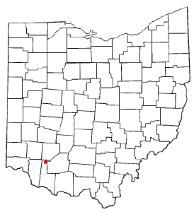
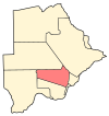
St. Martin is an unincorporated community and former village in Brown County, Ohio, United States. The community is served by the Fayetteville (45118) post office. The population was 129 at the 2010 census. In November 2011, voters chose to unincorporate St. Martin, and it now falls solely under the jurisdiction of Perry Township.
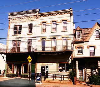
Ashley is a borough in Luzerne County, Pennsylvania, one mile (2 km) from Wilkes Barre. The population was 2,790 at the 2010 census.
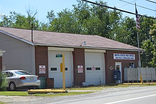
Donegal Township is a township in Westmoreland County, Pennsylvania, United States. The population was 2,442 at the 2000 census.
Unity is a town in Clark County in the U.S. state of Wisconsin. The population was 745 at the 2000 census. The Village of Unity is located partially within the town. The unincorporated community of Riplinger is also located in the town.
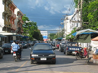
Nakhon Nayok City is a capital of Nakhon Nayok Province in the central region of Thailand.

Jemielna is a village in the administrative district of Gmina Bierutów, within Oleśnica County, Lower Silesian Voivodeship, in south-western Poland. Prior to 1945 it was in Germany.
Gmina Rędziny is a rural gmina in Częstochowa County, Silesian Voivodeship, in southern Poland. Its seat is the village of Rędziny, which lies approximately 10 kilometres (6 mi) north-east of Częstochowa and 70 km (43 mi) north of the regional capital Katowice.

Arshaluys in the village of Vagharshapat in the Armavir Province of Armenia. It is located 14 km north-east from the regional center. It is located on the right bank of the Kasagh River. The city is about 19 km from Yerevan. The settlement is 860 meters above sea level. The territory occupies the 2nd place among the entire Armenian villages. It has a direct road to Vagharshapat, Yerevan. Echmiadzin also joins 2-3 small villages.
Aghdzk is a village on the slopes of Mount Aragats in the Aragatsotn Province of Armenia. It is home to the Arshakid Mausoleum, a large grave monument complex and basilica of the 4th to 5th centuries. King Shapur II of Persia exhumed the bones of the Armenian kings and took them to Persia symbolically taking Armenia's power. When Sparapet Vassak Mamikonian defeated the Persians and reclaimed the bones of the Arshakuni monarchs, he buried them at Aghdzk. Remains of the monuments and the basilica may still to be seen.
Artsni is a town located in the Lori Province of Armenia.
Saratovka is a town in the Lori Province of Armenia.
Giełczynek is a village in the administrative district of Gmina Strzegowo, within Mława County, Masovian Voivodeship, in east-central Poland. It lies approximately 26 kilometres (16 mi) south-west of Mława and 94 km (58 mi) north-west of Warsaw.

Dąbki is a village in the administrative district of Gmina Darłowo, within Sławno County, West Pomeranian Voivodeship, in north-western Poland. It lies approximately 8 kilometres (5 mi) south-west of Darłowo, 24 km (15 mi) west of Sławno, and 157 km (98 mi) north-east of the regional capital Szczecin.
El Khabouzia is a town and commune in Bouïra Province, Algeria. According to the 1998 census it has a population of 5,572.

Drešnica is a village in the municipality of Blace, Serbia. According to the 2002 census, the village has a population of 102 people.
Jezdina is a village in the municipality of Čačak, Serbia. According to the 2011 census, the village has a population of 246 people.
Luiste is a village in Märjamaa Parish, Rapla County in western Estonia.

Podgrađe is a village in the municipality of Nevesinje, Republika Srpska, Bosnia and Herzegovina.