Rosenheim is a Landkreis (district) in the south of Bavaria, Germany. Neighboring districts are, clockwise from the west, Miesbach, Munich, Ebersberg, Mühldorf, and Traunstein, with the Austrian province Tirol across the southern border. The district entirely surrounds the city of Rosenheim, which is independently administered but hosts the district's administration; both the city and the district share the "RO" designation for their license plates.
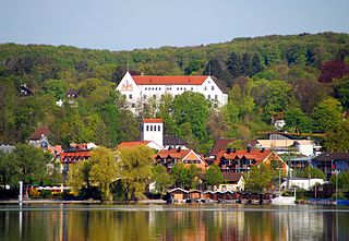
Starnberg is a town in Bavaria, Germany, some 30 kilometres (19 mi) southwest of Munich. It is at the north end of Lake Starnberg, in the heart of the "Five Lakes Country", and serves as capital of the district of Starnberg. Recording a disposable per-capita income of €26,120 in 2007, Starnberg regained its status as the wealthiest town in Germany.

Eching is a municipality in the district of Freising, in Upper Bavaria, Germany.

Herrieden is a town in the district of Ansbach and situated in the Middle Franconia region of Bavaria, Germany. It lies along the upper Altmühl river, about 9 km (6 mi) southwest of the city of Ansbach, 47 km southwest of the city of Nürnberg, 95 km east of Heilbronn and 144 km northwest of Munich.

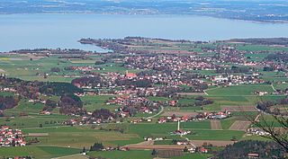
Gstadt am Chiemsee is a municipality and a village in the district of Rosenheim, Bavaria, Germany. It is located on Lake Chiemsee.
Übersee is a municipality and a village in the rural district of Traunstein in upper Bavaria, Germany. It lies on the south shore of lake Chiemsee.

Icking is a municipality in the district of Bad Tölz-Wolfratshausen in Bavaria in Germany.
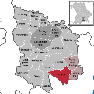
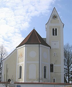
Aßling is a municipality in the district of Ebersberg, Upper Bavaria, Germany. It is, along with the communities of Emmering and Frauenneuharting, a member of the administrative community of the same name.

Baiern is a community in the district of Ebersberg, Upper Bavaria, Germany. It is a member of the administrative community (Verwaltungsgemeinschaft) of Glonn.

Bruck is a community in the Upper Bavarian district of Ebersberg. It is a member of the municipal association (Verwaltungsgemeinschaft) of Glonn.

Emmering is a community in the Upper Bavarian district of Ebersberg. It is a member of the administrative community (Verwaltungsgemeinschaft) of Aßling.

Frauenneuharting is a community in the district of Ebersberg in Upper Bavaria and a member of the administrative community of Aßling.

Oberpframmern is a community in the Upper Bavarian district of Ebersberg and a member of the Verwaltungsgemeinschaft of Glonn. It lies roughly 24 kilometres southeast of Munich.
Steinhöring is a community in the Upper Bavarian district of Ebersberg.

Oberding is a municipality in the district of Erding in Upper Bavaria in Germany, and member of the same administrative community. Almost half of the area of Munich Airport, including both terminals, falls within the municipal bounds.

Aiglsbach is a town and municipality in the Lower Bavarian district of Kelheim, Germany, and a member of the Mainburg administrative partnership, a voluntary resource-pooling agreement with three neighbouring municipalities.

Aura im Sinngrund is a community in the Main-Spessart district in the Regierungsbezirk of Lower Franconia (Unterfranken) in Bavaria, Germany and a member of the Verwaltungsgemeinschaft of Burgsinn.

Otterfing is a municipality in the district of Miesbach in Bavaria in Germany.

Aschheim is a small town and municipality in the district of Munich in Bavaria in Germany. It lies beyond the northeastern outskirts of Munich.
Seefeld is a municipality in the district of Starnberg in Bavaria, Germany. The town lies on the western shore of the Pilsensee. It is connected to the Bavarian capital city of Munich by the S-Bahn line S8. Seefeld is notable for the Seefeld Castle, a seat of the Toering noble family of Bavaria.