Bruck, Upper Bavaria

Last updated
Bruck
Wappen Bruck (Oberbayern).svg
Coat of arms
Location of Bruck within Ebersberg district
Bruck in EBE.svg
Germany adm location map.svg
Red pog.svg
Bruck
Bavaria location map.svg
Red pog.svg
Bruck
Coordinates: 48°1′N11°55′E / 48.017°N 11.917°E / 48.017; 11.917 Coordinates: 48°1′N11°55′E / 48.017°N 11.917°E / 48.017; 11.917
Country Germany
State Bavaria
Admin. region Oberbayern
District Ebersberg
Municipal assoc. Glonn
Government
   Mayor (202026) Josef Schwäbl [1] (CSU)
Area
  Total21.60 km2 (8.34 sq mi)
Elevation
513 m (1,683 ft)
Population
 (2020-12-31) [2]
  Total1,315
  Density61/km2 (160/sq mi)
Time zone UTC+01:00 (CET)
  Summer (DST) UTC+02:00 (CEST)
Postal codes
85567
Dialling codes 08093
Vehicle registration EBE
Website www.glonn.de

Bruck is a community in the Upper Bavarian district of Ebersberg. It is a member of the municipal association (Verwaltungsgemeinschaft) of Glonn.

Contents

Geography

Bruck lies in the Munich region. It includes one traditional rural land unit – Gemarkung in German – also called Bruck.

The constituent communities of Taglaching, Pienzenau, Alxing, Bauhof, Pullenhofen, Loch, Nebelberg, Schlipfhausen, Eichtling, Doblbach, Wildaching, Feichten, Hamburg, Einharting and Wildenholzen are to be found within Bruck.

History

Bruck belonged to the Lord (Freiherr) of Pienzenau. It was part of the Electorate of Bavaria, belonging to the lordly estate of Wildenholzen. In 1818 the community of Bruck came into being.

Population development

The community's land area was home to 879 inhabitants in 1970, 908 in 1987 and 1047 in 2000.

Politics

The community's mayor (Bürgermeister) is Josef Schwäbl (CSU).

The community's tax revenue in 1999, converted into euros, was €364,000, of which €102,000 was from business taxes.

Economy and infrastructure

In 1998, the industries of agriculture and forestry employed no workers on the social insurance contribution rolls. In industry it was 21 and in trade and transport, none. Also, 285 people on the aforesaid rolls worked from their homes. There were five processing businesses. There was one business in contracting. Furthermore, in 1999, there were 62 agricultural businesses with a total productive land area of 1 478 ha, of which 903 ha was meadowland.

Education

In 1999, the following institutions could be found in Bruck:

Related Research Articles

Stegaurach Place in Bavaria, Germany

Stegaurach is a community in the Upper Franconian district of Bamberg and the seat of the administrative community (Verwaltungsgemeinschaft) of Stegaurach.

Hohenlinden Place in Bavaria, Germany

Hohenlinden is a community in the Upper Bavarian district of Ebersberg. The city of Lynden, Washington is named after it, as is Linden, Alabama. Hohenlinden is also the subject of an eponymous poem by Thomas Campbell.

Emmerting Place in Bavaria, Germany

Emmerting is a municipality in the district of Altötting in Bavaria in Germany and member of the administrative association of the same name.

Lauter, Bavaria Place in Bavaria, Germany

Lauter is a community in the Upper Franconian district of Bamberg and a member of the administrative community (Verwaltungsgemeinschaft) of Baunach.

Priesendorf Place in Bavaria, Germany

Priesendorf is a community in the Upper Franconian district of Bamberg and a member of the administrative community (Verwaltungsgemeinschaft) of Lisberg.

Rattelsdorf Place in Bavaria, Germany

Rattelsdorf is a community with market rights in the Upper Franconian district of Bamberg.

Schönbrunn im Steigerwald Place in Bavaria, Germany

Schönbrunn im Steigerwald is a community in the Upper Franconian district of Bamberg and a member of the administrative community (Verwaltungsgemeinschaft) of Burgebrach.

Strullendorf Place in Bavaria, Germany

Strullendorf is a community in the Upper Franconian district of Bamberg.
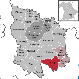
Aßling Place in Bavaria, Germany

Aßling is a municipality in the district of Ebersberg, Upper Bavaria, Germany. It is, along with the communities of Emmering and Frauenneuharting, a member of the administrative community of the same name.

Baiern Place in Bavaria, Germany

Baiern is a community in the district of Ebersberg, Upper Bavaria, Germany. It is a member of the administrative community (Verwaltungsgemeinschaft) of Glonn.
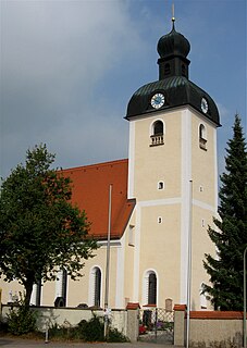
Egmating Place in Bavaria, Germany

Egmating is a community in the Upper Bavarian district of Ebersberg in Germany. It is a member of the administrative community (Verwaltungsgemeinschaft) of Glonn.

Emmering, Ebersberg Place in Bavaria, Germany

Emmering is a community in the Upper Bavarian district of Ebersberg. It is a member of the administrative community (Verwaltungsgemeinschaft) of Aßling.

Forstinning Place in Bavaria, Germany

Forstinning is a community in the district of Ebersberg in Upper Bavaria, Germany.

Frauenneuharting Place in Bavaria, Germany

Frauenneuharting is a community in the district of Ebersberg in Upper Bavaria and a member of the administrative community of Aßling.

Oberpframmern Place in Bavaria, Germany

Oberpframmern is a community in the Upper Bavarian district of Ebersberg and a member of the Verwaltungsgemeinschaft of Glonn. It lies roughly 24 kilometres southeast of Munich.
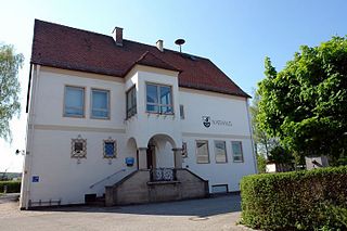
Steinhöring Place in Bavaria, Germany

Steinhöring is a community in the Upper Bavarian district of Ebersberg.

Oberding Place in Bavaria, Germany

Oberding is a municipality in the district of Erding in Upper Bavaria in Germany, and member of the same administrative community. Almost half of the area of Munich Airport, including both terminals, falls within the municipal bounds.

Gössenheim Place in Bavaria, Germany

Gössenheim is a community in the Main-Spessart district in the Regierungsbezirk of Lower Franconia (Unterfranken) in Bavaria, Germany and a member of the Verwaltungsgemeinschaft of Gemünden am Main.
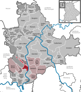
Hafenlohr Place in Bavaria, Germany

Hafenlohr is a community in the Main-Spessart district in the Regierungsbezirk of Lower Franconia (Unterfranken) in Bavaria, Germany and a member of the Verwaltungsgemeinschaft of Marktheidenfeld.

Himmelstadt Place in Bavaria, Germany

Himmelstadt is a community in the Main-Spessart district in the Regierungsbezirk of Lower Franconia (Unterfranken) in Bavaria, Germany and a member of the Verwaltungsgemeinschaft of Zellingen.

References

  1. Liste der ersten Bürgermeister/Oberbürgermeister in kreisangehörigen Gemeinden, Bayerisches Landesamt für Statistik, accessed 19 July 2021.
  2. "Tabellenblatt "Daten 2", Statistischer Bericht A1200C 202041 Einwohnerzahlen der Gemeinden, Kreise und Regierungsbezirke". Bayerisches Landesamt für Statistik und Datenverarbeitung (in German). June 2021.