Vaterstetten

Last updated

Vaterstetten
Vaterstetten- Rathaus - geo.hlipp.de - 20049.jpg
Town hall
DEU Vaterstetten COA.svg
Coat of arms
Location of Vaterstetten within Ebersberg district
Vaterstetten in EBE.svg
Germany adm location map.svg
Red pog.svg
Vaterstetten
Bavaria location map.svg
Red pog.svg
Vaterstetten
Coordinates: 48°06′18″N11°46′14″E / 48.10500°N 11.77056°E / 48.10500; 11.77056 Coordinates: 48°06′18″N11°46′14″E / 48.10500°N 11.77056°E / 48.10500; 11.77056
Country Germany
State Bavaria
Admin. region Oberbayern
District Ebersberg
Subdivisions7 officially named centres
Government
   Mayor (202026) Leonhard Spitzauer [1] (CSU)
Area
  Total34.18 km2 (13.20 sq mi)
Elevation
528 m (1,732 ft)
Population
 (2020-12-31) [2]
  Total24,789
  Density730/km2 (1,900/sq mi)
Time zone UTC+01:00 (CET)
  Summer (DST) UTC+02:00 (CEST)
Postal codes
85591
Dialling codes 08106
Vehicle registration EBE
Website www.vaterstetten.de

Vaterstetten is a municipality in the Upper Bavarian district of Ebersberg. It lies east of Munich and is the district's biggest community. Vaterstetten is on the outskirts of Munich, roughly twenty minutes by S-Bahn from Marienplatz.

Contents

Geography

Location

Vaterstetten borders in the north on the community of Poing, in the northeast on the community of Anzing, in the east on the unincorporated area of the Ebersberg Forest (Ebersberger Forst), in the southeast on the community of Zorneding (all in Ebersberg district), in the southwest on the community of Grasbrunn, and in the west on the communities of Haar and Feldkirchen (all three in Munich district).

Constituent communities

The community consists of the constituent centres of Baldham, Hergolding, Neufarn, Parsdorf, Purfing, Vaterstetten and Weißenfeld.

History

Weissenfeldchurch WeissenfeldKirche Vaterstetten-01.JPG
Weißenfeldchurch
Soldier killed in action - USAAF B-24J Liberator shot down by German Flak on July 19th, 1944 Abschuss B-24J Ottendichler Strasse 1944-07-19.jpg
Soldier killed in action - USAAF B-24J Liberator shot down by German Flak on July 19th, 1944

Because of being on the border of the sandur of Munich, an early settlement in the southern part of today's community area is unlikely, because the tillage was disadvantaged here compared to the northern part. Consequently, the oldest town of the community is Purfing, where a settlement from the period between 750 and 600 BC was found.

Vaterstetten was founded by the Old Bavarii Fater family.

Until 1056 the district of Weißenfeld (Wizzinvelt) was in the possession of the Holy Roman Emperor Henry III as a Reichsgut . The fact he instructed his wife about negotiations over his ownership on these lands on his deathbed in the year 1056, shows how significant they must have been for him. [3]

It was here in the summer of 1800 that the Parsdorf Ceasefire was signed by Major General Franz Joseph of Dietrichstein and General Jean Victor Moreau, which later came to an end with the Battle of Hohenlinden. In 1818, when there was the Royal Bavarian territorial reform, the community of Parsdorf was founded and it replaced the former "Steuerdistricts". The administrative seat of the community was transferred to Parsdorf probably because of its important coaching inn.

An increase of the population of the community began with the connection to the rail network in 1871.

In 1913 physicist and philosopher Ernst Mach settled in Vaterstetten, where he died 1916.

The district of Baldham was selected as a location for the studio of Hitler's sculptor Josef Thorak before the beginning of World War II. The building, which was created by Albert Speer, is now a branch of the Bavarian State Archaeological Collection in Munich. On 5 May 1945, the delegations of the German Army Group G and the 7th U.S. Army met here to discuss the surrender of the 200,000 German soldiers in southern Germany, which was finally signed in the neighbour community of Haar.

On 19 July 1944, a US Consolidated B-24 bomber crashed into the forest between Vaterstetten and the neighbouring town of Ottendichl (part of Haar). In 2009, the place has been marked by a memorial plaque. [4]

The current community of Vaterstetten came into being with the municipal reform of 1978. The old community included all the same current centres as are now found in Vaterstetten, but it was named Parsdorf. On 1 May 1978, the community's name was changed to Vaterstetten, by which time the community's main centre had long been of that same name, along with Baldham. Before that reform, a part of Baldham (named Baldham-Kolonie) belonged to Zorneding.

Economy

Transport

Vaterstetten is part of the Munich Transport and Tariff Association ( Münchner Verkehrs- und Tarifverbund , or MVV). The Munich S-Bahn’s lines S4 and S6 run over the Munich–Rosenheim line through the community serving the Vaterstetten and Baldham stations.

Four buslines of the Vaterstettener Innerörtlicher Personennahverkehr (Vaterstetten Local Passenger Transport, or VIP) run regularly in the local area.

The name Vaterstetten is well known to many motorists for its Autobahn roadhouse lying on the A99. The Autobahn itself runs by the community about one kilometre away. Through the community’s south end runs the Wasserburger Landstraße (officially named B304), one of Munich’s main arterial roads.

Educational institutions

Within the community stand four elementary schools, a Hauptschule, a Realschule and the Humboldt-Gymnasium Vaterstetten, as well as a folk high school and a music school.

Town partnerships

Regular events

Community development

Population development

Year- Inhabitants
1867175
19101,407
19251,565
19391,837
19451,300
19615,420
198717,843
200221,113
200621,401
200821,697
201121,286
201322,087
201522,768
201622,936
201723,229
201823,422

(1910, 1925, 1939, 1961, 1987: census results)

Related Research Articles

Ebersberg (district) District in Bavaria, Germany

Ebersberg is a Landkreis (district) in Bavaria, Germany. It is bounded by the districts of Erding, Mühldorf, Rosenheim and Munich.

Erding is a Landkreis (district) in Bavaria, Germany. It is bounded by the districts of Landshut, Mühldorf, Ebersberg, Munich and Freising.

Oberhaching Place in Bavaria, Germany

Oberhaching is a municipality in Bavaria, Germany, with 13,638 inhabitants (2020) on an area of 26.6 km2 (10.3 sq mi). It is located 15 km (9.3 mi) south of Munich city centre and has a 1,250 year history.

Ebersberg Place in Bavaria, Germany

Ebersberg is the seat of the similarly named Ebersberg Landkreis (district) in the Oberbayern Regierungsbezirk in Bavaria, southern Germany. The Ebersberger Forst (forest) is one of Germany’s largest continuous area of woodlands.

Puchheim Place in Bavaria, Germany

Puchheim is a town near Munich in the district of Fürstenfeldbruck, in Bavaria, Germany. It has about 20,000 inhabitants.

Zorneding Place in Bavaria, Germany

Zorneding is a community in district of Ebersberg, Upper Bavaria, Germany. It lies some 20 km east of Munich, Bavaria’s capital.

Eching, Freising Place in Bavaria, Germany

Eching is a municipality in the district of Freising, in Upper Bavaria, Germany.

Grafing Place in Bavaria, Germany

Grafing bei München is a town in the district of Ebersberg, Upper Bavaria, Germany.

Poing, Bavaria Place in Bavaria, Germany

Poing is a municipality in the Upper Bavarian district of Ebersberg, lying 18 kilometres (11 mi) east of central Munich.

Anzing Place in Bavaria, Germany

Anzing is a municipality in the Upper Bavarian district of Ebersberg.

Aßling Place in Bavaria, Germany

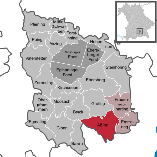
Aßling is a municipality in the district of Ebersberg, Upper Bavaria, Germany. It is, along with the communities of Emmering and Frauenneuharting, a member of the administrative community of the same name.

Bruck, Upper Bavaria Place in Bavaria, Germany

Bruck is a community in the Upper Bavarian district of Ebersberg. It is a member of the municipal association (Verwaltungsgemeinschaft) of Glonn.

Egmating Place in Bavaria, Germany

Egmating is a community in the Upper Bavarian district of Ebersberg in Germany. It is a member of the administrative community (Verwaltungsgemeinschaft) of Glonn.

Emmering, Ebersberg Place in Bavaria, Germany

Emmering is a community in the Upper Bavarian district of Ebersberg. It is a member of the administrative community (Verwaltungsgemeinschaft) of Aßling.

Forstinning Place in Bavaria, Germany

Forstinning is a community in the district of Ebersberg in Upper Bavaria, Germany.

Kirchseeon Place in Bavaria, Germany

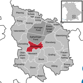
Kirchseeon is a market town in the Upper Bavarian district of Ebersberg and lies 15 km east of Munich city limits.

Moosach Place in Bavaria, Germany

Moosach is a municipality in the Upper Bavarian district of Ebersberg and a member of the Verwaltungsgemeinschaft of Glonn.

Oberpframmern Place in Bavaria, Germany

Oberpframmern is a community in the Upper Bavarian district of Ebersberg and a member of the Verwaltungsgemeinschaft of Glonn. It lies roughly 24 kilometres southeast of Munich.

Steinhöring Place in Bavaria, Germany

Steinhöring is a community in the Upper Bavarian district of Ebersberg.

Baldham

Baldham is a district of Vaterstetten in the Upper Bavarian district of Ebersberg, Germany. It is located approximately 18 km east of the state capital Munich and 15 km west of the district capital Ebersberg.

References

  1. Liste der ersten Bürgermeister/Oberbürgermeister in kreisangehörigen Gemeinden, Bayerisches Landesamt für Statistik, accessed 19 July 2021.
  2. "Tabellenblatt "Daten 2", Statistischer Bericht A1200C 202041 Einwohnerzahlen der Gemeinden, Kreise und Regierungsbezirke". Bayerisches Landesamt für Statistik und Datenverarbeitung (in German). June 2021.
  3. "St. Bartholomäus Weißenfeld". Archived from the original on 7 October 2013. Retrieved 2 May 2020.
  4. "Damals waren sie Feinde  ..." [Those days, they were enemies...] (in German). Hallo München. Retrieved 21 March 2015.